Barlovento, Santa Cruz de Tenerife facts for kids
Quick facts for kids
Barlovento
|
|||
|---|---|---|---|
 |
|||
|
|||

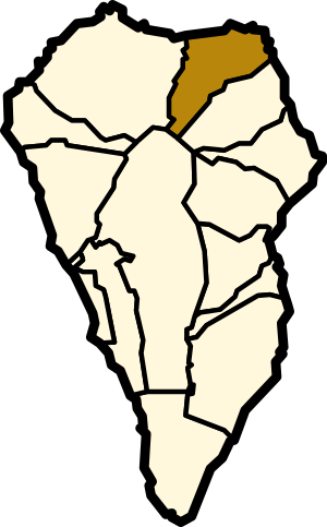
Location in La Palma
|
|||
| Country | |||
| Autonomous Community | |||
| Province | |||
| Island | |||
| Area | |||
| • Total | 43.55 km2 (16.81 sq mi) | ||
| Elevation | 548 m (1,798 ft) | ||
| Population
(2018)
|
|||
| • Total | 1,855 | ||
| • Density | 42.595/km2 (110.32/sq mi) | ||
| Climate | Csa | ||
Barlovento is a charming municipality located in the northern part of La Palma. This island is one of the beautiful Canary Islands, part of Spain. The name "Barlovento" means "windward" in Spanish. This name fits its location on the island.
Barlovento is found along the main highway that goes around the island. The land here rises very steeply from a small flat area near the coast. It goes all the way up to the edge of the Caldera de Taburiente. This is a huge volcanic crater. The highest point is Pico de la Cruz, which is about 2,350 meters high.
Contents
Discovering Barlovento's Main Town
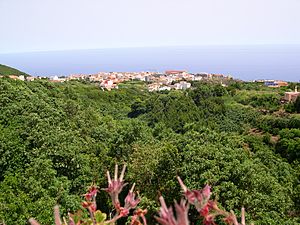
Most of Barlovento is rural, meaning it has lots of countryside. The only main town is also called Barlovento. Here, you'll find the ayuntamiento, which is like the town hall or municipal office. The town sits at 548 meters above sea level.
Exploring Barlovento's Unique Attractions
Barlovento is in the cloudier northeast part of the island. It has a short, rocky coastline. Because of this, it gets less tourism than other areas. However, you can still find many casas rurales (country homes) to rent. These are great for a quiet getaway.
There is also a large recreation area and campsite. It is located at the Laguna de Barlovento. This is an artificial reservoir and the biggest freshwater area on the island. It's a perfect spot for outdoor fun.
You can also visit the saltwater bathing pools called Piscina Fajana. These pools have a restaurant and other facilities. They are located at Punta del Corcho, near the Faro de Punta Complida lighthouse. This lighthouse marks the northeastern tip of the island.
Nature's Beauty in Barlovento
Barlovento is home to beautiful laurisilva forests. These are ancient types of forests. They are very green and full of unique plants. Exploring these forests feels like stepping into another world.
Historical Church of Barlovento
The main church in Barlovento is called Iglesia de Nuestra Señora del Rosario, Barlovento. This church has a long history. It dates back to the 16th century, which means it's over 400 years old! It is also a listed monument, showing its importance.
Barlovento's Population Over Time
Here's a look at how Barlovento's population has changed over the years:
| Year | Population |
|---|---|
| 1970 | 3,286 |
| 1981 | 2,772 |
| 1991 | 2,644 |
| 1996 | 2,488 |
| 2001 | 2,382 |
| 2002 | 2,378 |
| 2003 | 2,367 |
| 2004 | 2,350 |
| 2007 | 2,383 |
| 2013 | 2,085 |
See also
 In Spanish: Barlovento (La Palma) para niños


