Bath, Michigan facts for kids
Quick facts for kids
Bath, Michigan
|
|
|---|---|

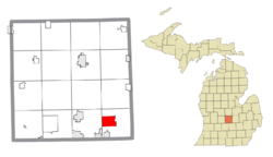
Location within Clinton County
|
|
| Country | United States |
| State | Michigan |
| County | Clinton |
| Township | Bath |
| Platted | 1864 |
| Area | |
| • Total | 6.06 sq mi (15.69 km2) |
| • Land | 5.86 sq mi (15.18 km2) |
| • Water | 0.20 sq mi (0.52 km2) |
| Elevation | 824 ft (251 m) |
| Population
(2020)
|
|
| • Total | 2,841 |
| • Density | 484.81/sq mi (187.17/km2) |
| Time zone | UTC−5 (Eastern (EST)) |
| • Summer (DST) | UTC−4 (EDT) |
| ZIP code(s) |
48808
|
| Area code(s) | 517 |
| FIPS code | 26-05880 |
| GNIS feature ID | 2583717 |
Bath is a small community in Michigan, a state in the United States. It is not a city or town with its own government. Instead, it is an unincorporated community. This means it is a recognized place where people live, but it is part of a larger local government area. Bath is located within Bath Charter Township in Clinton County.
In 2010, Bath was officially recognized as a census-designated place (CDP). This means it now has clear boundaries and its own population count. As of the 2020 census, about 2,841 people lived in Bath.
History of Bath
Bath was first mapped out and planned in 1864. This is when the community officially began to take shape.
An American woman named Irene Dunham, who lived to be very old (a supercentenarian), was born in Bath.
The Bath School Disaster
On May 18, 1927, a very sad event happened in Bath. It is known as the Bath School disaster. A man named Andrew Kehoe caused explosions at his home and then at the school. He also set off more explosives near the school superintendent.
This terrible event resulted in the deaths of 44 people. Among those who died were 38 children, three teachers, the school superintendent, the postmaster, and a local farmer. Fifty-eight other people were hurt. Most of the children who died were in second to sixth grade. This event was one of the worst school attacks in U.S. history.
Geography of Bath
Bath is located in Clinton County. The community covers an area of about 5.94 square miles (15.38 square kilometers). Most of this area is land, about 5.74 square miles (14.87 square kilometers). The rest, about 0.20 square miles (0.52 square kilometers), is water.
Population Information
| Historical population | |||
|---|---|---|---|
| Census | Pop. | %± | |
| 2020 | 2,841 | — | |
| U.S. Decennial Census | |||
The population of Bath has been counted several times. In 2020, the population was 2,841 people. This information helps us understand how the community has grown over time.
See also
 In Spanish: Bath (Míchigan) para niños
 | Chris Smalls |
 | Fred Hampton |
 | Ralph Abernathy |


