Bear River (Nova Scotia) facts for kids
Quick facts for kids Bear River |
|
|---|---|

Bear River, Nova Scotia
|
|
| Country | Canada |
| Province | Nova Scotia |
| Physical characteristics | |
| River mouth | Annapolis Basin sea level |
| Length | 40 km (25 mi) |
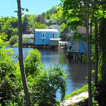
The Bear River is a special river in western Nova Scotia, Canada. It flows about 40 kilometers (25 miles) from its source to the Annapolis Basin. The last 9.7 kilometers (6 miles) of the river are tidal. This means the water level rises and falls with the ocean's tides. The village of Bear River is located near where the tides begin. It's even known as "The Tidal Village" because of this cool feature!
History of the Bear River
The Bear River area has been home to the native Mi'kmaq people for a very long time. Today, members of the Bear River First Nation still live along the river. Their traditional name for the river is L'sitkuk.
European settlers arrived in the early 1600s at nearby Port Royal. Samuel de Champlain first called it "Rivière St. Antoine." But this name didn't stick. In 1609, a map showed it as "Rivière Hébert," likely named after Louis Hébert. This name was used for a while. Later, after the English took control of the region, the name changed to Bear River.
Nature and Geography
The Bear River forms part of the border between Annapolis and Digby Counties. The river valley has steep, forested slopes and beautiful natural areas. Because of its stunning scenery, some people call the river valley "The Switzerland of Nova Scotia."
The river flows through a deep valley. This valley was carved out where two different types of rock meet. The river valley is also a drowned river valley. This means it was once a regular river valley that became partly submerged by rising sea levels. The Digby Gut on the Bay of Fundy is the very northern end of this drowned valley.
How the River Works
Many smaller streams feed into the Bear River. When the tide is low, you can see wide mud flats, grasses, and reeds. But when the tide comes in, salt water from the Annapolis Basin rushes in. This fills the river, raising the water level by up to 26 feet!
The river has two main branches that meet where the tide begins: the East Branch and the West Branch. The West Branch is also called the Franklin River. The East Branch was once famous for its salmon fishing. One lake in the area, now called Charlotte Lake, used to be known as Salmon Lake.
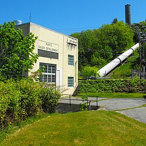
Since around 1950, the river has been used to create hydroelectric power. This means using the force of water to make electricity. Dams were built on Mulgrave Lake and other spots to hold water. This water then flows to the Gulch Power Station in Bear River to generate power.
Bridges Over the River
There are several bridges that cross the Bear River. The longest one is the Bear River Bridge on Nova Scotia Highway 101. This bridge is located near where the river meets the Annapolis Basin. It's about 6 kilometers (4 miles) from the village.
Another important bridge is in downtown Bear River. This bridge connects the two parts of the village. There are also a few smaller bridges further up the river.
 | Lonnie Johnson |
 | Granville Woods |
 | Lewis Howard Latimer |
 | James West |


