Annapolis Basin facts for kids
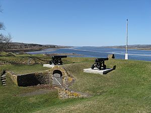
The Annapolis Basin is a large body of water in Nova Scotia, Canada. It's like a smaller bay that connects to the huge Bay of Fundy. You can find it on the western side of the Annapolis Valley.
This basin gets its name from the Annapolis River. This river flows into the basin at its eastern end, near the town of Annapolis Royal. The basin is about 24 kilometers (15 miles) long from northeast to southwest. It's also about 6 kilometers (4 miles) wide at its broadest point.
The Annapolis Basin is a calm and mostly shallow area. It is surrounded by the North Mountain and South Mountain ranges. These are part of the Annapolis Valley. The basin is actually a natural extension of the valley floor. A narrow opening in the North Mountain range, called Digby Gut, connects the basin to the Bay of Fundy.
A ferry service called Bay Ferries Limited operates here. It carries people and cars across the Bay of Fundy. The ferry travels between Digby (on the western side of the basin) and Saint John in New Brunswick.
Rivers Flowing In
Several rivers flow into the Annapolis Basin. They bring fresh water from the surrounding land.
- Annapolis River
- Bear River
- Moose River
Islands in the Basin
There are two main islands located within the Annapolis Basin.
- Bear Island
- Goat Island
Communities Around the Basin
Many towns and villages are located along the shores of the Annapolis Basin. Some of these are historic seaports, meaning they were important trading and fishing towns long ago.
- The towns of Annapolis Royal and Digby
- The village of Bear River
- Other communities like Granville Ferry, Port Royal, Port Wade, Victoria Beach, Clementsport, Deep Brook, and Smiths Cove
Between Deep Brook and Clementsport, there used to be a Canadian military base. It was called CFB Cornwallis. It was a training base for the Royal Canadian Navy and later for the Canadian Forces. It is no longer active.
 | Janet Taylor Pickett |
 | Synthia Saint James |
 | Howardena Pindell |
 | Faith Ringgold |


