Bechtelsville, Pennsylvania facts for kids
Quick facts for kids
Bechtelsville, Pennsylvania
|
|
|---|---|

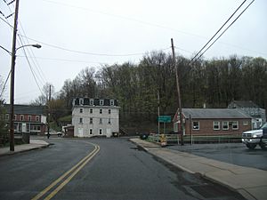
Old Pennsylvania Route 100 in Bechtelsville
|
|

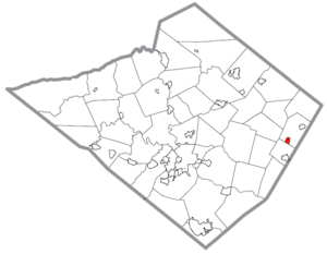
Location of Bechtelsville in Berks County, Pennsylvania.
|
|
| Country | United States |
| State | Pennsylvania |
| County | Berks |
| Area | |
| • Total | 0.53 sq mi (1.37 km2) |
| • Land | 0.53 sq mi (1.37 km2) |
| • Water | 0.00 sq mi (0.01 km2) |
| Elevation | 404 ft (123 m) |
| Population
(2020)
|
|
| • Total | 884 |
| • Density | 1,674.24/sq mi (647.03/km2) |
| Time zone | UTC-5 (EST) |
| • Summer (DST) | UTC-4 (EDT) |
| ZIP Code |
19505
|
| Area codes | 610 and 484 |
Bechtelsville is a small town, also called a borough, located in Berks County, Pennsylvania, in the United States. In 2020, about 884 people lived there.
About Bechtelsville
Bechtelsville is found at coordinates 40°22′12″N 75°37′43″W / 40.37000°N 75.62861°W. It's a small place, covering about half a square mile (or 1.3 square kilometers). All of this area is land, meaning there are no large lakes or rivers within its borders.
Getting Around Town
Bechtelsville has several public roads that help people get around. Some of these roads are looked after by the state's transportation department, called Pennsylvania Department of Transportation (PennDOT). Other roads are maintained by the local borough government.
You won't find any big numbered highways going right through Bechtelsville. However, there are important local streets like Main Street, Chestnut Street, Race Street, and Mill Street. The closest major road is Pennsylvania Route 100, which is just a short drive southeast of the borough.
Who Lives Here?
The number of people living in Bechtelsville has changed over the years. Here's a quick look at how the population has grown and shrunk:
| Historical population | |||
|---|---|---|---|
| Census | Pop. | %± | |
| 1900 | 381 | — | |
| 1910 | 417 | 9.4% | |
| 1920 | 502 | 20.4% | |
| 1930 | 549 | 9.4% | |
| 1940 | 587 | 6.9% | |
| 1950 | 603 | 2.7% | |
| 1960 | 625 | 3.6% | |
| 1970 | 728 | 16.5% | |
| 1980 | 832 | 14.3% | |
| 1990 | 864 | 3.8% | |
| 2000 | 931 | 7.8% | |
| 2010 | 942 | 1.2% | |
| 2020 | 884 | −6.2% | |
| Sources: | |||
In 2010, there were 942 people living in Bechtelsville. Most people (about 98.3%) were White. A very small number were African American or Asian. About 1.3% of the population identified as Hispanic or Latino.
There were 362 households in 2010. A household means all the people living together in one home. Many households (about 65.5%) were married couples. About 31.2% of households had children under 18 living with them.
The average age of people in Bechtelsville in 2010 was about 39.6 years old. This means half the people were younger than 39.6, and half were older.
Learning and Schools
Children and teens living in Bechtelsville attend schools within the Boyertown Area School District. This district provides public education for students in the area.
See also
 In Spanish: Bechtelsville para niños
 | William Lucy |
 | Charles Hayes |
 | Cleveland Robinson |


