Bellevue, Alberta facts for kids
Quick facts for kids
Bellevue
Maple Leaf
|
|
|---|---|
|
Former village
|
|

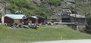
Bellevue Underground Mine museum
|
|
| Country | Canada |
| Province | Alberta |
| Specialized municipality | Crowsnest Pass |
| Village | January 1, 1957 |
| Amalgamation | January 1, 1979 |
| Government | |
| • Type | Unincorporated |
| Area
(2021)
|
|
| • Land | 3.01 km2 (1.16 sq mi) |
| Population
(2021)
|
|
| • Total | 911 |
| • Density | 302.2/km2 (783/sq mi) |
| Time zone | UTC−7 (MST) |
| • Summer (DST) | UTC−6 (MDT) |
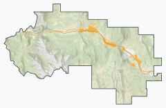
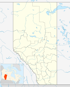
Bellevue is an urban community located high up in the Rocky Mountains in southwest Alberta, Canada. It sits at an elevation of about 4,280 feet (1,305 meters). Bellevue is part of the Municipality of Crowsnest Pass. It used to be its own village until 1979. That's when it joined with four other nearby towns to form the Crowsnest Pass municipality.
Unlike some other towns in the Crowsnest Pass that depended on just one coal mine, Bellevue was lucky. It had several successful mines nearby. This helped it keep going even through tough times. These challenges included fires, worker strikes, mining accidents, and changes in how much coal was needed.
Contents
History of Bellevue
How Bellevue Started
Bellevue was founded in 1905. It was built on flat land above the Bellevue Mine. This mine was run by a French company called West Canadian Collieries (WCC). The town got its name from Elsie Fleutot. She was the young daughter of one of the company's leaders. She saw the view and exclaimed, "Quelle belle vue!" which means "What a beautiful view!"
Bellevue got its own post office in 1907. In 1909, another company started the Mohawk Bituminous Mine. They built a small settlement called Maple Leaf right next to Bellevue. In 1913, many workers moved to Bellevue. They came from another WCC mine in Lille that had closed.
Challenges and Changes
Even with growth, Bellevue faced difficulties. On December 9, 1910, an explosion happened in the Bellevue Mine. Sadly, 30 miners lost their lives. Later, in 1917, a big fire destroyed most of Bellevue's business area. Smaller fires also happened in 1921 and 1922.
There was also a shanty-town below Bellevue called Bush town, or Il Bosc. It was flooded in 1923 but continued to exist for several years.
The Coal Mines Close
West Canadian Collieries opened another mine, the Adanac Mine, in 1945. However, by 1957, all the mines in the Bellevue area had closed. The coal processing plant in Bellevue kept working for a while. It processed coal from WCC's Grassy Mountain open-pit mine. But that plant was removed in 1962 when the Grassy Mountain mine also closed.
These mine closures meant a big drop in the money Bellevue collected from taxes. This made it harder for the community to operate.
Becoming a Village and Amalgamation
Bellevue officially became a village in 1957. In the 1970s, Highway 3 was rerouted. This caused Bellevue's business section to decline. However, the residential areas continued to grow.
In 1966, five local school districts joined together. Then, in 1979, Bellevue joined with four other communities. They all came together to form the Municipality of Crowsnest Pass. This joining, called an amalgamation, helped bring financial stability back to Bellevue. Today, Bellevue continues to be a thriving community.
Population in Bellevue
How Many People Live Here?
|
||||||||||||||||||||||||||||||||||||||||||||||||||||||||||||||||||
In the 2021 Census, Statistics Canada counted the population of Bellevue. There were 911 people living there. These people lived in 445 of the 555 homes available. This was a small increase of about 5.2% from its 2016 population of 866.
Bellevue has a land area of 3.01 square kilometers (about 1.16 square miles). In 2021, this meant there were about 302 people living in each square kilometer. This is called population density.
 | Sharif Bey |
 | Hale Woodruff |
 | Richmond Barthé |
 | Purvis Young |


