Belpre, Kansas facts for kids
Quick facts for kids
Belpre, Kansas
|
|
|---|---|

|
|

|
|
| Country | United States |
| State | Kansas |
| County | Edwards |
| Founded | 1879 |
| Incorporated | 1906 |
| Area | |
| • Total | 0.41 sq mi (1.06 km2) |
| • Land | 0.41 sq mi (1.06 km2) |
| • Water | 0.00 sq mi (0.00 km2) |
| Elevation | 2,090 ft (640 m) |
| Population
(2020)
|
|
| • Total | 97 |
| • Density | 237/sq mi (91.5/km2) |
| Time zone | UTC-6 (CST) |
| • Summer (DST) | UTC-5 (CDT) |
| ZIP code |
67519
|
| Area code | 620 |
| FIPS code | 20-05825 |
| GNIS ID | 2394124 |
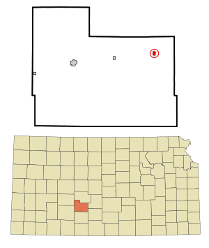
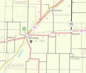
Belpre is a small city in Edwards County, Kansas, United States. In 2020, about 97 people lived there. The city is located right along Highway 50, which is a major road.
Contents
History of Belpre
Belpre was started in 1879. It became an official city in 1906. The name "Belpre" comes from a French phrase, "belle prairie," which means "beautiful meadow." The first post office in Belpre opened in 1879, the same year the town was founded.
Geography and Climate
Belpre is located at 37°57′4″N 99°5′59″W / 37.95111°N 99.09972°W. This means it's in the central part of the United States. The city covers a total area of about 0.41 square miles (1.06 square kilometers). All of this area is land, with no large bodies of water.
What is the Climate Like in Belpre?
The weather in Belpre has hot and humid summers. Winters are usually mild to cool. This type of weather is called a humid subtropical climate. It means there's a lot of moisture in the air, especially in summer.
Population and People
| Historical population | |||
|---|---|---|---|
| Census | Pop. | %± | |
| 1910 | 485 | — | |
| 1920 | 488 | 0.6% | |
| 1930 | 382 | −21.7% | |
| 1940 | 300 | −21.5% | |
| 1950 | 231 | −23.0% | |
| 1960 | 211 | −8.7% | |
| 1970 | 191 | −9.5% | |
| 1980 | 154 | −19.4% | |
| 1990 | 116 | −24.7% | |
| 2000 | 104 | −10.3% | |
| 2010 | 84 | −19.2% | |
| 2020 | 97 | 15.5% | |
| U.S. Decennial Census | |||
How Many People Live in Belpre?
The 2020 United States census counted 97 people living in Belpre. There were 40 households, which are groups of people living together. About 28 of these households were families. The population density was about 236 people per square mile.
Most people in Belpre are white or European American. About 69% of the population identified as Hispanic or Latino.
What is the Age Range in Belpre?
In 2020, about 32% of the people in Belpre were under 18 years old. About 13% were 65 years or older. The average age in the city was about 26.8 years old.
How Do People Live in Belpre?
In 2010, there were 34 households in Belpre. About 29% of these households had children under 18. Many households were married couples living together. Some households had a single parent or someone living alone. The average household had about 2.47 people.
Education
Students in Belpre attend schools in the Macksville USD 351 public school district.
See also

- In Spanish: Belpre (Kansas) para niños
 | Anna J. Cooper |
 | Mary McLeod Bethune |
 | Lillie Mae Bradford |

