Belston Loch facts for kids
Quick facts for kids Belston Loch |
|
|---|---|

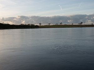
A view from the centre of Belston Loch
|
|
| Lua error in Module:Location_map at line 420: attempt to index field 'wikibase' (a nil value). | |
| Location | Ochiltree, East Ayrshire, Scotland |
| Lake type | Freshwater loch |
| Primary inflows | Polquharn Burn, rainfall and runoff |
| Primary outflows | Taiglum Burn. |
| Basin countries | Scotland |
| Settlements | Ochiltree |
Belston Loch is a small freshwater loch (that's a Scottish word for lake!) located in East Ayrshire, Scotland. It's near a place called Sinclairston, about 2 miles southeast of Drongan. This loch sits in a special type of dip in the land called a Kettle Hole, which was formed by glaciers long ago. It's also known as Dromsmodda Loch.
Contents
Discovering Belston Loch
Belston Loch was quite big in the 1880s. It measured about 400 meters long and 300 meters wide. It was the largest of four small lochs in the area of Ochiltree Parish. Most of the land around the loch is farmland. However, there's a nice patch of woodland next to the loch's southwest side.
What's in a Name?
The study of where names come from is called etymology. Belston Loch was once called Drumsmodda Loch around the year 1654. There's even a farm called Drumsmodden that still exists today. The name Polquhairn, which is a burn (small stream) flowing into the loch, might come from an old Celtic word.
Loch History on Old Maps
Old maps help us learn about the past. Robert Gordon's map from the 1630s to 1650s shows Belston Loch. It also marks Auchencloigh Castle nearby. A map by Blaeu from around 1654, based on an even older map by Timothy Pont, clearly shows "Drumsmodda Loch" and the castle.
Later maps also show the loch. Molls map from 1745 likely shows Belston Loch. Roy's map in 1747 and Armstrong's map in 1775 also mark its location. By 1821, the loch was clearly drawn on maps. Thomson's map in 1832 even shows a stream, the Polquhairn, flowing into "Belton Loch."
How People Use Belston Loch
Belston Loch is a popular spot for fishing. It's part of the Mauchline & Ballochmyle Angling Club. Anglers can catch different types of fish here. The loch is home to large rainbow trout, brown trout, and pike.
In the past, the loch was also used for curling. This is a sport played on ice. A Belston Curling Club existed in the early 1900s. People would gather on the frozen loch for matches.
Auchencloigh Castle: A Nearby Ruin
Auchencloigh Castle is a ruined old building not far from Belston Loch. It's located near the Burnton Burn. This castle was once part of the lands belonging to the Craufurd family. It's another interesting historical site in the Ochiltree area of East Ayrshire.
Interesting Facts About the Area
The area around Belston Loch has a history of coal mining. There were many mines, including open-cast mines (where coal is dug from the surface) and underground collieries. Some of these mines were at places like Drumsmodden and Polquhairn.
A famous Scottish writer, George Douglas Brown, had a connection to this area. His father lived at Drumsmodden Farm. George Douglas Brown wrote a well-known book called The House with the Green Shutters.
Old roads and paths also ran close to the loch. Some place names, like Glenconner, might even come from old Gaelic words for "path." There's also a farm called Rottenrow nearby. Its name might come from "Route de Roi," which means "King's Highway" in French, suggesting it was once an important road!
 | Claudette Colvin |
 | Myrlie Evers-Williams |
 | Alberta Odell Jones |


