Bergeron River facts for kids
Quick facts for kids Bergeron River |
|
|---|---|

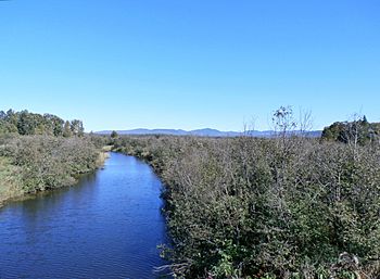
Bergeron River at the confluence of Lac Mégantic.
|
|
| Native name | Rivière Bergeron |
| Country | Canada |
| Province | Quebec |
| Region | Estrie |
| MRC | Le Granit Regional County Municipality |
| Physical characteristics | |
| Main source | Little mountain stream Val-Racine 577 metres (1,893 ft) 45°28′35″N 71°01′23″W / 45.476435°N 71.022988°W |
| River mouth | Lake Mégantic, Chaudière River Piopolis 395 metres (1,296 ft) 45°27′17″N 70°53′07″W / 45.45483°N 70.88528°W |
| Length | 12.8 kilometres (8.0 mi) |
| Basin features | |
| Progression | Chaudière River, St. Lawrence River |
| River system | St. Lawrence River |
| Basin size | 55.5 kilometres (34.49 mi) |
| Tributaries |
|
The Bergeron River (called rivière Bergeron in French) is a small river in Quebec, Canada. It flows into Lake Mégantic, which then connects to the Chaudière River. The Chaudière River eventually joins the mighty St. Lawrence River.
This river runs through the towns of Val-Racine and Piopolis. It is located in the Estrie region of Quebec.
Where Does the Bergeron River Flow?
The Bergeron River starts high up in the mountains. Its source is east of Mont Mégantic in the town of Val-Racine.
From its source, the Bergeron River flows for about 12.8 kilometres (8.0 mi) (about 8 miles). It travels through forested areas.
- First, it flows about 0.5 kilometres (0.31 mi) (0.3 miles) towards the southeast. This takes it to the edge of the town of Piopolis.
- Next, it flows about 9.6 kilometres (6.0 mi) (6 miles) to the east. This part of the river is in Marston Township.
- Finally, it flows about 2.7 kilometres (1.7 mi) (1.7 miles) eastward in Clinton Township. Here, it crosses Route 263 before reaching its end.
The river ends when it flows into Lake Mégantic.
What's in a Name?
The name "rivière Bergeron" became official on December 5, 1968. This was decided by the Commission de toponymie du Québec, which is like a special committee that names places in Quebec.
 | Victor J. Glover |
 | Yvonne Cagle |
 | Jeanette Epps |
 | Bernard A. Harris Jr. |


