Berry Island, New South Wales facts for kids
Quick facts for kids Berry IslandSydney, New South Wales |
|||||||||||||||
|---|---|---|---|---|---|---|---|---|---|---|---|---|---|---|---|

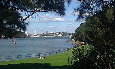
Berry Island reserve park view.
|
|||||||||||||||
| LGA(s) | North Sydney Council | ||||||||||||||
|
|||||||||||||||
Berry Island is a special place in Wollstonecraft, a suburb on the lower North Shore of Sydney, New South Wales, Australia. It was once a true island in Sydney Harbour. However, it is now connected to the mainland. This connection was made by building a path and filling in some land.
What Can You Do at Berry Island?
Today, Berry Island is a fun public park. It's a great place for families and friends to visit. You can enjoy a bushland walk that teaches you about nature. There's also a playground for younger kids and a picnic area. It's perfect for a day out in nature.
A Look Back: Berry Island's History
Berry Island got its name from Alexander Berry. He was one of two people who received this land in 1820. The land was given to him and Edward Wollstonecraft by Governor Macquarie.
Later, a stone path was built to connect the island to the mainland. This path went over muddy areas. In the 1960s, more land was filled in between the island and the mainland. This created the grassy area you see today.
Discovering Ancient Aboriginal Sites
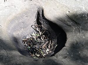
Berry Island is home to important Aboriginal sites. These sites show us how Indigenous Australians lived long ago. You can find rock carvings, places where they cooked, and a cave with smoke stains. There are also spots where they sharpened stone tools.
There's a special walking path called the Gadyan Track. It's about 750 meters long and takes around 20 minutes to walk. Along the track, signs explain the history and meaning of different spots. The most famous carving is a large whale shape. You can also see a boomerang-shaped carving, a waterhole, and grinding grooves nearby.
 | Sharif Bey |
 | Hale Woodruff |
 | Richmond Barthé |
 | Purvis Young |


