Birmingham Township, Chester County, Pennsylvania facts for kids
Quick facts for kids
Birmingham Township, Pennsylvania
|
|
|---|---|
|
Township
|
|

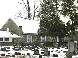
Birmingham Friends Meeting
|
|

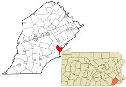
Location of Birmingham Township in Chester County, Pennsylvania (left) and of Chester County in Pennsylvania (right)
|
|

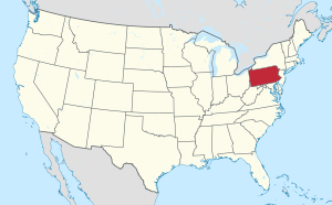
Location of Pennsylvania in the United States
|
|
| Country | United States |
| State | Pennsylvania |
| County | Chester |
| Area | |
| • Total | 6.43 sq mi (16.65 km2) |
| • Land | 6.32 sq mi (16.38 km2) |
| • Water | 0.11 sq mi (0.28 km2) |
| Elevation | 249 ft (76 m) |
| Population
(2020)
|
|
| • Total | 4,085 |
| • Estimate
(2021)
|
4,074 |
| • Density | 672.10/sq mi (259.48/km2) |
| Time zone | UTC-5 (EST) |
| • Summer (DST) | UTC-4 (EDT) |
| Area code(s) | 610 |
| FIPS code | 42-029-06544 |
Birmingham Township is a special kind of local government area called a township in Chester County, Pennsylvania, United States. In 2020, about 4,085 people lived there.
Contents
History of Birmingham Township
Birmingham Township is famous for being the place where the Battle of Brandywine happened on September 11, 1777. This was a really important battle during the American Revolutionary War. More than 18,000 soldiers fought here, making it the biggest land battle in North America at that time!
The Birmingham Friends Meeting, which started in 1690, has a special common grave. Both American and British soldiers who died in the battle are buried there. A lot of the original battlefield is still protected today. Birmingham is actually the oldest township in Chester County.
Philadelphia magazine once said Birmingham Township was one of the top five best places to live near Philadelphia. They also called it the "Place with the Biggest Paychecks."
Many historic places in Birmingham Township are listed on the National Register of Historic Places. These include the Lenape Bridge, the Birmingham Friends Meetinghouse and School, Brinton's Mill, and the Dilworthtown Historic District.
Geography and Nature
Birmingham Township covers about 6.5 square miles (16.65 square kilometers). Most of this area is land, with a small part being water. The township is mostly made up of pretty farmland and rolling hills. There are also a few small communities within it.
A small part of the township is separated by the Brandywine Creek. This area includes some roads and a railroad. It borders Chadds Ford Township in Delaware County. Interestingly, Chadds Ford Township used to be called Birmingham Township until 1996!
Part of a place called Chadds Ford is in the southern part of Birmingham Township. Another area called Dilworthtown is in the eastern part of the township.
Neighboring Townships
Birmingham Township shares borders with these other townships:
- Pennsbury Township, Chester County (to the southwest)
- Pocopson Township, Chester County (to the west)
- East Bradford Township, Chester County (to the north)
- Westtown Township, Chester County (to the northeast)
- Thornbury Township, Chester County (to the east)
- Chadds Ford Township, Delaware County (to the south)
The weather in the township is generally warm and humid, like a humid subtropical climate.
Population Facts
| Historical population | |||
|---|---|---|---|
| Census | Pop. | %± | |
| 1930 | 338 | — | |
| 1940 | 384 | 13.6% | |
| 1950 | 429 | 11.7% | |
| 1960 | 453 | 5.6% | |
| 1970 | 834 | 84.1% | |
| 1980 | 1,584 | 89.9% | |
| 1990 | 2,636 | 66.4% | |
| 2000 | 4,221 | 60.1% | |
| 2010 | 4,208 | −0.3% | |
| 2020 | 4,085 | −2.9% | |
| 2021 (est.) | 4,074 | −3.2% | |
In 2010, most of the people living in Birmingham Township were White (about 90.6%). There were also people of Asian (5.2%) and Black or African American (1.4%) backgrounds. About 2.1% of the population had Hispanic or Latino family roots.
In 2000, there were 4,221 people living in the township. The average household had about 3 people. Many households (86.4%) were married couples living together.
The median age in 2000 was 41 years old. This means half the people were younger than 41 and half were older. About 30.1% of the population was under 18 years old.
Getting Around (Transportation)
As of 2020, Birmingham Township has about 38.90 miles of public roads. The Pennsylvania Department of Transportation (PennDOT) takes care of about 13.50 miles of these roads. The township itself maintains the other 25.40 miles.
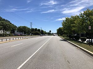
Several important highways pass through Birmingham Township. These include U.S. Route 202 and U.S. Route 322. They follow Wilmington Pike through the eastern part of the township. Pennsylvania Route 52 (Lenape Road) goes through the northwestern corner. Finally, Pennsylvania Route 926 (Street Road) crosses the middle of the township.
Schools in the Area
Students living in Birmingham Township usually go to either Chadds Ford Elementary School or Pocopson Elementary School. After elementary school, they attend Charles F. Patton Middle School. For high school, students go to Unionville High School. All these schools are part of the Unionville-Chadds Ford School District. There are also private school options nearby.
See also
 In Spanish: Municipio de Birmingham (Pensilvania) para niños


