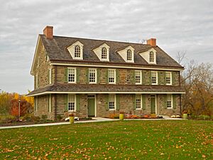
Delaware County, Pennsylvania facts for kids
Quick facts for kids
Delaware County
|
|||
|---|---|---|---|
|
County
|
|||
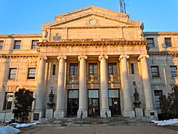
Delaware County Courthouse in Media, Pennsylvania
|
|||
|
|||
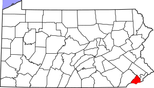
Location within the U.S. state of Pennsylvania
|
|||
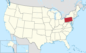 Pennsylvania's location within the U.S. |
|||
| Country | |||
| State | |||
| Founded | September 26, 1789 | ||
| Named for | Delaware River | ||
| Seat | Media | ||
| Largest Township | Upper Darby | ||
| Other cities | Chester | ||
| Area | |||
| • Total | 191 sq mi (490 km2) | ||
| • Land | 184 sq mi (480 km2) | ||
| • Water | 6.8 sq mi (18 km2) 3.5%% | ||
| Population
(2020)
|
|||
| • Total | 576,830 | ||
| • Estimate
(2023)
|
576,720 |
||
| • Density | 3,020/sq mi (1,166.0/km2) | ||
| Congressional district | 5th | ||
|
Pennsylvania Historical Marker
|
|||
| Designated: | October 3, 1982 | ||
Delaware County, often called Delco, is a county in Pennsylvania. It is the fifth-most populated county in Pennsylvania. It is also the third-smallest in size. In 2020, about 576,830 people lived here.
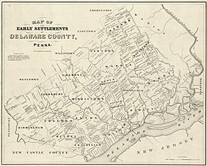
The county was created on September 26, 1789. It was formed from a part of Chester County. It was named after the Delaware River. Delaware County is part of the Delaware Valley region.
Delaware County is next to Philadelphia. Philadelphia is one of the largest cities in the United States. Delaware County is also part of the larger Philadelphia–Camden–Wilmington metropolitan area. The main town where the county government is located is Media.
Contents
History of Delaware County
Delaware County is in an area named "Delaware." This name honors Thomas West, 3rd Baron De La Warr. He was a governor of the English colony of Virginia.
Henry Hudson explored this land in 1609. Over the years, different groups claimed and settled it. These included the Swedes, the Dutch, and the English. The first people to live here were the Lenape tribe of Native Americans.
Later, King Charles II of England gave William Penn the right to start a colony. This colony became Pennsylvania. Penn divided his colony into three counties: Bucks, Philadelphia, and Chester. The land along the river south of Philadelphia was easy to reach. So, it was quickly settled.
In 1789, the southeastern part of Chester County became its own county. It was named Delaware County after the Delaware River.
Geography of Delaware County
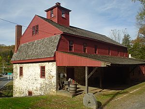
Delaware County covers about 191 square miles. Most of this is land (184 square miles). About 6.8 square miles (3.5%) is water. It is the third-smallest county in Pennsylvania by area.
The county has a unique shape, like a diamond or a kite. Its borders are with Chester County to the northwest. To the southwest, it borders the state of Delaware. The Delaware River forms its border with New Jersey to the southeast. To the east and northeast, it borders Philadelphia and Montgomery County.
The lowest point in Pennsylvania is in Delaware County. It is on the Delaware River in Marcus Hook. The highest point in the county is 500 feet high. This is found in Newtown Township.
Rivers and creeks in Delaware County usually flow south. They all end up in the Delaware River. Some of these waterways include the Brandywine River, Chester Creek, Ridley Creek, and Darby Creek.
Crum Creek was dammed in 1931. This created Springton Lake, also known as Geist Reservoir. It is about 391 acres large. This lake provides drinking water for the county.
Delaware County is the only county in Pennsylvania that borders both Delaware and New Jersey.
Neighboring Counties
- Montgomery County (north)
- Philadelphia County (northeast)
- Gloucester County, New Jersey (southeast)
- New Castle County, Delaware (southwest)
- Chester County (west)
Delaware County is special because it borders a state with the same name (Delaware). Only a few counties in the U.S. do this.
Protected Natural Areas
- First State National Historical Park (part of it)
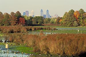
- John Heinz National Wildlife Refuge (part of it)
About 2,600 acres of the county are part of Ridley Creek State Park.
Population and People
| Historical population | |||
|---|---|---|---|
| Census | Pop. | %± | |
| 1790 | 9,469 | — | |
| 1800 | 12,809 | 35.3% | |
| 1810 | 14,734 | 15.0% | |
| 1820 | 14,810 | 0.5% | |
| 1830 | 17,323 | 17.0% | |
| 1840 | 19,791 | 14.2% | |
| 1850 | 24,679 | 24.7% | |
| 1860 | 30,597 | 24.0% | |
| 1870 | 39,403 | 28.8% | |
| 1880 | 56,101 | 42.4% | |
| 1890 | 74,683 | 33.1% | |
| 1900 | 94,762 | 26.9% | |
| 1910 | 117,906 | 24.4% | |
| 1920 | 173,084 | 46.8% | |
| 1930 | 280,264 | 61.9% | |
| 1940 | 310,756 | 10.9% | |
| 1950 | 414,234 | 33.3% | |
| 1960 | 553,154 | 33.5% | |
| 1970 | 600,035 | 8.5% | |
| 1980 | 555,007 | −7.5% | |
| 1990 | 547,651 | −1.3% | |
| 2000 | 550,864 | 0.6% | |
| 2010 | 558,979 | 1.5% | |
| 2020 | 576,830 | 3.2% | |
| U.S. Decennial Census 1790–1960 1900–1990 1990–2000 2010–2019 |
|||
In 2020, the county's population was 576,830 people. Most residents (63%) were White. About 22% were Black or African American. Around 6.3% were Asian, and 4.6% were Hispanic or Latino. The rest were Native American, Pacific Islander, or from two or more races.
The county is home to many different backgrounds. In 2000, many residents had Irish, Italian, German, and English family roots.
2020 Census Breakdown
| Race | Number | Percent |
|---|---|---|
| White (not Hispanic) | 363,249 | 63% |
| Black or African American (not Hispanic) | 127,055 | 22% |
| Native American (not Hispanic) | 676 | 0.12% |
| Asian (not Hispanic) | 36,317 | 6.3% |
| Pacific Islander (not Hispanic) | 133 | 0.02% |
| Other/Mixed (not Hispanic) | 22,628 | 3.9% |
| Hispanic or Latino | 26,772 | 4.6% |
Towns and Cities
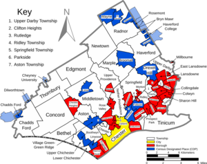
In Pennsylvania, there are different types of towns and cities. These are called cities, boroughs, and townships. Delaware County has 49 of these communities.
City
Boroughs
- Aldan
- Brookhaven
- Chester Heights
- Clifton Heights
- Collingdale
- Colwyn
- Darby
- East Lansdowne
- Eddystone
- Folcroft
- Glenolden
- Lansdowne
- Marcus Hook
- Media (This is the county seat, where the main county offices are)
- Millbourne
- Morton
- Norwood
- Parkside
- Prospect Park
- Ridley Park
- Rose Valley
- Rutledge
- Sharon Hill
- Swarthmore
- Trainer
- Upland
- Yeadon
Townships
- Aston
- Bethel
- Chadds Ford
- Chester
- Concord
- Darby
- Edgmont
- Haverford
- Lower Chichester
- Marple
- Middletown
- Nether Providence
- Newtown
- Radnor
- Ridley
- Springfield
- Thornbury
- Tinicum
- Upper Chichester
- Upper Darby
- Upper Providence
Census-Designated Places (CDPs)
CDPs are areas the U.S. Census Bureau defines for collecting data. They are not official towns.
- Ardmore (partially in Montgomery County)
- Boothwyn
- Broomall
- Bryn Mawr (mostly in Montgomery County)
- Chadds Ford (mostly in Chester County)
- Cheyney University (mostly in Chester County)
- Drexel Hill
- Folsom
- Haverford College (partially in Montgomery County)
- Lima
- Linwood
- Rosemont (mostly in Montgomery County)
- St. Davids
- Village Green-Green Ridge
- Villanova (partially in Montgomery County)
- Wayne
- Woodlyn
Unincorporated Communities
- Brookline
- Garrett Hill
- Glen Mills
- Havertown
- Llanerch
- Oakmont
- Radnor
- Riddlewood
- Secane
- Thornton
- Wallingford
- Wawa
Largest Communities by Population (2020 Census)
† county seat
| Rank | Community Name | Type | Population (2020) |
|---|---|---|---|
| 1 | Upper Darby | Township | 85,681 |
| 2 | Haverford | Township | 50,431 |
| 3 | Radnor | Township | 33,228 |
| 4 | Chester | City | 32,605 |
| 5 | Ridley | Township | 31,053 |
| 6 | Drexel Hill | CDP | 29,181 |
| 7 | Springfield | Township | 25,070 |
| 8 | Marple | Township | 24,214 |
| 9 | Concord | Township | 18,295 |
| 10 | Upper Chichester | Township | 16,898 |
| 11 | Aston | Township | 16,791 |
| 12 | Middletown | Township | 16,373 |
| 13 | Newtown | Township | 15,002 |
| 14 | Nether Providence | Township | 14,525 |
| 15 | Ardmore | CDP | 13,566 |
| 16 | Yeadon | Borough | 12,054 |
| 17 | Broomall | CDP | 11,718 |
| 18 | Lansdowne | Borough | 11,107 |
| 19 | Upper Providence | Township | 10,852 |
| 20 | Darby | Borough | 10,715 |
Education
Public School Districts
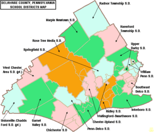
Delaware County has many public school districts. These districts serve different areas of the county.
- Chester Upland School District
- Chichester School District
- Garnet Valley School District
- Haverford Township School District
- Interboro School District
- Marple Newtown School District
- Penn-Delco School District
- Radnor Township School District
- Ridley School District
- Rose Tree Media School District
- Southeast Delco School District
- Springfield School District
- Upper Darby School District
- Wallingford-Swarthmore School District
- West Chester Area School District
- William Penn School District
Students from all over the county can also attend Delaware County Technical High School.
Charter Schools
- Chester Community Charter School
- Widener Partnership Charter School
- Chester Charter Scholars Academy
Private Schools
There are also private schools in Delaware County. One well-known private school is Friends School Haverford.
Colleges and Universities
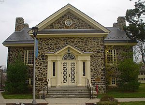
Delaware County is home to many colleges and universities.
- Cabrini University
- Cheyney University
- Eastern University
- Delaware County Community College
- Haverford College
- Neumann University
- Pendle Hill Quaker Center for Study and Contemplation
- Pennsylvania Institute of Technology
- Penn State Brandywine
- Rosemont College
- Swarthmore College
- Villanova University
- Widener University
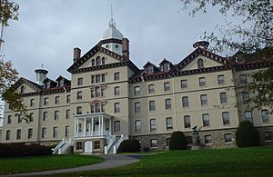
- Williamson College of the Trades
Adult Education
For adults who want to keep learning, there are several programs.
- Haverford Adult School
- Main Line School Night
- Senior Community Services Lifelong Learning
- Delaware County Literacy Council
Libraries
You can find many public libraries throughout Delaware County.
Transportation

Delaware County has major roads that help people travel. Interstate 476 (also called the Blue Route) runs north to south. It connects to Interstate 95, which runs along the county's southeastern edge.
The county has a large transportation hub called 69th Street Transportation Center in Upper Darby. From here, you can take different types of public transport. These include the Norristown High Speed Line, trolley lines, and several Regional Rail Lines. The Airport Line also serves the area. Many bus routes also run through the county.
Part of Philadelphia International Airport is located in Delaware County. The county also hosts businesses related to the airport, like the UPS terminal.
Major Roads and Highways
Fun and Sports
Parks
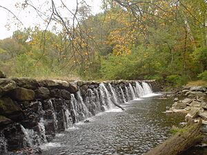
There is one state park in Delaware County:
The county also has several local parks:
- Clayton Park & Golf Course
- Glen Providence Park
- Kent Park/Dog Park
- Rose Tree Park
- Smedley Park
- Upland Park
Racing
Harrah's Philadelphia is a place in Chester where you can watch harness racing. It also has a casino.
Sports Teams and Leagues
Chester is home to the Philadelphia Union. This is a professional soccer team in Major League Soccer. They play at Subaru Park.
Delaware County has a long history with women's professional soccer. Past teams like the Philadelphia Charge and Philadelphia Independence played here.
The Delco League is one of the oldest baseball leagues in the country. It was once known for having famous baseball players.
Every summer, the Delco Pro-Am basketball league takes place. It features current and former NBA players.
The Aston Bulls, a rugby league team, used to be based in Delaware County.
Darby was home to the Hilldale Club. This baseball team won the 1925 Colored World Series.
Media
Several newspapers serve Delaware County. These include the Delaware County Daily Times and News of Delaware County. Delaware County Magazine is a popular local magazine.
Climate
Delaware County has two main geographic areas: the Piedmont and the Atlantic Coastal Plain. Most of the county has a humid subtropical climate. This means it has hot, humid summers and mild winters. Some northern areas have a hot-summer humid continental climate. This climate also has warm to hot summers but colder winters.
The average high temperature in July is around 85-87°F (29-31°C). In January, the average high is about 38-40°F (3-4°C). The county gets a good amount of rain throughout the year, usually between 43 and 47 inches.
See also
 In Spanish: Condado de Delaware (Pensilvania) para niños
 | William M. Jackson |
 | Juan E. Gilbert |
 | Neil deGrasse Tyson |


