Gloucester County, New Jersey facts for kids
Quick facts for kids
Gloucester County
|
|||
|---|---|---|---|
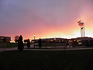
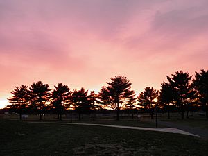
Rowan College of South Jersey in Sewell at sunset in November 2010
|
|||
|
|||
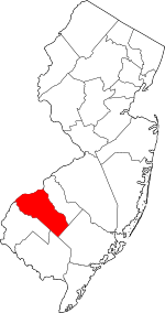
Location within the U.S. state of New Jersey
|
|||
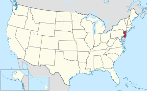 New Jersey's location within the U.S. |
|||
| Country | |||
| State | |||
| Founded | 1686 | ||
| Named for | Gloucester / Gloucestershire, England | ||
| Seat | Woodbury | ||
| Largest Municipality | Washington Township (population) Franklin Township (area) |
||
| Area | |||
| • Total | 336.77 sq mi (872.2 km2) | ||
| • Land | 322.00 sq mi (834.0 km2) | ||
| • Water | 14.77 sq mi (38.3 km2) 4.4% | ||
| Population
(2020)
|
|||
| • Total | 302,294 | ||
| • Estimate
(2023)
|
308,423 |
||
| • Density | 897.627/sq mi (346.576/km2) | ||
| Time zone | UTC−5 (Eastern) | ||
| • Summer (DST) | UTC−4 (EDT) | ||
| Congressional districts | 1st, 2nd | ||
Gloucester County is a county located in the state of New Jersey, in the United States. In 2020, about 302,294 people lived here. This makes it the 14th most populated county in New Jersey.
The county seat, which is like the main town for government, is Woodbury. Gloucester County is part of the South Jersey area. The biggest town by population is Washington Township. The largest town by land area is Franklin Township.
Gloucester County is close to Philadelphia, one of the largest cities in the U.S. It is also near Atlantic City. This area is becoming a big center for logistics and warehouse buildings.
Contents
History of Gloucester County
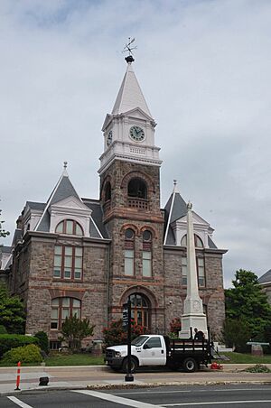
Some of the first European settlements in New Jersey were in this area. Towns like Swedesboro and Bridgeport were part of the New Sweden colony in the 1600s.
Gloucester County was officially started on May 26, 1686. Its borders were set on May 17, 1694, as part of West Jersey. Later, parts of Gloucester County were used to create Atlantic County in 1837 and Camden County in 1844. The county was named after the city of Gloucester and the county of Gloucestershire in England.
Woodbury was founded in 1683 and is the oldest town in the county. Another town, National Park, was important during the American Revolutionary War. The Battle of Red Bank happened there, where Fort Mercer once stood. During the early days, farming was the main way people made a living in Gloucester County.
Geography and Climate
Gloucester County covers about 336.77 square miles. Most of this area, about 322 square miles, is land. The rest is water. The county has many low-lying rivers and flat coastal areas. These stretch from the Delaware River to the New Jersey Pine Barrens.
The highest point in the county is about 180 feet above sea level. The lowest point is at sea level along the Delaware River.
Weather in Gloucester County
The weather in Gloucester County is usually warm and humid in the summer and cold in the winter. In Woodbury, the average temperature in January is about 26 degrees Fahrenheit. In July, it's around 87 degrees Fahrenheit. The county gets a good amount of rain throughout the year.
Population Information
| Historical population | |||
|---|---|---|---|
| Census | Pop. | %± | |
| 1790 | 13,363 | — | |
| 1800 | 16,115 | 20.6% | |
| 1810 | 19,744 | 22.5% | |
| 1820 | 23,089 | 16.9% | |
| 1830 | 28,431 | 23.1% | |
| 1840 | 25,438 | * | −10.5% |
| 1850 | 14,655 | * | −42.4% |
| 1860 | 18,444 | 25.9% | |
| 1870 | 21,562 | 16.9% | |
| 1880 | 25,886 | 20.1% | |
| 1890 | 28,649 | 10.7% | |
| 1900 | 31,905 | 11.4% | |
| 1910 | 37,368 | 17.1% | |
| 1920 | 48,224 | 29.1% | |
| 1930 | 70,802 | 46.8% | |
| 1940 | 72,219 | 2.0% | |
| 1950 | 91,727 | 27.0% | |
| 1960 | 134,840 | 47.0% | |
| 1970 | 172,681 | 28.1% | |
| 1980 | 199,917 | 15.8% | |
| 1990 | 230,082 | 15.1% | |
| 2000 | 254,673 | 10.7% | |
| 2010 | 288,288 | 13.2% | |
| 2020 | 302,294 | 4.9% | |
| 2023 (est.) | 308,423 | 7.0% | |
| Historical sources: 1790–1990 1970–2010 2000 2010 2020 * = Lost territory in previous decade. |
|||
The population of Gloucester County has grown a lot over the years. In 2020, the county had 302,294 people. This was an increase of about 14,000 people since 2010.
Economy
In 2021, the total value of all goods and services produced in Gloucester County was about $14 billion. This shows how much economic activity happens in the county.
Education
Gloucester County has many schools and colleges for students of all ages.
Colleges and Universities
- Rowan University is a public university in Glassboro. It started in 1923.
- Rowan College of South Jersey is the county college. It opened in 1968 and has its main campus in Sewell. It also has campuses in other counties.
School Districts
There are many school districts in Gloucester County. They serve students from kindergarten all the way through high school. Some districts cover all grades (K-12), while others focus on secondary (high school) or elementary (K-8) grades.
- K-12 School Districts
- Clayton Public Schools
- Deptford Township Schools
- Glassboro Public Schools
- Gloucester County Special Services School District
- Gloucester County Vocational-Technical School District
- Monroe Township Public Schools
- Paulsboro Public Schools
- Pitman School District
- Washington Township Public School District
- West Deptford Public Schools
- Woodbury Public Schools
- Secondary School Districts
- Clearview Regional High School District
- Delsea Regional School District
- Gateway Regional School District
- Kingsway Regional School District
- Elementary School Districts
- East Greenwich Township School District
- Elk Township School District
- Franklin Township Public Schools
- Greenwich Township School District (K-8)
- Harrison Township School District
- Logan Township School District (K-8)
- Mantua Township School District
- National Park School District
- South Harrison Township School District
- Swedesboro-Woolwich School District – Consolidated
- Wenonah School District
- Westville School District
- Woodbury Heights School District
Vocational School
The Gloucester County Institute of Technology is a special high school. It teaches students job skills and is located in Deptford Township.
Towns and Communities
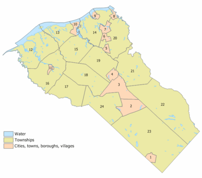
Gloucester County is made up of many different towns and communities. Each one has its own unique features and history. Some of the types of towns include boroughs and townships.
Transportation
Getting around Gloucester County is easy with many roads and public transport options.
Roads and Highways
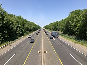
The county has over 1,600 miles of roads. These roads are maintained by local towns, the county, and the state of New Jersey. Important roads include state routes like New Jersey Route 42 and New Jersey Route 55. U.S. Routes like U.S. Route 130 and U.S. Route 322 also pass through.
The Commodore Barry Bridge connects Gloucester County to Chester, Pennsylvania across the Delaware River. Major highways like Interstate 295 and the New Jersey Turnpike also run through the county. The Atlantic City Expressway briefly touches the county.
Public Transportation
NJ Transit offers bus services that connect Gloucester County to Philadelphia and other nearby towns. There are also local bus routes to help people get around within the county.
There is a plan for a new light rail system called the Glassboro–Camden Line. It would connect towns in Gloucester County to Camden. This project is still being planned and funded.
Freight Rail and Port
Gloucester County has freight train lines that help move goods. The Port of Paulsboro is a busy port on the Delaware River. It handles many different types of cargo, like oil products and large items. The port is also being developed to handle parts for wind turbines, which are used to create wind power.
Emergency Services
Gloucester County has its own emergency medical services, called Gloucester County Emergency Medical Services (GCEMS). It was the first county-based EMS agency in New Jersey, starting in 2007.
GCEMS aims to reach people needing help within nine minutes most of the time. They have many ambulances and special quick response vehicles. They operate from 19 stations across the county. In 2010, GCEMS was recognized as an Outstanding Public EMS Agency by the State of New Jersey.
Notable People
Many interesting people have come from Gloucester County, including:
- Corey Clement (born 1994), a former professional football player.
- Linda Fiorentino (born 1958 or 1960), an actress.
- Grace Helbig (born 1985), a comedian and YouTube personality.
- Tara Lipinski (born 1982), an Olympic gold medal winner in figure skating.
- Jimmy Rollins (born 1978), a former professional baseball player.
- Patti Smith (born 1946), a famous punk rock musician.
- Steve Squyres (born 1956), a scientist who worked on the Mars Exploration Rover mission.
Recreation
Gloucester County Historical Society
The Gloucester County Historical Society was started in 1903. It collects and displays old items and information about the history of South Jersey. You can see many of these items at the Hunter–Lawrence–Jessup House in Woodbury.
National Protected Area
Part of the Great Egg Harbor River is a nationally protected area, offering natural beauty and outdoor activities.
Images for kids
-
Rowan College of South Jersey in Sewell at sunset in November 2010
See also
 In Spanish: Condado de Gloucester (Nueva Jersey) para niños
 | Audre Lorde |
 | John Berry Meachum |
 | Ferdinand Lee Barnett |


