
Camden County, New Jersey facts for kids
Quick facts for kids
Camden County
|
|||
|---|---|---|---|

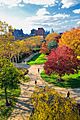
Rutgers University–Camden in Camden, August 2007
|
|||
|
|||

Location within the U.S. state of New Jersey
|
|||
 New Jersey's location within the U.S. |
|||
| Country | |||
| State | |||
| Founded | March 13, 1844 | ||
| Named for | Charles Pratt, 1st Earl Camden | ||
| Seat | Camden | ||
| Largest municipality | Cherry Hill (population) Winslow Township (area) |
||
| Area | |||
| • Total | 227.42 sq mi (589.0 km2) | ||
| • Land | 221.36 sq mi (573.3 km2) | ||
| • Water | 6.06 sq mi (15.7 km2) 2.7% | ||
| Population
(2020)
|
|||
| • Total | 523,485 | ||
| • Estimate
(2023)
|
527,196 |
||
| • Density | 2,301.84/sq mi (888.746/km2) | ||
| Time zone | UTC−5 (Eastern) | ||
| • Summer (DST) | UTC−4 (EDT) | ||
| Congressional district | 1st | ||


Camden County is a place in New Jersey, a state in the United States. Its main city, called the county seat, is Camden. In 2020, over 523,000 people lived here, making it the ninth-most populated county in New Jersey. This was the highest number of people ever counted in the county!
The largest town by population is Cherry Hill, with over 74,500 residents. The biggest town by land area is Winslow Township, which covers about 58 square miles. Camden County is very close to Philadelphia, one of the biggest cities in the U.S.
The county was created on March 13, 1844. It was formed from parts of Gloucester County. Camden County is named after Charles Pratt, 1st Earl Camden. He was a British judge who supported the American colonies. The county is part of a larger area called the Delaware Valley.
Contents
- Exploring Camden County's Past
- Understanding Camden County's Land and Weather
- Who Lives in Camden County?
- How Does Camden County Make Money?
- Towns and Cities in Camden County
- Learning and Education in Camden County
- Arts, Culture, and Fun in Camden County
- Getting Around Camden County
- Images for kids
- See also
Exploring Camden County's Past
How Did Camden County Get Its Name?
Camden County is named after Charles Pratt, 1st Earl Camden. He was an important judge in Great Britain. The city of Camden, which is the county's main city, was officially started in 1828.
Understanding Camden County's Land and Weather
What Is the Geography Like in Camden County?
Camden County covers about 227 square miles. Most of this area, about 221 square miles, is land. The rest, about 6 square miles, is water. The county is mostly flat and low, like a coastal plain. The highest point is about 219 feet above sea level. The lowest point is at sea level along the Delaware River.
What Is the Climate and Weather Like?
| Weather chart for Camden, New Jersey | |||||||||||||||||||||||||||||||||||||||||||||||
|---|---|---|---|---|---|---|---|---|---|---|---|---|---|---|---|---|---|---|---|---|---|---|---|---|---|---|---|---|---|---|---|---|---|---|---|---|---|---|---|---|---|---|---|---|---|---|---|
| J | F | M | A | M | J | J | A | S | O | N | D | ||||||||||||||||||||||||||||||||||||
|
3
40
26
|
2.8
44
28
|
3.8
53
34
|
3.6
64
44
|
3.7
74
54
|
3.4
83
64
|
4.4
87
69
|
3.5
85
68
|
3.8
78
60
|
3.2
67
48
|
3
56
39
|
3.6
45
30
|
||||||||||||||||||||||||||||||||||||
| temperatures in °F precipitation totals in inches source: The Weather Channel |
|||||||||||||||||||||||||||||||||||||||||||||||
|
Metric conversion
|
|||||||||||||||||||||||||||||||||||||||||||||||
The weather in Camden County is usually warm and humid in summer. It is cold in winter. In the city of Camden, temperatures usually range from 26°F in January to 87°F in July. The most rain usually falls in July. The county has a humid subtropical climate.
Who Lives in Camden County?
| Historical population | |||
|---|---|---|---|
| Census | Pop. | %± | |
| 1850 | 25,422 | — | |
| 1860 | 34,457 | 35.5% | |
| 1870 | 46,193 | 34.1% | |
| 1880 | 62,942 | 36.3% | |
| 1890 | 87,687 | 39.3% | |
| 1900 | 107,643 | 22.8% | |
| 1910 | 142,029 | 31.9% | |
| 1920 | 190,508 | 34.1% | |
| 1930 | 252,312 | 32.4% | |
| 1940 | 255,727 | 1.4% | |
| 1950 | 300,743 | 17.6% | |
| 1960 | 392,035 | 30.4% | |
| 1970 | 456,291 | 16.4% | |
| 1980 | 471,650 | 3.4% | |
| 1990 | 502,824 | 6.6% | |
| 2000 | 508,932 | 1.2% | |
| 2010 | 513,657 | 0.9% | |
| 2020 | 523,485 | 1.9% | |
| 2023 (est.) | 527,196 | 2.6% | |
| Historical sources: 1790–1990 1970–2010 2000 2010 2020 |
|||
Camden County has 36 different towns and cities. Some are small, and some are very large. Many people live in five main towns. These are Cherry Hill, Camden, Gloucester Township, Winslow, and Pennsauken.
What Did the 2020 Census Show?
In 2020, Camden County had 523,485 people. About 56% of the people were White. About 19% were African American. About 6% were Asian. And about 8% were from two or more races. About 18% of the people were Hispanic or Latino.
The average age of people in the county was 38.7 years old. About 22.5% of the people were under 18. About 16% were 65 or older.
How Does Camden County Make Money?
In 2021, Camden County's economy produced about $23.3 billion. This shows how much value is created by all the businesses and workers in the county. It was a 6.5% increase from the year before. This makes Camden County's economy the 11th largest in New Jersey.
Towns and Cities in Camden County
Camden County has 36 different towns and cities. Here is a list of them with their populations from the 2010 census:
| Municipality (with map key) |
Map key | Mun. type |
Pop. | Housing units |
Total area |
Water area |
Land Area |
Pop. density |
Housing density |
School district | Communities |
|---|---|---|---|---|---|---|---|---|---|---|---|
| Audubon | 9 | borough | 8,707 | 3,779 | 1.50 | 0.02 | 1.49 | 5,925.7 | 2,539.2 | Audubon | |
| Audubon Park | 6 | borough | 991 | 499 | 0.16 | 0.01 | 0.15 | 7,046.7 | 3,437.3 | Audubon (S/R) | |
| Barrington | 16 | borough | 7,075 | 3,158 | 1.61 | 0.00 | 1.61 | 4,346.0 | 1,965.4 | Haddon Heights (9-12) (S/R) Barrington (K-8) |
|
| Bellmawr | 12 | borough | 11,707 | 4,883 | 3.11 | 0.13 | 2.98 | 3,887.7 | 1,638.9 | Black Horse Pike (9-12) Bellmawr (PK-8) |
|
| Berlin Borough | 28 | borough | 7,489 | 2,949 | 3.60 | 0.01 | 3.59 | 2,114.9 | 821.9 | E. Camden County (9-12) Berlin Borough (PK-8) |
|
| Berlin Township | 32 | township | 5,867 | 2,069 | 3.24 | 0.01 | 3.23 | 1,657.5 | 640.2 | Pine Hill (9-12) (S/R) Berlin Township (PK-8) |
West Berlin CDP (2,686) |
| Brooklawn | 11 | borough | 1,815 | 806 | 0.52 | 0.03 | 0.49 | 3,974.6 | 1,638.6 | Gloucester City (9-12) (S/R) Brooklawn (PK-8) |
|
| Camden | 2 | city | 71,191 | 28,358 | 10.34 | 1.42 | 8.92 | 8,669.6 | 3,178.7 | Camden | |
| Cherry Hill | 35 | township | 74,553 | 28,452 | 24.24 | 0.15 | 24.10 | 2,948.3 | 1,180.7 | Cherry Hill | Ashland CDP (8,513) Barclay CDP (4,656) Cherry Hill Mall CDP (14,805) Ellisburg CDP (4,601) Golden Triangle CDP (4,764) Greentree CDP (12,012) Kingston Estates CDP (6,322) Springdale CDP (14,518) Westmont CDP (13,726) Woodcrest |
| Chesilhurst | 29 | borough | 1,536 | 621 | 1.72 | 0.00 | 1.72 | 951.2 | 361.5 | Winslow Township (S/R) | |
| Clementon | 25 | borough | 5,338 | 2,235 | 1.97 | 0.06 | 1.91 | 2,612.0 | 1,167.6 | Pine Hill (9-12) (S/R) Clementon (PK-8) |
|
| Collingswood | 3 | borough | 14,186 | 6,822 | 1.92 | 0.10 | 1.82 | 7,639.4 | 3,742.3 | Collingswood | |
| Gibbsboro | 24 | borough | 2,189 | 809 | 2.22 | 0.04 | 2.18 | 1,041.9 | 370.7 | E. Camden County (9-12) Gibbsboro (K-8) |
|
| Gloucester City | 5 | city | 11,484 | 4,712 | 2.78 | 0.46 | 2.32 | 4,937.8 | 2,031.0 | Gloucester City | |
| Gloucester Township | 33 | township | 66,034 | 24,711 | 23.26 | 0.28 | 22.98 | 2,812.2 | 1,075.2 | Black Horse Pike (9-12) Gloucester Township (K-8) |
Blackwood CDP (4,622) Blenheim Chews Landing Glendora CDP (4,784) Grenloch CDP (part; 863) Sicklerville CDP (45,084) |
| Haddon Township | 36 | township | 15,407 | 6,477 | 2.79 | 0.10 | 2.69 | 5,472.6 | 2,410.1 | Haddon Township | |
| Haddonfield | 8 | borough | 12,550 | 4,634 | 2.87 | 0.05 | 2.82 | 4,104.9 | 1,640.8 | Haddonfield | |
| Haddon Heights | 13 | borough | 7,495 | 3,159 | 1.57 | 0.01 | 1.57 | 4,764.1 | 2,013.9 | Haddon Heights | |
| Hi-Nella | 20 | borough | 927 | 420 | 0.23 | 0.00 | 0.23 | 3,773.3 | 1,821.6 | Sterling (9-12) (S/R) Stratford (PK-8) (S/R) |
|
| Laurel Springs | 22 | borough | 1,978 | 771 | 0.47 | 0.01 | 0.46 | 4,163.7 | 1,682.5 | Sterling (9-12) (S/R) Stratford (7-8) (S/R) Laurel Springs (K-6) |
|
| Lawnside | 15 | borough | 2,955 | 1,174 | 1.41 | 0.00 | 1.41 | 2,091.5 | 833.7 | Haddon Heights (9-12) (S/R) Lawnside (K-8) |
|
| Lindenwold | 23 | borough | 21,641 | 8,251 | 3.95 | 0.06 | 3.89 | 4,525.1 | 2,119.8 | Lindenwold | |
| Magnolia | 18 | borough | 4,352 | 1,850 | 0.97 | 0.00 | 0.97 | 4,485.3 | 1,911.5 | Sterling (9-12) Magnolia (PK-8) |
|
| Merchantville | 1 | borough | 3,820 | 1,688 | 0.60 | 0.00 | 0.60 | 6,371.3 | 2,814.6 | Haddon Heights (9-12) (S/R) Merchantville (PK-8) |
|
| Mount Ephraim | 10 | borough | 4,651 | 2,010 | 0.90 | 0.02 | 0.88 | 5,307.9 | 2,281.6 | Audubon (9-12) (S/R) Mount Ephraim (PK-8) |
|
| Oaklyn | 7 | borough | 3,930 | 1,847 | 0.69 | 0.07 | 0.63 | 6,432.9 | 2,942.4 | Collingswood (6-12) (S/R) Oaklyn (K-5) |
|
| Pennsauken Township |
27 | township | 37,074 | 13,275 | 12.08 | 1.65 | 10.44 | 3,438.9 | 1,272.2 | Pennsauken | |
| Pine Hill | 26 | borough | 10,764 | 4,357 | 3.91 | 0.04 | 3.87 | 2,643.4 | 1,125.5 | Pine Hill | |
| Runnemede | 17 | borough | 8,324 | 3,548 | 2.11 | 0.06 | 2.06 | 4,117.2 | 1,725.1 | Black Horse Pike (9-12) Runnemede (PK-8) |
|
| Somerdale | 19 | borough | 5,566 | 2,158 | 1.39 | 0.00 | 1.39 | 3,714.0 | 1,556.0 | Sterling (9-12) Somerdale (PK-8) |
|
| Stratford | 21 | borough | 6,981 | 2,761 | 1.55 | 0.00 | 1.55 | 4,547.0 | 1,783.3 | Sterling (9-12) Stratford (PK-8) |
|
| Tavistock | 14 | borough | 9 | 3 | 0.26 | 0.00 | 0.25 | 19.7 | 11.8 | Haddonfield (S/R) | |
| Voorhees Township |
34 | township | 31,069 | 12,260 | 11.64 | 0.15 | 11.49 | 2,534.9 | 1,066.8 | E. Camden County (9-12) Voorhees (K-8) |
Echelon CDP (11,896) Kirkwood Kresson Osage |
| Waterford Township |
31 | township | 10,421 | 3,839 | 36.27 | 0.23 | 36.04 | 295.5 | 106.5 | Hammonton (7-12) (S/R) Waterford Township (PK-6) |
Atco CDP (9,058) |
| Winslow Township |
30 | township | 39,907 | 14,560 | 58.19 | 0.85 | 57.34 | 688.8 | 253.9 | Winslow Township | Sicklerville Tansboro Waterford Works West Atco |
| Woodlynne | 4 | borough | 2,902 | 1,016 | 0.23 | 0.01 | 0.22 | 13,600.4 | 4,640.0 | Collingswood (9-12) (S/R) Woodlynne (K-5) |
|
| Camden County | county | 523,485 | 204,943 | 227.29 | 6.03 | 221.26 | 2,321.5 | 926.2 |
Learning and Education in Camden County
Colleges and Universities in the Area
Camden County is home to several colleges and universities.
- Rutgers University-Camden is in the city of Camden. It started as the South Jersey Law School in 1926.
- Rutgers School of Law–Camden is one of two law school campuses for Rutgers.
- The Rowan-Virtua School of Osteopathic Medicine is in Stratford. It opened in 1976. It is New Jersey's only osteopathic medical school.
- The Cooper Medical School of Rowan University is also in Camden. It became part of Rowan University in 2008.
- Rutgers Biomedical and Health Sciences has a campus in Stratford. It has schools for dental and public health.
- Rowan University at Camden offers college degrees.
- Camden County College is a two-year college. It has campuses in Blackwood, Camden, and Cherry Hill. It was founded in 1967.
School Districts for Kids and Teens
Camden County has many school districts. They serve students from kindergarten through high school.
- Schools for all grades (K-12)
- Audubon School District
- Camden City School District
- Cherry Hill Public Schools
- Collingswood Public Schools
- Gloucester City Public Schools
- Haddon Heights School District
- Haddon Township School District
- Haddonfield Public Schools
- Lindenwold Public Schools
- Pennsauken Public Schools
- Pine Hill Schools
- Winslow Township School District
- High Schools (Grades 9-12)
- Black Horse Pike Regional School District
- Camden County Technical Schools
- Eastern Camden County Regional High School District
- Sterling High School
- Elementary and Middle Schools (Grades K-8, some K-6 or K-5)
- Barrington Public Schools
- Bellmawr School District
- Berlin Borough School District
- Berlin Township Public Schools
- Brooklawn Public School District
- Chesilhurst Borough School District (K-6)
- Clementon School District
- Gibbsboro School District
- Gloucester Township Public Schools
- Laurel Springs School District (K-6)
- Lawnside School District
- Magnolia School District
- Merchantville School District
- Mount Ephraim Public Schools
- Oaklyn Public School District (K-5)
- Runnemede Public School District
- Somerdale School District
- Stratford School District
- Voorhees Township Public Schools
- Waterford Township School District (K-6)
- Woodlynne School District
The Roman Catholic Diocese of Camden also runs Catholic schools in the area.
Arts, Culture, and Fun in Camden County
Places for Arts and Performances
- The Ritz Theater in Haddon Township was built in 1927. It hosts plays and film festivals.
- Symphony in C is an orchestra based at Rutgers University-Camden. It started in 1952.
- Perkins Center for the Arts has locations in Moorestown and Collingswood.
- The Scottish Rite Auditorium in Collingswood hosts music and theater shows. It is known for its beautiful building.
Local Wineries and Breweries
Camden County has several places that make drinks.
- Amalthea Cellars (in Winslow Township)
- Devil's Creek Brewery (Collingswood)
- Tonewood Brewing (Oaklyn)
- Flying Fish Brewing (in Somerdale)
- Sharrott Winery (in Winslow Township)
- Armageddon Brewing (Somerdale)
Famous Writers and Poets from Camden County
- The famous poet Walt Whitman lived in Camden County.
- Matthew Quick's book The Silver Linings Playbook takes place in Collingswood and Voorhees Township.
- Poet Nick Virgilio was born in Camden.
Camden County in Movies
Some movies have scenes filmed or set in Camden County.
- The Last Broadcast was partly filmed in the Pine Barrens.
- Harold & Kumar Go to White Castle is partly set in Cherry Hill.
- Camden was used for some scenes in 12 Monkeys.
Getting Around Camden County
Roads and Highways for Driving
Camden County has many roads for cars and trucks. As of 2015, there were over 2,000 miles of roads. Most of these roads are kept up by the local towns. Others are managed by the county or the state.
Major roads include:
- County Roads: County Road 534, 536, 537, 543, 544, 551, and 561.
- State Routes: Route 38, 41, 42 (North-South Freeway), 47, 70, 73, 90 (Betsy Ross Bridge), 143, 154, and 168.
- U.S. Routes: U.S. Route 30 and U.S. Route 130.
- Interstates: Interstate 76 (Walt Whitman Bridge), Interstate 295, and Interstate 676 (Ben Franklin Bridge).
- Other Highways: The Atlantic City Expressway and the New Jersey Turnpike also pass through.
Public Transportation Options
You can get around Camden County using public transportation.
- NJ Transit Trains: The Atlantic City Line has stops in Pennsauken, Cherry Hill, Lindenwold, and Atco. These trains connect to Philadelphia and Atlantic City.
- River Line Light Rail: This is a light rail system that runs from Trenton. It has many stops in Camden, including the Walter Rand Transportation Center. Other stops are in Pennsauken Township.
- PATCO Speedline: This train goes from Philadelphia through Camden to Lindenwold. It has stops in towns like Woodcrest, Westmont, and Collingswood.
- NJ Transit Buses: Buses offer rides to Philadelphia and Atlantic City. There are also many local bus routes within the county.
Images for kids
-
Rutgers University–Camden in Camden, August 2007
See also
 In Spanish: Condado de Camden (Nueva Jersey) para niños
