Tavistock, New Jersey facts for kids
Quick facts for kids
Tavistock, New Jersey
|
||
|---|---|---|
|
Borough
|
||
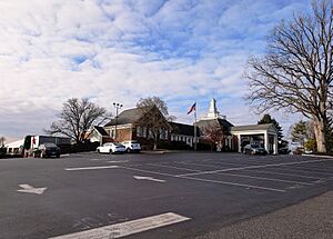
Tavistock Country Club clubhouse
|
||
|
||
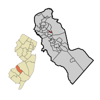
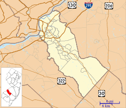
Tavistock highlighted in Camden County. Inset: Location of Camden County highlighted in the State of New Jersey.
|
||
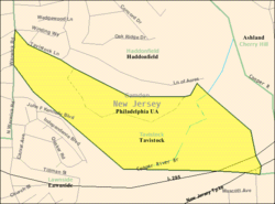
Census Bureau map of Tavistock, New Jersey
|
||
| Country | ||
| State | ||
| County | Camden | |
| Incorporated | February 16, 1921 | |
| Government | ||
| • Type | Walsh Act | |
| • Body | Board of Commissioners | |
| Area | ||
| • Total | 0.28 sq mi (0.71 km2) | |
| • Land | 0.27 sq mi (0.71 km2) | |
| • Water | 0.00 sq mi (0.01 km2) 1.07% | |
| Area rank | 555th of 565 in state 34th of 37 in county |
|
| Elevation | 46 ft (14 m) | |
| Population
(2020)
|
||
| • Total | 9 | |
| • Estimate
(2023)
|
7 | |
| • Rank | 564th of 565 in state 37th of 37 in county |
|
| • Density | 33.0/sq mi (12.7/km2) | |
| • Density rank | 558th of 565 in state 36th of 37 in county |
|
| Time zone | UTC−05:00 (Eastern (EST)) | |
| • Summer (DST) | UTC−04:00 (Eastern (EDT)) | |
| ZIP Code |
08033 – Haddonfield
|
|
| Area code(s) | 856 | |
| FIPS code | 3400772240 | |
| GNIS feature ID | 0885416 | |
Tavistock is a small borough located in Camden County, in the state of New Jersey. It is known for being one of the smallest towns in New Jersey by population. In 2020, only 9 people lived there.
Tavistock became a borough on February 16, 1921. It was created from parts of an older area called Centre Township. The name "Tavistock" comes from a family estate in England that belonged to some of the first settlers.
The main reason Tavistock was formed was to allow members of the Tavistock Country Club to play golf on Sundays. At their old club in Haddonfield, a "blue law" (a law that restricts certain activities on Sundays) stopped them from playing. By creating their own borough, they could set their own rules. Even though Tavistock was formed during Prohibition, when alcohol was banned, the new borough was also a way for the club members to avoid Haddonfield's strict rules about alcohol. Important state leaders helped make Tavistock its own town.
Contents
Geography and Location
Tavistock is a very small place. It covers about 0.28 square miles (0.71 square kilometers). Most of this area is land, with a tiny bit of water.
The borough shares its borders with other towns. These include Barrington, Haddonfield, and Lawnside.
Population Changes Over Time
| Historical population | |||
|---|---|---|---|
| Census | Pop. | %± | |
| 1930 | 20 | — | |
| 1940 | 13 | −35.0% | |
| 1950 | 15 | 15.4% | |
| 1960 | 10 | −33.3% | |
| 1970 | 12 | 20.0% | |
| 1980 | 9 | −25.0% | |
| 1990 | 35 | 288.9% | |
| 2000 | 24 | −31.4% | |
| 2010 | 5 | −79.2% | |
| 2020 | 9 | 80.0% | |
| 2023 (est.) | 7 | 40.0% | |
| Population sources: 1930–2000 1930 1940–2000 2000 2010 2020 |
|||
Tavistock has always had a very small population. In 2010, only 5 people lived there, making it the smallest town in New Jersey at that time. By 2020, the population grew to 9 people.
Life in Tavistock: 2010 Census
In 2010, there were 5 people living in 3 homes in Tavistock. Two of these homes were married couples. The third home had a man over 65 living by himself. All the residents were white. Most residents were either young adults (25-44 years old) or older adults (over 65). The average age was about 66 years old.
How Tavistock is Governed
Tavistock uses a special type of local government called the Walsh Act. This means it is run by a group of three commissioners. These commissioners are elected by the people living in Tavistock. They serve for four years at a time. Each commissioner is in charge of a different part of the town's services. One of the commissioners is also chosen to be the Mayor.
As of 2023, the commissioners for Tavistock are Mayor Joseph Del Duca, Colin Mack-Allen, and Mindy Del Duca. Their terms are set to end on December 31, 2025.
Tavistock has very high property taxes compared to other towns. In 2018, the average property tax bill was over $31,000. This was the highest in Camden County.
Political Views in Tavistock
Because Tavistock has so few residents, its political numbers are very small. As of March 2011, there were only seven registered voters. Most of these voters were registered as Republicans.
In recent presidential elections, the small number of votes cast shows how tiny the population is. For example, in the 2012 election, only 3 votes were cast. In 2020, 5 votes were cast for the Democratic candidate and 0 for the Republican.
Education for Tavistock Students
Tavistock does not have its own schools. Instead, students living in Tavistock attend public schools in the nearby town of Haddonfield. This is part of a "sending/receiving relationship" between the two towns.
The Haddonfield Public Schools district has five schools. These include three elementary schools (Central, Elizabeth Haddon, and J. Fithian Tatem), a middle school (Haddonfield Middle School), and a high school (Haddonfield Memorial High School). In the 2018–2019 school year, the district had over 2,700 students.
Getting Around Tavistock
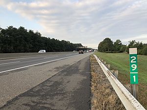
Tavistock has a very small amount of roads, only about 0.17 miles (0.27 kilometers) in total. All these roads are maintained by the New Jersey Department of Transportation.
Major highways like Interstate 295 and the New Jersey Turnpike pass through or near Tavistock. However, the closest exits for these highways are in neighboring towns. The main road serving the borough is Tavistock Lane, which is right on the border with Haddonfield.
For public transportation, NJ Transit offers local bus service. The 451 bus route connects Tavistock to Camden and the Lindenwold station.
Notable People from Tavistock
Even though Tavistock is very small, some notable people have lived there:
- John Aglialoro (born 1943), a businessman and film producer.
- Joan Carter (born 1943), a businesswoman and philanthropist.
See also
 In Spanish: Tavistock (Nueva Jersey) para niños


