Haddon Heights, New Jersey facts for kids
Quick facts for kids
Haddon Heights, New Jersey
|
|
|---|---|
|
Borough
|
|
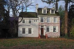
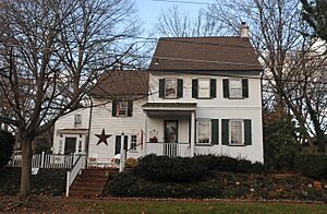
Hinchman-Lippincott House
|
|
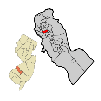
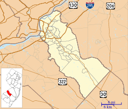
Haddon Heights highlighted in Camden County. Inset: Location of Camden County in the State of New Jersey.
|
|
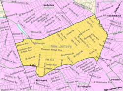
Census Bureau map of Haddon Heights, New Jersey
|
|
| Country | |
| State | |
| County | Camden |
| European settlement | 1699 |
| Incorporated | March 2, 1904 |
| Named for | Elizabeth Haddon |
| Government | |
| • Type | Borough |
| • Body | Borough Council |
| Area | |
| • Total | 1.57 sq mi (4.07 km2) |
| • Land | 1.57 sq mi (4.06 km2) |
| • Water | 0.01 sq mi (0.01 km2) 0.32% |
| Area rank | 445th of 565 in state 22nd of 37 in county |
| Elevation | 59 ft (18 m) |
| Population
(2020)
|
|
| • Total | 7,495 |
| • Estimate
(2023)
|
7,511 |
| • Rank | 306th of 565 in state 17th of 37 in county |
| • Density | 4,786.1/sq mi (1,847.9/km2) |
| • Density rank | 118th of 565 in state 12th of 37 in county |
| Time zone | UTC−05:00 (Eastern (EST)) |
| • Summer (DST) | UTC−04:00 (Eastern (EDT)) |
| ZIP Code |
08035
|
| Area code(s) | 856 |
| FIPS code | 3400728800 |
| GNIS feature ID | 0885239 |
Haddon Heights is a small town, called a borough, located in Camden County, New Jersey. In 2020, about 7,495 people lived here. The town was officially created on March 2, 1904. It was formed from parts of other nearby areas.
The borough was named after Elizabeth Haddon, an early settler in the region. Haddon Heights is known as a "dry town," which means that alcohol is not usually sold in stores or restaurants. However, voters recently approved a plan that might allow some places to sell alcohol in the future.
New Jersey Monthly magazine has often listed Haddon Heights as one of the best places to live in New Jersey. It was also recognized as a "Classic Town" by the Delaware Valley Regional Planning Commission.
Contents
History of Haddon Heights
The area that is now Haddon Heights was first settled in 1699 by John Hinchman. Later, in 1713, John Siddon built a farmhouse nearby. Before 1776, John Thorn Glover built a mill on the property.
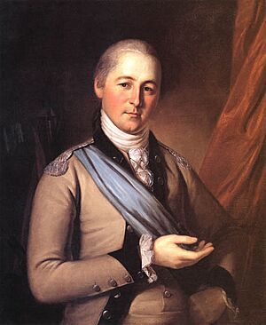
A house built around 1720 by Jacob Hinchman was later made bigger by American Revolutionary War hero Col. Joseph Ellis. This house is now called the Col. Joseph Ellis House. New Jersey governor Joseph Bloomfield later bought this property.
In 1890, Benjamin A. Lippincott built a train station in the middle of his land for the Atlantic City Railroad. Lippincott and Charles Hillman then planned out the streets for a new community. They called it Haddon Heights because it was close to Haddonfield and was on higher ground.
Large homes were built in popular styles like Colonial Revival and Queen Anne. These homes attracted families moving from cities. In 1904, Haddon Heights became an official borough, and Lippincott was elected mayor. A small downtown area grew near the railroad and the White Horse Pike. Eight churches and a synagogue were also built.
In 1926, an area called Fairfield Estates joined Haddon Heights. More single-family homes were built there through the 1940s and 1950s. Even though train passenger service stopped in 1965, Haddon Heights still looks like a classic early 1900s railroad town with shady streets and comfortable homes.
Geography and Location
Haddon Heights covers about 1.57 square miles (4.07 square kilometers). Most of this area is land, with a very small amount of water.
The borough shares its borders with several other towns. These include Audubon, Barrington, Bellmawr, Haddonfield, Haddon Township, and Mount Ephraim.
Population Information
| Historical population | |||
|---|---|---|---|
| Census | Pop. | %± | |
| 1910 | 1,452 | — | |
| 1920 | 2,950 | 103.2% | |
| 1930 | 5,394 | 82.8% | |
| 1940 | 5,555 | 3.0% | |
| 1950 | 7,287 | 31.2% | |
| 1960 | 9,260 | 27.1% | |
| 1970 | 9,365 | 1.1% | |
| 1980 | 8,361 | −10.7% | |
| 1990 | 7,860 | −6.0% | |
| 2000 | 7,547 | −4.0% | |
| 2010 | 7,473 | −1.0% | |
| 2020 | 7,495 | 0.3% | |
| 2023 (est.) | 7,511 | 0.5% | |
| Population sources: 1910–2000 1910–1920 1910 1910–1930 1940–2000 2000 2010 2020 |
|||
2020 Census Data
As of the 2020 United States census, Haddon Heights had a population of 7,495 people.
2010 Census Data
In the 2010 United States census, there were 7,473 people living in Haddon Heights. Most residents were White (95.45%). There were also smaller groups of Black or African American, Native American, Asian, and Pacific Islander people. About 2.65% of the population identified as Hispanic or Latino.
Arts and Culture
The Haddon Heights Public Library offers many resources for residents. You can find over 46,000 books, including fiction, mystery, teen, and children's books. The library also has magazines, DVDs, music CDs, and online resources.
The library's history goes back to 1902. The building used today was built in 1965. It is a great place for learning and finding entertainment.
Education in Haddon Heights
The Haddon Heights School District serves public school students from kindergarten through 12th grade. In the 2020–21 school year, the district had about 1,519 students and 132 teachers. This means there were about 11.5 students for every teacher.
The district has four schools:
- Atlantic Avenue Elementary School (Pre-K–6)
- Glenview Elementary School (K–6)
- Seventh Avenue Elementary School (K–6)
- Haddon Heights Junior/Senior High School (7–12)
Students from nearby towns like Barrington and Lawnside also attend Haddon Heights Junior/Senior High School.
There are also private schools in Haddon Heights:
- St. Rose of Lima School: This is a K–8 elementary school. It is part of the Roman Catholic Diocese of Camden. It was founded in 1921.
- Baptist Regional School: This is a private school for K–12 students. It prepares students for college and teaches with a Christian viewpoint.
Transportation
Roads and Highways
As of 2010, Haddon Heights had about 30.82 miles of roads. Most of these roads are maintained by the town itself. Some are managed by Camden County or the New Jersey Department of Transportation.
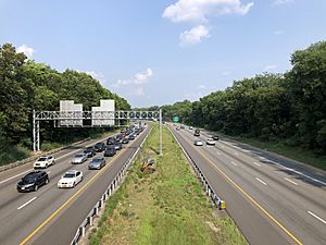
Major highways near Haddon Heights include Interstate 295, which runs along the southern edge of the borough. Route 168 (Black Horse Pike) is on the western border, and Route 41 is on the eastern border.
Public Transportation
NJ Transit offers local bus service from Haddon Heights to Philadelphia. These routes are the 400 and 403. Local bus service is also available on the 455 and 457 routes.
For train service to Philadelphia, you can use the PATCO Speedline. The closest train stops are Westmont and Haddonfield.
Notable People from Haddon Heights
Many interesting people have lived in or are connected to Haddon Heights. Here are a few:
- Rob Andrews (born 1957), a former Congressman.
- Andrew Bailey (born 1984), a professional baseball player who was an MLB All-Star.
- Edward Clyde Benfold (1931–1952), a United States Navy Hospital Corpsman who received the Medal of Honor.
- Mary Chalmers (born 1927), an author and illustrator known for her children's books.
- Erin Donohue (born 1983), a middle-distance runner who competed in the 2008 Summer Olympics.
- Patrick T. Harker (born 1958), the President of the Philadelphia Federal Reserve.
- Steve Israel (born 1969), a former NFL football player.
- Herb Kelleher (1931–2019), the founder of Southwest Airlines.
- Willie Mosconi (1913–1993), a world champion billiards player.
- Blaine Neal (born 1978), a professional baseball player and Olympic bronze medalist.
- Haason Reddick (born 1994), an American football linebacker who plays in the NFL.
- Steven Spielberg (born 1946), a famous film director and producer.
See also
 In Spanish: Haddon Heights para niños
 | Stephanie Wilson |
 | Charles Bolden |
 | Ronald McNair |
 | Frederick D. Gregory |


