Magnolia, New Jersey facts for kids
Quick facts for kids
Magnolia, New Jersey
|
||
|---|---|---|
|
Borough
|
||
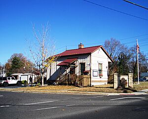
Former train station now housing the Magnolia Historical Society
|
||
|
||
| Motto(s):
"One Square Mile of Friendliness"
|
||
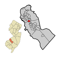
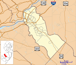
Magnolia highlighted in Camden County. Inset: Location of Camden County in New Jersey.
|
||
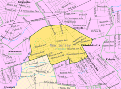
Census Bureau map of Magnolia, New Jersey
|
||
| Country | ||
| State | ||
| County | Camden | |
| Incorporated | May 12, 1915 | |
| Government | ||
| • Type | Borough | |
| • Body | Borough Council | |
| Area | ||
| • Total | 0.98 sq mi (2.53 km2) | |
| • Land | 0.98 sq mi (2.53 km2) | |
| • Water | 0.00 sq mi (0.00 km2) 0.00% | |
| Area rank | 503rd of 565 in state 27th of 37 in county |
|
| Elevation | 79 ft (24 m) | |
| Population
(2020)
|
||
| • Total | 4,352 | |
| • Estimate
(2023)
|
4,356 | |
| • Rank | 403rd of 565 in state 25th of 37 in county |
|
| • Density | 4,447.9/sq mi (1,717.3/km2) | |
| • Density rank | 138th of 565 in state 15th of 37 in county |
|
| Time zone | UTC−05:00 (Eastern (EST)) | |
| • Summer (DST) | UTC−04:00 (Eastern (EDT)) | |
| ZIP Code |
08049
|
|
| Area code(s) | 609 and 856 | |
| FIPS code | 3400742630 | |
| GNIS feature ID | 0885288 | |
Magnolia is a small town, called a borough, located in Camden County, New Jersey, in the United States. In 2020, about 4,352 people lived here. It's a friendly place, known for its motto: "One Square Mile of Friendliness."
Contents
History of Magnolia
Magnolia became an official borough on April 14, 1915. This happened after people voted for it on May 12, 1915. The town was named after the beautiful magnolia trees that grow in the area.
Magnolia is also famous for having one of the last seven single-arch McDonald's signs in the United States. Most McDonald's signs today have the well-known "Golden Arches."
Geography and Location
Magnolia is a small town, covering about 0.98 square miles (2.53 square kilometers) of land. It doesn't have any large bodies of water within its borders.
The borough shares its borders with several other towns in Camden County. These include Barrington, Gloucester Township, Lawnside, Runnemede, and Somerdale.
Population Changes Over Time
| Historical population | |||
|---|---|---|---|
| Census | Pop. | %± | |
| 1920 | 1,245 | — | |
| 1930 | 1,522 | 22.2% | |
| 1940 | 1,552 | 2.0% | |
| 1950 | 1,883 | 21.3% | |
| 1960 | 4,199 | 123.0% | |
| 1970 | 5,893 | 40.3% | |
| 1980 | 4,881 | −17.2% | |
| 1990 | 4,861 | −0.4% | |
| 2000 | 4,409 | −9.3% | |
| 2010 | 4,341 | −1.5% | |
| 2020 | 4,352 | 0.3% | |
| 2023 (est.) | 4,356 | 0.3% | |
| Population sources:1920–2000 1920 1920–1930 1940–2000 2000 2010 2020 |
|||
The population of Magnolia has changed over the years. In 1920, there were 1,245 people. The population grew quite a bit in the 1960s and 1970s. By 2020, about 4,352 people called Magnolia home.
More About the People of Magnolia
In 2010, there were 4,341 people living in Magnolia. Most residents were White (about 74.7%). About 18.3% were Black or African American, and 1.9% were Asian. People of Hispanic or Latino background made up about 7.8% of the population.
The average age in Magnolia in 2010 was 38.3 years old. About 21.8% of the population was under 18 years old.
Education in Magnolia
Students in Magnolia attend public schools run by the Magnolia School District.
Magnolia School District
The district has one school, Magnolia School. It serves students from pre-kindergarten all the way up to eighth grade. In the 2018–19 school year, there were 408 students and about 39 teachers. This means there were about 10 students for every teacher.
Sterling High School
For high school, students from Magnolia go to Sterling High School. This school is located in Somerdale. It also serves students from Somerdale, Stratford, Hi-Nella, and Laurel Springs. In 2018–19, Sterling High School had 958 students and about 70 teachers.
Transportation Around Town
Magnolia has a good network of roads and highways to help people get around.
Main Roads and Highways
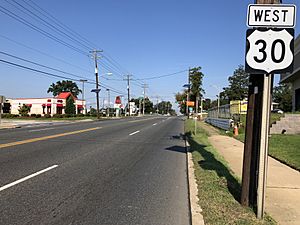
The main highway that goes through Magnolia is U.S. Route 30, also known as White Horse Pike. County Route 544 also passes through the borough.
Public Bus Service
If you need to travel by bus, NJ Transit offers a bus service. The 403 route connects Magnolia to Turnersville and Camden.
Famous People from Magnolia
Some notable people have connections to Magnolia:
- Kristin Hunter (1931–2008) was an author. She is well-known for her first novel, God Bless the Child, published in 1964.
- Olamide Zaccheaus (born 1997) is an American football wide receiver. He plays for the Atlanta Falcons in the National Football League.
See also
 In Spanish: Magnolia (Nueva Jersey) para niños
 | Shirley Ann Jackson |
 | Garett Morgan |
 | J. Ernest Wilkins Jr. |
 | Elijah McCoy |


