Somerdale, New Jersey facts for kids
Quick facts for kids
Somerdale, New Jersey
|
||
|---|---|---|
|
Borough
|
||
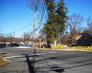
Somerdale Park
|
||
|
||
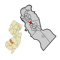
Somerdale highlighted in Camden County. Inset: Location of Camden County in New Jersey.
|
||
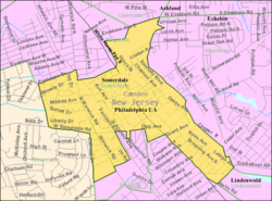
Census Bureau map of Somerdale, New Jersey
|
||
| Country | ||
| State | ||
| County | Camden | |
| Incorporated | April 23, 1929 | |
| Government | ||
| • Type | Borough | |
| • Body | Borough Council | |
| Area | ||
| • Total | 1.39 sq mi (3.61 km2) | |
| • Land | 1.39 sq mi (3.61 km2) | |
| • Water | 0.00 sq mi (0.00 km2) 0.00% | |
| Area rank | 461st of 565 in state 26th of 37 in county |
|
| Elevation | 85 ft (26 m) | |
| Population
(2020)
|
||
| • Total | 5,566 | |
| • Estimate
(2023)
|
5,567 | |
| • Rank | 362nd of 565 in state 22nd of 37 in county |
|
| • Density | 3,998.6/sq mi (1,543.9/km2) | |
| • Density rank | 158th of 565 in state 20th of 37 in county |
|
| Time zone | UTC−05:00 (Eastern (EST)) | |
| • Summer (DST) | UTC−04:00 (Eastern (EDT)) | |
| ZIP Code |
08083
|
|
| Area code(s) | 856 | |
| FIPS code | 3400768340 | |
| GNIS feature ID | 0885396 | |
Somerdale is a small town called a borough in Camden County, New Jersey. In 2020, about 5,566 people lived there. This was a bit more than in 2010.
Somerdale became a borough on April 23, 1929. It was formed from parts of Clementon Township. Four other towns were also created on the same day. These were Hi-Nella, Lindenwold, Pine Hill, and Pine Valley.
Contents
Geography of Somerdale
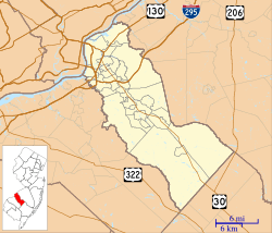
Somerdale is a small place, covering about 1.39 square miles (3.61 square kilometers). All of this area is land.
Somerdale shares its borders with several other towns in Camden County. These include Cherry Hill, Gloucester Township, Hi-Nella, Lawnside, Lindenwold, Magnolia, Stratford, and Voorhees Township.
Population Changes in Somerdale
| Historical population | |||
|---|---|---|---|
| Census | Pop. | %± | |
| 1930 | 1,151 | — | |
| 1940 | 1,170 | 1.7% | |
| 1950 | 1,417 | 21.1% | |
| 1960 | 4,839 | 241.5% | |
| 1970 | 6,510 | 34.5% | |
| 1980 | 5,900 | −9.4% | |
| 1990 | 5,440 | −7.8% | |
| 2000 | 5,123 | −5.8% | |
| 2010 | 5,151 | 0.5% | |
| 2020 | 5,566 | 8.1% | |
| 2023 (est.) | 5,567 | 8.1% | |
| Population sources: 1930–2000 1930 1940–2000 2000 2010 2020 |
|||
Somerdale's Population in 2010
In 2010, Somerdale had 5,151 people living in 2,026 homes. About two-thirds of the people were White. There were also many Black or African American people. Other groups included Asian people and those from two or more races. About 8% of the population was Hispanic or Latino.
The average home had about 2.5 people. Families, on average, had about 3.1 people.
Education in Somerdale
Somerdale has its own school district for younger students.
Somerdale School District
The Somerdale School District serves students from pre-kindergarten up to eighth grade. These students attend Somerdale Park School. In the 2022-2023 school year, there were 447 students. There was about one teacher for every 10 students.
Sterling High School
For high school, students in Somerdale go to Sterling High School. This school is for students from ninth grade to twelfth grade. It also serves students from nearby towns like Magnolia and Stratford. The high school is actually located right in Somerdale. In 2022-2023, the high school had 894 students. There was about one teacher for every 13 students.
Former Schools
Our Lady of Grace was a Catholic elementary school in Somerdale. It taught students from kindergarten to eighth grade. The school and its church closed in 2009. This happened as part of a plan by the Roman Catholic Diocese of Camden.
Transportation in Somerdale
Somerdale has several roads that help people get around.
Roads and Highways
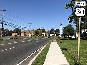
As of 2010, Somerdale had over 24 miles of roads. Most of these roads are kept up by the town itself. U.S. Route 30 goes through Somerdale. It connects the town to Magnolia and Stratford.
Public Transportation
If you need to travel by bus, NJ Transit offers service. The 403 bus route connects Somerdale to Philadelphia. Local bus service is also available on the 451 route.
Famous People from Somerdale
Many interesting people have lived in or are connected to Somerdale.
- Jason Cook (born 1980), an actor and director for television.
- Darryl Dawkins (born 1957), a former professional basketball player in the NBA.
- Zac Gallen (born 1995), a baseball pitcher for the Arizona Diamondbacks.
- April Holmes (born 1973), a paralympic runner who holds world records.
- Michael Kidd-Gilchrist (born 1993), a professional basketball player.
- Sophia A. Nelson (born 1967), an author, political expert, and lawyer.
- Tim Saunders (born 1962), a radio announcer for the Philadelphia Flyers hockey team.
See also
 In Spanish: Somerdale para niños
 | Tommie Smith |
 | Simone Manuel |
 | Shani Davis |
 | Simone Biles |
 | Alice Coachman |


