Stratford, New Jersey facts for kids
Quick facts for kids
Stratford, New Jersey
|
||
|---|---|---|
|
Borough
|
||
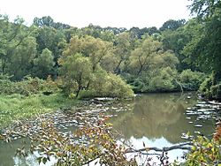
Big Timber Creek in Stratford
|
||
|
||
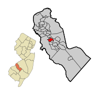
Location of Stratford in Camden County highlighted in red (right). Inset map: Location of Camden County in New Jersey highlighted in orange (left).
|
||
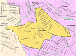
Census Bureau map of Stratford, New Jersey
|
||
| Country | ||
| State | ||
| County | Camden | |
| Incorporated | February 13, 1925 | |
| Named for | Stratford-upon-Avon, England | |
| Government | ||
| • Type | Borough | |
| • Body | Borough Council | |
| Area | ||
| • Total | 1.57 sq mi (4.07 km2) | |
| • Land | 1.57 sq mi (4.07 km2) | |
| • Water | 0.00 sq mi (0.00 km2) 0.00% | |
| Area rank | 445th of 565 in state 22nd of 37 in county |
|
| Elevation | 79 ft (24 m) | |
| Population
(2020)
|
||
| • Total | 6,981 | |
| • Estimate
(2023)
|
7,000 | |
| • Rank | 321st of 565 in state 20th of 37 in county |
|
| • Density | 4,446.5/sq mi (1,716.8/km2) | |
| • Density rank | 139th of 565 in state 16th of 37 in county |
|
| Time zone | UTC−05:00 (Eastern (EST)) | |
| • Summer (DST) | UTC−04:00 (Eastern (EDT)) | |
| ZIP Code |
08084
|
|
| Area code(s) | 856 | |
| FIPS code | 3400771220 | |
| GNIS feature ID | 0885411 | |
Stratford is a small town, called a borough, located in Camden County, in the state of New Jersey. In 2020, about 6,981 people lived here. Stratford is also home to the Rowan-Virtua School of Osteopathic Medicine.
Contents
About Stratford's Location
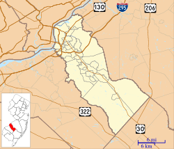
Stratford covers an area of about 1.57 square miles (4.07 square kilometers). All of this area is land.
The borough shares its borders with several other towns. To the north and east, it borders Gloucester Township. Hi-Nella is to the north, and Laurel Springs is to the south. To the south and west, you'll find Lindenwold, and Somerdale is to the west.
Stratford's History
Early Settlers and the Village of White Horse
The first European settlers arrived in the 1740s. They gathered around a place called the White Horse Tavern. This area grew into a small village known as White Horse. Today, the only building left from that early village is the Stratford Quaker Store.
How Stratford Got Its Name
In the 1880s, a company called the Rural Land Improvement Company started building up the area. They named the village "Stratford" after a famous town in England, Stratford-upon-Avon.
Becoming an Official Borough
Stratford officially became a borough on February 13, 1925. It was one of seven new towns created from parts of Clementon Township.
Growth in the 1960s
In the 1960s, a large farm called Hunt's farm was sold. Developers built a new neighborhood there called Laurel Mill Farms. This area is right next to the North Branch of Big Timber Creek.
Who Lives in Stratford?
| Historical population | |||
|---|---|---|---|
| Census | Pop. | %± | |
| 1930 | 958 | — | |
| 1940 | 980 | 2.3% | |
| 1950 | 1,356 | 38.4% | |
| 1960 | 4,308 | 217.7% | |
| 1970 | 9,801 | 127.5% | |
| 1980 | 8,005 | −18.3% | |
| 1990 | 7,614 | −4.9% | |
| 2000 | 7,271 | −4.5% | |
| 2010 | 7,040 | −3.2% | |
| 2020 | 6,981 | −0.8% | |
| 2023 (est.) | 7,000 | −0.6% | |
| Population sources: 1930–2000 1930 1940–2000 2000 2010 2020 |
|||
Population in 2010
In 2010, the 2010 United States census counted 7,040 people living in Stratford. There were 2,641 households, which are groups of people living together. About 1,822 of these were families.
Most people in Stratford were White, making up about 82.4% of the population. About 8.2% were Black or African American, and 4.2% were Asian. People from Hispanic or Latino backgrounds made up about 6.5% of the population.
About 31% of households had children under 18 years old. The average household had 2.64 people, and the average family had 3.19 people. The median age in Stratford was 39.1 years old.
Schools in Stratford
Public Schools
The Stratford School District serves students from pre-kindergarten through eighth grade. Students from Hi-Nella also attend these schools. This is part of a special agreement between the towns. Students from Laurel Springs come to Stratford for grades 7 and 8.
The district has two schools:
- Parkview Elementary School: For students in pre-kindergarten through third grade.
- Samuel S. Yellin Elementary School: For students in grades 4 through 8.
For high school, students attend Sterling High School. This school is for grades 9 through 12. It also serves students from Magnolia, Somerdale, Hi-Nella, and Laurel Springs. The high school is located in Somerdale.
Private and Higher Education
- John Paul II Regional School: This is a Catholic elementary school. It opened in 2008.
- Rowan University School of Osteopathic Medicine: This university campus is in Stratford. It has several buildings, including a doctors' pavilion and a science center.
- Rutgers University's Biomedical and Health Sciences: Rutgers University also has a campus here.
- Stratford Classical Christian Academy: This school used to be in Stratford. It closed in 2015.
Getting Around Stratford
Roads and Highways
Stratford has about 26 miles of roads. Most of these roads are maintained by the town itself.
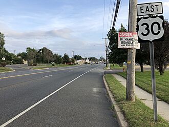
U.S. Route 30, also known as White Horse Pike, runs through Stratford. It goes from Laurel Springs and then along the border with Somerdale.
Public Transportation
NJ Transit offers bus services in Stratford.
- Route 403: This bus goes between Turnersville and Camden.
- Route 459: This route provides local service. It travels between Voorhees Town Center and the Avandale Park and Ride in Winslow Township.
Famous People from Stratford
Many notable people have connections to Stratford. Here are a few:
- Tamika Catchings (born 1979): A professional basketball player for the WNBA's Indiana Fever.
- Mike Daniels (born 1989): A defensive end who played for the Green Bay Packers.
- Lee DeRamus (born 1972): A wide receiver who played for the New Orleans Saints.
- Steven Ferrari (born 1962): A US Army major general who lived in Stratford.
- Juwan Johnson (born 1996): An American football wide receiver for the New Orleans Saints.
- Ken Kelley (born 1960): An American football linebacker who played in the United States Football League.
- Brett Laxton (born 1973): A former MLB pitcher for the Oakland Athletics and Kansas City Royals.
- Kelly Ripa (born 1970): A famous actress and talk show host of Live! with Kelly.
- Julian Talley (born 1989): An NFL wide receiver for the New York Giants.
See also
 In Spanish: Stratford (Nueva Jersey) para niños
 | Emma Amos |
 | Edward Mitchell Bannister |
 | Larry D. Alexander |
 | Ernie Barnes |


