Runnemede, New Jersey facts for kids
Quick facts for kids
Runnemede, New Jersey
|
||
|---|---|---|
|
Borough
|
||
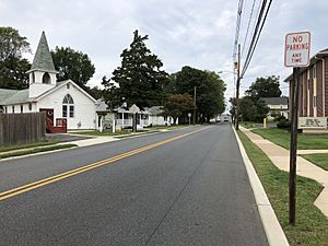
Street in Runnemede, October 2018
|
||
|
||
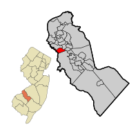
Runnemede highlighted in Camden County. Inset: Location of Camden County highlighted in the State of New Jersey.
|
||
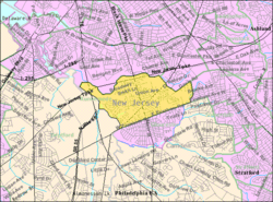
Census Bureau map of Runnemede, New Jersey.
|
||
| Country | ||
| State | ||
| County | Camden | |
| European settlement | 1626 | |
| Incorporated | April 24, 1926 | |
| Named for | Runnymede, England | |
| Government | ||
| • Type | Borough | |
| • Body | Borough Council | |
| Area | ||
| • Total | 2.10 sq mi (5.45 km2) | |
| • Land | 2.05 sq mi (5.31 km2) | |
| • Water | 0.05 sq mi (0.14 km2) 2.56% | |
| Area rank | 402nd of 565 in state 17th of 37 in county |
|
| Elevation | 69 ft (21 m) | |
| Population
(2020)
|
||
| • Total | 8,324 | |
| • Estimate
(2023)
|
8,338 | |
| • Rank | 285th of 565 in state 16th of 37 in county |
|
| • Density | 4,058.5/sq mi (1,567.0/km2) | |
| • Density rank | 155th of 565 in state 19th of 37 in county |
|
| Time zone | UTC−05:00 (Eastern (EST)) | |
| • Summer (DST) | UTC−04:00 (Eastern (EDT)) | |
| ZIP Code |
08078
|
|
| Area code(s) | 856 exchanges: 312, 931, 933, 939 | |
| FIPS code | 3400765160 | |
| GNIS feature ID | 0885382 | |
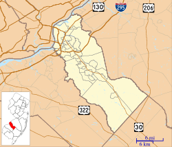
Runnemede is a small town, called a borough, located in Camden County, in the state of New Jersey. In 2020, about 8,324 people lived there.
Runnemede became an official borough on April 24, 1926. It was created from parts of an older area called Centre Township. The name "Runnemede" might come from Runnymede, England. Some people thought it meant "running water" in a Native American language, but that's not true. Other stories about the name are also likely just myths.
Contents
Geography of Runnemede
Runnemede covers a total area of about 2.11 square miles (5.45 square kilometers). Most of this area is land, with a small part being water.
A community called Glendora is located partly or entirely within Runnemede.
Runnemede shares its borders with several other towns in Camden County. These include Barrington, Bellmawr, Gloucester Township, and Magnolia. It also borders Deptford Township in Gloucester County.
People and Population
| Historical population | |||
|---|---|---|---|
| Census | Pop. | %± | |
| 1930 | 2,436 | — | |
| 1940 | 2,835 | 16.4% | |
| 1950 | 4,217 | 48.7% | |
| 1960 | 8,396 | 99.1% | |
| 1970 | 10,475 | 24.8% | |
| 1980 | 9,461 | −9.7% | |
| 1990 | 9,042 | −4.4% | |
| 2000 | 8,533 | −5.6% | |
| 2010 | 8,648 | 1.3% | |
| 2020 | 8,324 | −3.7% | |
| 2023 (est.) | 8,338 | −3.6% | |
| Population sources: 1930–2000 1930 1940–2000 2000 2010 2020 |
|||
Population in 2010
In 2010, there were 8,468 people living in Runnemede. They lived in 3,370 homes, and 2,214 of these were families. The town had about 4,117 people per square mile.
Most of the people in Runnemede were White (88.52%). There were also Black or African American (4.72%), Asian (2.63%), and Native American (0.30%) residents. About 6.09% of the population was Hispanic or Latino.
About 20.9% of the people were under 18 years old. The average age in Runnemede was 40.1 years.
Local Economy
Mister Softee, a well-known company that sells ice cream from trucks, has its main office in Runnemede. They have about 350 owners who run 625 trucks in 18 different states. Mister Softee has been based in Runnemede since 1958.
Education in Runnemede
Public Schools
The Runnemede Public School District serves students from pre-kindergarten up to eighth grade. In the 2018–19 school year, the district had 814 students and 68.5 teachers. This means there were about 11.9 students for every teacher.
The schools in the district are:
- Aline Bingham Elementary School (grades K–3, 174 students)
- Grace Downing Elementary School (grades K–3, 167 students)
- Mary E. Volz Elementary and Middle School (grades 4–8, 469 students)
For high school, students from Runnemede go to Triton Regional High School. This school is part of the Black Horse Pike Regional School District. This district also includes students from Bellmawr and Gloucester Township. Triton Regional High School had 1,159 students and 95.5 teachers in the 2018–19 school year.
Private Schools
St. Teresa Regional School is a private school for students from pre-kindergarten to eighth grade. This school is part of the Roman Catholic Diocese of Camden. Famous Olympic gold medalist and figure skater Tara Lipinski once attended St. Teresa Regional School.
Transportation
Roads and Highways
Runnemede has many roads, totaling about 31.16 miles (50.15 kilometers). Most of these roads are maintained by the town itself.
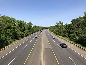
The New Jersey Turnpike is a very important highway that goes through Runnemede. Part of its Exit 3 is located in the borough, near the border with Bellmawr.
Several state highways also pass through Runnemede. These include Route 168 and Route 41, which cross each other in the town. The North-South Freeway (Route 42) also goes through a small part of Runnemede, but there are no exits to the town from this freeway.
A major county road, CR 544, runs along the southern edge of Runnemede.
Public Transportation
NJ Transit offers bus service for people traveling between Runnemede and Philadelphia on the 400 route. There is also local bus service available on the 455 route.
Notable People from Runnemede
Many interesting people have connections to Runnemede. Some of them include:
- Brigid Callahan Harrison (born 1965), a professor who teaches political science and law.
- Michael Iaconelli (born 1972), a famous bass fisherman who won the Bassmaster Angler of the Year award in 2006.
- Bill Moen (born 1986), a politician who represents the 5th Legislative District in the New Jersey Assembly.
- Jack O'Halloran (born 1943), a former heavyweight boxer and actor. He appeared in movies like King Kong and Superman.
- Tim Tetrick (born 1981), a professional harness racing driver.
- Theresa Anne Tull (born 1936), a diplomat who served as the United States Ambassador to Guyana and Brunei.
See also
 In Spanish: Runnemede para niños
 | William M. Jackson |
 | Juan E. Gilbert |
 | Neil deGrasse Tyson |


