East Lansdowne, Pennsylvania facts for kids
Quick facts for kids
East Lansdowne, Pennsylvania
|
|
|---|---|
|
Borough
|
|

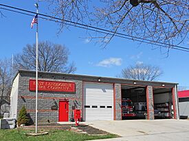
East Lansdowne Fire Department
|
|

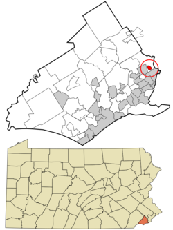
Location of East Lansdowne in Delaware County, Pennsylvania
|
|
| Country | United States |
| State | Pennsylvania |
| County | Delaware |
| Founded | 1682 |
| Incorporated | June 3, 1911 |
| Named for | Lansdowne Boro |
| Area | |
| • Total | 0.206 sq mi (0.534 km2) |
| • Land | 0.206 sq mi (0.534 km2) |
| • Water | 0.000 sq mi (0.000 km2) |
| Elevation | 118 ft (36 m) |
| Population
(2020)
|
|
| • Total | 2,714 |
| • Estimate
(2023)
|
2,687 |
| • Density | 13,020/sq mi (5,028/km2) |
| Time zone | UTC−5 (Eastern (EST)) |
| • Summer (DST) | UTC−4 (EDT) |
| ZIP Code |
19050
|
| Area code(s) | 610, 484, and 835 |
| FIPS code | 42-21384 |
| GNIS feature ID | 1215181 |
| Sales tax | 6.0% |
East Lansdowne is a small town, called a borough, located in Delaware County, Pennsylvania, in the United States. In 2020, about 2,714 people lived there.
Contents
Where is East Lansdowne Located?
East Lansdowne is found at coordinates 39.944162 degrees North and -75.260253 degrees West. It covers a total area of about 0.206 square miles (0.534 square kilometers), and all of it is land.
This borough is located about half a mile west of Southwest Philadelphia. It is surrounded by Upper Darby Township. The towns of Lansdowne and Yeadon are also nearby.
Schools in East Lansdowne
The William Penn School District serves East Lansdowne. This school district was created in 1972.
Elementary and Middle Schools
- East Lansdowne Basics Magnet Elementary School (Kindergarten to 6th grade)
- In 1972, this school's library was open to the public. This was special because East Lansdowne did not have another public library.
- Vision Academy Charter School (Kindergarten to 8th grade)
- Penn Wood Middle School (7th to 8th grade) is located in Darby.
High Schools
- Penn Wood High School, Cypress Street Campus (9th to 10th grade) is in Yeadon.
- Penn Wood High School, Green Ave Campus (11th to 12th grade) is in Lansdowne.
Private Schools in the Area
Saint Cyril of Alexandria Catholic Elementary School (Kindergarten to 8th grade) opened in September 1929. In 2021, this school moved and joined with St. Philomena School in nearby Lansdowne, Pennsylvania.
In 2005, there was a plan to close Saint Cyril's. However, the community worked together to keep it open. People donated $200,000, inspired by a child with a serious illness who wished for the school to be saved. This event was called the "Miracle at St. Cyril." In 2012, there was another plan to close it, but this decision was changed. The school then became part of the Independence Mission Schools.
Vision Academy Charter School bought the St. Cyril of Alexandria buildings. It opened there for the 2021-2022 school year.
Religious Places
The Roman Catholic Archdiocese of Philadelphia oversees Catholic churches in the area. St. Cyril of Alexandria Church in East Lansdowne opened in June 1928. In 2013, St. Cyril of Alexandria joined with St. Philomena Church in Lansdowne. The St. Cyril parish then closed.
How Many People Live Here?
| Historical population | |||
|---|---|---|---|
| Census | Pop. | %± | |
| 1920 | 1,561 | — | |
| 1930 | 3,168 | 102.9% | |
| 1940 | 3,323 | 4.9% | |
| 1950 | 3,527 | 6.1% | |
| 1960 | 3,224 | −8.6% | |
| 1970 | 3,186 | −1.2% | |
| 1980 | 2,806 | −11.9% | |
| 1990 | 2,691 | −4.1% | |
| 2000 | 2,586 | −3.9% | |
| 2010 | 2,668 | 3.2% | |
| 2020 | 2,714 | 1.7% | |
| 2023 (est.) | 2,687 | 0.7% | |
| U.S. Decennial Census 2020 Census |
|||
Population in 2020
| Race / Ethnicity (NH = Non-Hispanic) | Pop 2000 | Pop 2010 | Pop 2020 | % 2000 | % 2010 | 2020 |
|---|---|---|---|---|---|---|
| White alone (NH) | 1,833 | 790 | 429 | 70.88% | 29.61% | 15.81% |
| Black or African American alone (NH) | 521 | 1,452 | 1,780 | 20.15% | 54.42% | 65.59% |
| Native American or Alaska Native alone (NH) | 2 | 3 | 6 | 0.08% | 0.11% | 0.22% |
| Asian alone (NH) | 156 | 232 | 201 | 6.03% | 8.70% | 7.41% |
| Pacific Islander alone (NH) | 0 | 6 | 0 | 0.00% | 0.22% | 0.00% |
| Some Other Race alone (NH) | 3 | 6 | 26 | 0.12% | 0.22% | 0.96% |
| Mixed Race or Multi-Racial (NH) | 39 | 63 | 101 | 1.51% | 2.36% | 3.72% |
| Hispanic or Latino (any race) | 32 | 116 | 171 | 1.24% | 4.35% | 6.30% |
| Total | 2,586 | 2,668 | 2,714 | 100.00% | 100.00% | 100.00% |
In 2020, the census counted 2,714 people living in East Lansdowne. There were 931 households and 644 families. The population density was about 13,100 people per square mile (5,058 people per square kilometer).
The people living in East Lansdowne came from many different backgrounds:
- 16.6% were White
- 66.0% were African American
- 0.4% were Native American
- 7.4% were Asian
- 4.8% were from other races
- 4.8% were from two or more races
- 6.3% of the population were Hispanic or Latino (of any race).
Population in 2010
According to the 2010 census, there were 2,668 people living in the borough. The racial makeup was:
- 30.5% White
- 55.8% African American
- 0.1% Native American
- 8.8% Asian
- 0.2% Native Hawaiian and Other Pacific Islander
- 1.3% from other races
- 3.1% from two or more races
- 4.3% of the population were Hispanic or Latino (of any race).
Getting Around East Lansdowne
As of 2014, East Lansdowne had about 5.03 miles (8.10 kilometers) of public roads. Most of these roads, about 4.37 miles (7.03 kilometers), were taken care of by the borough itself. The rest, about 0.66 miles (1.06 kilometers), were maintained by the Pennsylvania Department of Transportation (PennDOT).
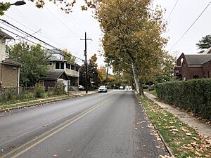
There are no major highways that go directly through East Lansdowne. The main roads in the town are Pembroke Avenue and Church Lane. These two roads meet near the eastern part of the borough.
Special Features of East Lansdowne
East Lansdowne is known for having the oldest 4th of July parade and celebration in all of Delaware County.
See also
 In Spanish: East Lansdowne para niños
 | Aaron Henry |
 | T. R. M. Howard |
 | Jesse Jackson |


