Swarthmore, Pennsylvania facts for kids
Quick facts for kids
Swarthmore, Pennsylvania
|
|
|---|---|
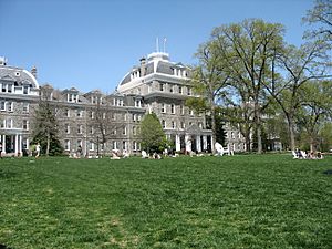
Parrish Hall at Swarthmore College
|
|
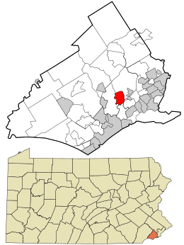
Location of Swarthmore in Delaware County (top) and of Delaware County in Pennsylvania (bottom)
|
|
| Country | United States |
| State | Pennsylvania |
| County | Delaware |
| Area | |
| • Total | 1.40 sq mi (3.63 km2) |
| • Land | 1.40 sq mi (3.63 km2) |
| • Water | 0.00 sq mi (0.00 km2) |
| Elevation | 125 ft (38 m) |
| Population
(2010)
|
|
| • Total | 6,194 |
| • Estimate
(2019)
|
6,346 |
| • Density | 4,532.86/sq mi (1,750.28/km2) |
| Time zone | UTC-5 (EST) |
| • Summer (DST) | UTC-4 (EDT) |
| ZIP code |
19081
|
| Area code(s) | 610 and 484 |
| FIPS code | 42-045-75648 |
| FIPS code | 42-75648 |
| GNIS feature ID | 1189142 |
Swarthmore is a small town, also called a borough, in Delaware County, Pennsylvania, United States. It was first named "Westdale" to honor a famous painter, Benjamin West, who lived there early on. The name changed to "Swarthmore" when Swarthmore College was built. In 2010, about 6,194 people lived in Swarthmore.
Contents
History of Swarthmore
Swarthmore was once part of Springfield Township. The town grew around Swarthmore College, which started in 1864. When train service to Philadelphia began in the 1880s, more people wanted to live in Swarthmore. It became a popular place for people to live and travel to work. The borough officially became a town in 1893.
About one-third of Swarthmore is taken up by the college campus. Many streets in the southern part of town are named after colleges. Many of the homes in Swarthmore were built between the Victorian era and the 1920s.
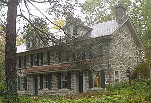
The Ogden House and Benjamin West Birthplace are two historic homes in Swarthmore. They are listed on the National Register of Historic Places.
Geography and Climate
Swarthmore is located in the eastern part of Delaware County. It is surrounded by Springfield Township to the north, east, and southwest. Ridley Township is to the southeast, and Nether Providence Township is to the west. A stream called Crum Creek flows south and forms the western edge of the town.
The total area of Swarthmore is about 3.63 square kilometers (1.40 square miles). All of this area is land. Swarthmore has a warm, wet climate, like the southeastern United States. The average monthly temperatures range from about 33 degrees Fahrenheit in January to 78 degrees Fahrenheit in July.
People and Population
|
||||||||||||||||||||||||||||||||||||||||||||||||||||||||||||||||
In 2010, there were 6,194 people living in Swarthmore. There were 1,963 households, and 1,327 of these were families. The town had about 4,460 people per square mile.
Most people in Swarthmore are White (82.5%). There are also people of Asian (7.7%), African American (5.0%), and other backgrounds. About 4.9% of the population was Hispanic or Latino.
About 34.1% of households had children under 18 living with them. Most households (57.3%) were married couples. The average household had 2.48 people, and the average family had 3.06 people.
The population is spread out in terms of age. About 20.7% of residents were under 18. About 15.8% were between 20 and 24 years old. The median age in Swarthmore was 30.8 years.
Education in Swarthmore
Swarthmore is part of the Wallingford-Swarthmore School District. This district was created in 1971 by combining a few smaller school districts.
- Younger students (grades K-5) go to Swarthmore-Rutledge School.
- Middle school students (grades 6-8) attend Strath Haven Middle School.
- High school students (grades 9-12) go to Strath Haven High School. Both the middle and high schools are located in Wallingford, a nearby town.
Swarthmore also has one private school, the George Crothers Memorial School. Notre Dame de Lourdes Catholic School is very close by in Ridley Township.
The town is also home to Swarthmore College. This is a private college that focuses on liberal arts, and it was founded in 1864.
Getting Around Swarthmore
Swarthmore has about 18.88 miles of public roads. Most of these roads are taken care of by the borough itself.
Pennsylvania Route 320 is the main highway that goes through Swarthmore. It runs north and south through the center of town.
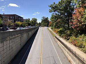
The Swarthmore Station is a train station for the SEPTA Regional Rail system. It's on the Media/Wawa Line and is located between the college and the town center. The SEPTA Route 109 bus also stops in Swarthmore. This bus connects Chester with Upper Darby.
Places to Visit and Things to Do
- The Scott Arboretum is a beautiful garden located on the campus of Swarthmore College.
- The Swarthmore Public Library is a great place to find books and learn. It's located at 121 Park Avenue.
- The Park Avenue Community Center is next to the Swarthmore Borough Hall. It hosts many fun activities, including theater and music events.
Notable People from Swarthmore
Many interesting people have lived in Swarthmore, including:
- Valerie Hollister (born 1939), an artist and painter.
- John Honnold (1915–2011), a law professor at the University of Pennsylvania.
- Edmund Jones, who was the Mayor of Swarthmore and a state representative.
- Mary Gay Scanlon (born 1959), a United States Representative.
- Rogers Stevens (born 1970), a guitarist for the band Blind Melon.
- Benjamin West (1738–1820), a famous British-American painter.
See also
 In Spanish: Swarthmore para niños
 | Lonnie Johnson |
 | Granville Woods |
 | Lewis Howard Latimer |
 | James West |


