Blae Loch (Beith) facts for kids
Quick facts for kids Blae Loch |
|
|---|---|

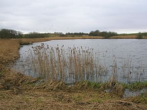
Blae Loch, East bank looking South
|
|
| Lua error in Module:Location_map at line 420: attempt to index field 'wikibase' (a nil value). | |
| Location | Blaelochhead and Lochend, North Ayrshire, Scotland |
| Type | Freshwater loch |
| Primary inflows | Highgate Burn, an un-named burn, rainfall and runoff |
| Primary outflows | Bungle Burn |
| Basin countries | Scotland |
| Max. length | c. 600 ft (180 m) |
| Max. width | c. 200 ft (61 m) |
| Average depth | Shallow |
| Islands | None |
| Settlements | Beith |
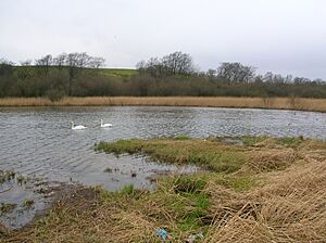
The Blae Loch is a small freshwater loch in North Ayrshire, Scotland. It sits in a low area near Blaelochhead Hill, close to the town of Beith.
Contents
History of Blae Loch
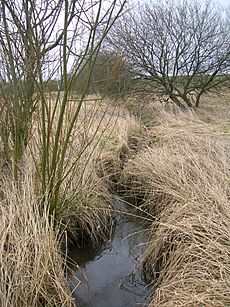
The Blae Loch formed naturally after the last Ice Age. It's a type of hole called a 'Kettle Hole'. It gets its water from local springs, a stream called Highgate Burn, and rainwater.
The name 'Blae' comes from an old Scottish word meaning 'dark' or 'black'. Around 1604, it was called 'Blaa-loche'. People said it looked pale and dull even on clear days. The Bungle Burn, which flows out of the loch, is named after a 'bungle', which was a big clump of earth.
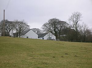
In 1845, some parts of the loch had been drained. By 1874, the loch was part of the Hessilhead estate. Today, it is owned by the people who own Blaelochhead Farm and Lochend House.
The Bungle Burn flows from the loch past an old mill site. It then joins the Lugton Water near Burnhouse.
How the Loch Was Used
Old maps from the 1800s show that a large water mill once stood near Wester Highgate. This mill had a big pond that was fed by the Bungle Burn from Blae Loch. The mill was already old by 1747, suggesting it had been there for a long time.
In the early 1600s, the loch was important to weavers. Many reeds grew around the loch. Weavers used these reeds to make 'pirns'. A pirn was a small spool that held yarn for weaving cloth. Later, pirns were made from wood.
In the 1800s, there was even a Blae Loch Curling Club! They had a special medal for their club.
What the Land is Made Of
The ground around Blae Loch is mostly made of a type of rock called basalt. There's also limestone nearby. These rocks are covered by soil from old rivers and lakes. You can also find a hard rock called whinstone near Lochend Farm.
Old Maps of the Loch
Many old maps show Blae Loch.
- A map from 1654 shows it as a large body of water.
- Herman Moll's map from 1745 marks the loch but doesn't name it.
- Roy's map from 1747 clearly shows the loch with two streams flowing in.
- Thomson's map from 1832 also marks and names Blae Loch.
Wildlife at Blae Loch
Blae Loch is a special place for wildlife. It was named a 'Local Wildlife Site' in 1981. This means it's an important area for plants and animals.
The loch has lots of reeds and a type of grass called reed canary grass. There are also many marsh plants and willow trees. You can find different types of ragwort plants here, including a rare hybrid.
One very rare plant found at Blae Loch is called Cowbane (Cicuta virosa). Other rare plants include brown sedge, white water lily, ivy-leaved water crowfoot, and bay willow.
Birds at the Loch
Many different birds live at Blae Loch. You might see:
Interesting Facts
- Lochend Farm was partly built using whinstone rock from a nearby quarry.
- Middleton Quarry, close to the loch, was once used by Nobel Explosives to test explosives. The quarry has since been filled in.
- There are other lochs in Scotland with the name 'Blae Loch'.
 | Isaac Myers |
 | D. Hamilton Jackson |
 | A. Philip Randolph |


