Blida Province facts for kids
Quick facts for kids
Blida Province
ولاية البليدة
|
|
|---|---|

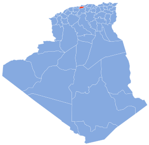
Map of Algeria highlighting Blida
|
|
| Country | |
| Capital | Blida |
| Area | |
| • Total | 1,696 km2 (655 sq mi) |
| Population
(2008)
|
|
| • Total | 1,009,892 |
| • Density | 595.46/km2 (1,542.2/sq mi) |
| Time zone | UTC+01 (CET) |
| Area Code | +213 (0) 25 |
| ISO 3166 code | DZ-09 |
| Districts | 10 |
| Municipalities | 25 |
Blida Province is an important region in Algeria, a large country in North Africa. It is like a state or a large county. The main city and capital of this province is Blida. This capital city is also called Blida.
The province is known for its beautiful natural areas. One of its most famous spots is the Chréa National Park. This park is a great place to explore nature. It has mountains, forests, and different kinds of animals.
Contents
Understanding Blida Province
Blida Province covers an area of about 1,696 square kilometers. That's roughly 655 square miles. In 2008, over one million people lived here. The province is led by a Wāli, which is like a governor. The current Wāli is Mr. Ouadah Hocine. There is also a People's Provincial Assembly, which helps manage the province. Its president is Mr. Kahla Mustapha.
What are Districts and Municipalities?
To help manage the province, Blida is divided into smaller areas. These areas are called districts and municipalities. Think of them as smaller towns and their surrounding areas.
Districts of Blida
Blida Province has 10 main districts. Each district includes several smaller towns or areas called municipalities.
The 10 districts are:
- Blida
- Boufarik
- Bougara
- Bouïnian
- El Affroun
- Larbaâ
- Meftah
- Mouzaïa
- Oued El Alleug
- Ouled Yaïch
In total, there are 25 municipalities within these districts. These smaller divisions help local governments serve the people better.
See also
 In Spanish: Provincia de Blida para niños

