Bluie facts for kids
This page is about the codename. For Louie Bluie, the musician, see Howard Armstrong (musician).
During World War II, the United States military used a secret code name for Greenland: Bluie. This name helped them talk about different places on the island without having to say the long, tricky Greenlandic Inuit or Danish names.
The US Coast Guard explored South Greenland in 1941. They created a list of numbered base locations. These locations were then used in radio messages. Airmen would say "BLUIE" followed by "East" or "West" and a number. This told everyone where the base was located along the Greenland coast, starting from Cape Farewell.
Bluie Locations: Secret Bases in Greenland
During the war, these "Bluie" locations were important for weather stations, airfields, and radio communication. They helped planes and ships travel safely across the North Atlantic.
Bluie East Bases
- Bluie East One: This was a radio and weather station at Torgilsbu. It was located near Aqissiat on Prince Christian Sound. 60°9′N 43°53′W / 60.150°N 43.883°W
- Bluie East Two: This base had an airfield, a radio station, and a weather station. It was located at Ikateq. 65°56′43″N 36°39′45″W / 65.94528°N 36.66250°W
- Bluie East Three: This was a radio and weather station at Gurreholm. It was found on Scoresby Sund. 71°14′43″N 24°35′01″W / 71.24528°N 24.58361°W
- Bluie East Four: This base on Ella Island had a radio, a weather station, and a sledge patrol station. 72°51′N 25°00′W / 72.850°N 25.000°W
- Bluie East Five: This radio and weather station was at Eskimonæs. German troops captured it in 1943, but it was later set up again at Myggbukta. 73°29′28″N 21°32′26″W / 73.49111°N 21.54056°W
Bluie West Bases
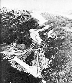
- Bluie West One: This was a major air base called Narsarsuaq Air Base. 61°10′N 45°26′W / 61.167°N 45.433°W
- Bluie West Two: This was an unused alternative airfield location on Coppermine Bay.
- Bluie West Three: This was a special radio station (HF/DF) at Simiutak. 60°41′N 46°34′W / 60.683°N 46.567°W
- Bluie West Four: This was a radio and weather station at Marrak Point. 63°27′N 51°11′W / 63.450°N 51.183°W
- Bluie West Five: This radio and weather station was located at Aasiaat on Disko Island. 68°42′35″N 52°52′10″W / 68.70972°N 52.86944°W
- Bluie West Six: This was a radio and weather station at Thule. 76°31′52″N 068°42′11″W / 76.53111°N 68.70306°W
- Bluie West Seven: This base at Kangilinnguit helped protect the important Ivittuut cryolite mine. 61°14′00″N 48°05′55″W / 61.23333°N 48.09861°W
- Bluie West Eight: This was another important air base called Sondrestrom Air Base. 67°00′38″N 50°42′33″W / 67.01056°N 50.70917°W
- Bluie West Nine: This was a light and radio beacon on Cruncher Island. 66°03′N 53°36′W / 66.050°N 53.600°W
Sources
Black History Month on Kiddle
Famous African-American Civil Rights Activists:
 | Aaron Henry |
 | T. R. M. Howard |
 | Jesse Jackson |

All content from Kiddle encyclopedia articles (including the article images and facts) can be freely used under Attribution-ShareAlike license, unless stated otherwise. Cite this article:
Bluie Facts for Kids. Kiddle Encyclopedia.

