Bonaventure River facts for kids
Quick facts for kids Bonaventure River |
|
|---|---|

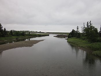
Mouth of the Bonaventure
|
|
| Other name(s) | Rivière Bonaventure |
| Country | Canada |
| Province | Quebec |
| Region | Gaspésie–Îles-de-la-Madeleine |
| Physical characteristics | |
| Main source | Chic-Choc Mountains Mont-Albert, Quebec 600 m (2,000 ft) 48°53′00″N 65°32′30″W / 48.88333°N 65.54167°W |
| River mouth | Chaleur Bay Bonaventure, Quebec 0 m (0 ft) 48°02′00″N 65°29′00″W / 48.03333°N 65.48333°W |
| Length | 115 km (71 mi) |
| Basin features | |
| Tributaries |
|
The Bonaventure River is a beautiful river located in Quebec, Canada. It flows through the Gaspé Peninsula. This river starts high up in the Chic-Choc Mountains. From there, it travels south for about 115 km (71 mi). Finally, it empties into Baie des Chaleurs, near the town of Bonaventure, Quebec.
Long ago, the Mi'kmaq people, who are indigenous, called this river Wagamet. This name means "clear water." Even today, the Bonaventure River is famous for its very clear and cold water. This makes it a perfect spot for catching Atlantic salmon. It's also a popular place for fun activities like canoeing.
Contents
The name "Bonaventure River" has a few possible origins. One idea is that it comes from the French words bonne aventure. This means "good fortune" or "good luck."
Another thought is that the river was named after a person. It might have been named to honor Simon-Pierre Denys de Bonaventure. He was an important person in history.
A Ship's Name?
A third idea suggests the river was named after a ship. This ship was called the Bonaventure. It belonged to a lord named La Court de Pré-Ravillon et de Granpré. This ship sailed into the Gulf of Saint Lawrence in 1591.
No matter the exact reason, the name "Bonaventure" was already in use by 1697. At that time, two important leaders, Governor Louis de Buade de Frontenac and Superintendent Jean Bochart de Champigny, gave the land along the river to Charles-Henry de La Croix. This land was called the Seignory of the Bonaventure River.
The Bonaventure River is well-known for its amazing clear and cold water. This makes it a special place for both nature and outdoor activities.
Fishing for Salmon
One of the most popular things to do here is Atlantic salmon fishing. Many people come from far away to try and catch these strong fish. The clear water makes it easier to see the fish. It also provides a healthy home for them.
Canoeing Adventures
If you love being on the water, the Bonaventure River is perfect for canoeing. The river's clear water and beautiful surroundings make for a wonderful trip. You can paddle along and enjoy the peaceful nature. It's a great way to explore the area.
Images for kids
 | Toni Morrison |
 | Barack Obama |
 | Martin Luther King Jr. |
 | Ralph Bunche |


