Bono, Arkansas facts for kids
Quick facts for kids
Bono, Arkansas
|
||
|---|---|---|

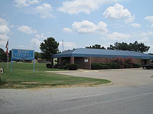
Bono City Hall, July 2011
|
||
|
||

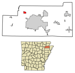
Location of Bono in Craighead County, Arkansas.
|
||
| Country | United States | |
| State | Arkansas | |
| County | Craighead | |
| Area | ||
| • Total | 2.66 sq mi (6.90 km2) | |
| • Land | 2.66 sq mi (6.90 km2) | |
| • Water | 0.00 sq mi (0.00 km2) | |
| Elevation | 262 ft (80 m) | |
| Population
(2020)
|
||
| • Total | 2,409 | |
| • Density | 904.28/sq mi (349.20/km2) | |
| Time zone | UTC-6 (Central (CST)) | |
| • Summer (DST) | UTC-5 (CDT) | |
| ZIP Code |
72416
|
|
| Area code(s) | 870 | |
| FIPS code | 05-07630 | |
| GNIS feature ID | 2403895 | |
Bono is a small city located in Craighead County, Arkansas, in the United States. It was officially established on July 14, 1916. In 2020, about 2,409 people lived there. This number has grown quite a bit from 1,512 people in 2000. Bono is part of the larger Jonesboro, Arkansas area. Two well-known spots in Bono are the Bono Bridge and the Bono Cemetery.
Contents
Where is Bono Located?
Bono is in the northwestern part of Craighead County. It is about 8 miles (13 km) northwest of Jonesboro, which is the main city of the county. The city of Walnut Ridge is about 15 miles (24 km) further northwest. As of 2024, the city is led by Mayor Danny Shaw.
The city covers a total area of about 2.66 square miles (6.90 square kilometers). All of this area is land, with no water.
Main Roads in Bono
Several important roads pass through or near Bono, making it easy to travel.
 US 63
US 63 U.S. Route 63 Business
 Arkansas Highway 230
Who Lives in Bono?
The number of people living in Bono has changed over the years. Here's how the population has grown:
| Historical population | |||
|---|---|---|---|
| Census | Pop. | %± | |
| 1930 | 209 | — | |
| 1940 | 248 | 18.7% | |
| 1950 | 352 | 41.9% | |
| 1960 | 339 | −3.7% | |
| 1970 | 428 | 26.3% | |
| 1980 | 967 | 125.9% | |
| 1990 | 1,220 | 26.2% | |
| 2000 | 1,512 | 23.9% | |
| 2010 | 2,131 | 40.9% | |
| 2020 | 2,409 | 13.0% | |
| U.S. Decennial Census 2014 Estimate |
|||
Bono's Population in 2020
In 2020, there were 2,409 people living in Bono. These people lived in 950 households, and 653 of these were families. The population is made up of different groups of people:
| Group | Number | Percentage |
|---|---|---|
| White (not Hispanic) | 2,079 | 86.3% |
| Black or African American (not Hispanic) | 110 | 4.57% |
| Native American | 2 | 0.08% |
| Other/Mixed | 130 | 5.4% |
| Hispanic or Latino | 88 | 3.65% |
Schools in Bono
Students in Bono attend schools that are part of the Westside Consolidated School District. This school district started in 1966. It was formed when the Bono School District joined with another. The high school for students in Bono is Westside High School.
What is the Weather Like in Bono?
Bono has a climate known as a "Humid Subtropical Climate." This means it has fairly high temperatures and rain spread out evenly throughout the year. Summers are hot and humid, while winters are mild.
| Climate data for Bono, Arkansas | |||||||||||||
|---|---|---|---|---|---|---|---|---|---|---|---|---|---|
| Month | Jan | Feb | Mar | Apr | May | Jun | Jul | Aug | Sep | Oct | Nov | Dec | Year |
| Mean daily maximum °C (°F) | 7 (45) |
10 (50) |
16 (61) |
22 (72) |
27 (81) |
32 (89) |
33 (92) |
32 (90) |
29 (84) |
23 (74) |
16 (61) |
9 (49) |
22 (71) |
| Mean daily minimum °C (°F) | −2 (28) |
0 (32) |
5 (41) |
11 (51) |
15 (59) |
19 (67) |
22 (71) |
21 (69) |
17 (62) |
10 (50) |
6 (42) |
0 (32) |
10 (50) |
| Average precipitation mm (inches) | 84 (3.3) |
97 (3.8) |
120 (4.8) |
130 (5.1) |
130 (5.1) |
79 (3.1) |
69 (2.7) |
76 (3) |
94 (3.7) |
86 (3.4) |
120 (4.7) |
110 (4.5) |
1,200 (47.2) |
| Source: Weatherbase | |||||||||||||
Learn More
 In Spanish: Bono (Arkansas) para niños
 | Aaron Henry |
 | T. R. M. Howard |
 | Jesse Jackson |


