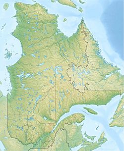
Bouchette Lake facts for kids
Quick facts for kids Bouchette Lake |
|
|---|---|
| Location | Lac-Bouchette, Le Domaine-du-Roy Regional County Municipality, Saguenay–Lac-Saint-Jean |
| Coordinates | 48°14′32″N 72°12′21″W / 48.24222°N 72.20583°W |
| Lake type | Natural |
| Primary inflows | (clockwise from the mouth) Ruisseau Thibault, Ouiatchouaniche River, discharge of lac à Pit. |
| Primary outflows | Ouiatchouane Lake |
| Basin countries | Canada |
| Max. length | 4.4 km (2.7 mi) |
| Max. width | 1.4 km (0.87 mi) |
| Surface elevation | 311 m (1,020 ft) |
Lac Bouchette is a freshwater lake in Quebec, Canada. It is located in the town of Lac-Bouchette. This lake is a popular spot for fun activities and tourism. It is surrounded by farms.
The lake usually freezes over in early December. You can safely walk or skate on the ice from late December until mid-March.
Contents
Discovering Lac Bouchette's Geography
Lac Bouchette is about 4.2 kilometres (2.6 mi) long from north to south. At its widest point, it measures 1.4 kilometres (0.87 mi). The lake gets water from the rivière des Commissaires at its southern end. This river flows from Lac des Commissaires. Sometimes, this part of the river is also called the Ouiatchouane River.
How Lac Bouchette Connects to Other Lakes
Just north of Lac Bouchette is Ouiatchouane Lake, which is about 2.1 kilometres (1.3 mi) long. Together, these two lakes form a long body of water, stretching about 6.3 kilometres (3.9 mi). A small strip of land, called an isthmus, separates them. There's also a narrow channel, about 250 meters long, called the "Pass." This "Pass" is how water from Lac Bouchette flows into Lac Ouiatchouane.
The Route 155 runs along the eastern side of both lakes. This road connects La Tuque and Chambord. The village of Lac-Bouchette is right on the eastern shore of these lakes. There is also a road that goes all the way around Lac Bouchette.
Streams and Wetlands Around the Lake
Several small streams flow into the eastern side of Lac Bouchette. These include the 7e rang stream, Bouchard-Cloutier stream, and Ruisseau Thibault. On the western side of Lac Bouchette, you'll find important wetlands. These wet areas are home to many plants and animals. They also cover part of Bouchette Island, which is a triangular island in the lake.
Lac des Commissaires: A Key Water Source
Lac des Commissaires is a large lake covering about 29 km². It is also very long, stretching for 29 km from north to south. This lake is a major source of water for the Ouiatchouane River. A dam, owned by the Quebec government, helps control the water flow from Lac des Commissaires.
The Ouiatchouane River's Journey
The water from Ouiatchouane Lake flows into the Ouiatchouane River. This river then travels about 28 km north. It eventually reaches Lac Saint-Jean. Most of the river flows through forests, but the last two kilometers pass through farmland.
The Story Behind the Name: Lac Bouchette
The name "Lac Bouchette" was given to the lake in 1828. This happened during an exploration trip to the area. The trip was part of a plan to create new settlements in Quebec.
The expedition was led by a surveyor named Joseph Bouchette (1774-1841). He traveled with commissioners Andrew and David Stuart. They started their journey from Trois-Rivières. They went up the Saint-Maurice River to La Tuque. Then, they used the Bostonnais River to reach lakes where they could switch to other rivers, like the Métabetchouan, to go down to Lac Saint-Jean.
Many places in Quebec are named "Bouchette" to remember Joseph Bouchette. The name "Lac Bouchette" was officially added to Quebec's list of place names on December 5, 1968.
Related articles
- Lac Saint-Jean
- Ouiatchouane River
- Lac-Bouchette, municipality
- Le Domaine-du-Roy Regional County Municipality
- Lac des Commissaires
 | Selma Burke |
 | Pauline Powell Burns |
 | Frederick J. Brown |
 | Robert Blackburn |


