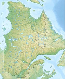
Lac des Commissaires facts for kids
Quick facts for kids Lac des Commissaires |
|
|---|---|
| Location | Lac-Ashuapmushuan, Le Domaine-du-Roy Regional County Municipality, Saguenay–Lac-Saint-Jean |
| Coordinates | 48°11′14″N 72°15′51″W / 48.18722°N 72.26417°W |
| Lake type | Natural |
| Primary inflows | (clockwise from the mouth) Décharge du lac Léandre et du lac des Deux Îles, ruisseau non identifié, ruisseau non identifié, rivière des Commissaires, décharge du Petit lac Caché, décharge du lac Caché, décharge d'un lac non identifié, décharge du lac de l'Épinette Rouge, décharge des lacs Gabriel et Malfait, décharge du lac Raquette, décharge du lac Cageux, ruisseau Jourdain, décharge du Grand lac Thaddé, décharge des lacs Isabeau et Gilbert, décharge du lac Miville, décharge du lac Pot, Goddard River, Goéland River (lac des Commissaires), décharge du lac à Roger. |
| Primary outflows | Ouiatchouane River |
| Basin countries | Canada |
| Max. length | 29 km (18 mi) |
| Max. width | 4 km (2.5 mi) |
| Surface area | 29 km2 (11 sq mi) |
| Average depth | 46 m (151 ft) |
| Max. depth | 46 m (151 ft) |
| Surface elevation | 331 m (1,086 ft) |
Lac des Commissaires is a beautiful lake located in Quebec, Canada. It's found near the town of Lac-Bouchette, in the Le Domaine-du-Roy Regional County Municipality. This lake is a popular spot for fun activities and visitors.
The lake's surface usually freezes over from early December to late March. You can safely walk or play on the ice from late December until mid-March.
Contents
About Lac des Commissaires
Lac des Commissaires is about 26 kilometres (16 mi) south of Roberval. It's also 22 kilometres (14 mi) south of Lac Saint-Jean. The lake is quite long, stretching 29 kilometres (18 mi) from north to south. It covers an area of 29 square kilometres (11 sq mi).
The lake has a unique shape, almost like two long parts joined together. The widest part of the lake is about 4 kilometres (2.5 mi). A road called Route 155 runs along the southern part of the lake.
How the Lake Connects to Rivers
In the northern part of the lake, there's a wider area known as "Hail Bay." This area was once called "Mirage Lake."
The main river flowing out of Lac des Commissaires is the Ouiatchouane River. This river is very important because it supplies water to many areas. The "Commissioners Dam" helps control the water flow from the lake.
The rivière des Commissaires also flows into Bouchette Lake. Bouchette Lake is about 4.2 kilometres (2.6 mi) long. The village of Lac-Bouchette is right on its eastern shore. From Bouchette Lake, the water then flows into Lake Ouiatchouane. Finally, the water from Lake Ouiatchouane joins the Ouiatchouane River, which eventually reaches Lac Saint-Jean.
The Commissioners Dam
The Commissioners Dam was built in 1971. It's 8.2 metres (27 ft) tall and can hold a lot of water. The dam helps manage the water levels of Lac des Commissaires. It's made of concrete and is 198.7 metres (652 ft) long. The government of Quebec manages this important dam.
Why is it Called Lac des Commissaires?
The name "Lac des Commissaires" means "Commissioners' Lake." It was named in 1828 by a land surveyor named Joseph Bouchette. He wanted to honor two Commissioners, Andrew and David Stuart. They led an important trip to explore the Saguenay area.
Long before that, in 1732, another surveyor named Joseph-Laurent Normandin called the lake "Eskaskouakama." This is a word from the Montagnais language. It means "lake where there is wood." Normandin noted that the north side of the lake had tall, wooded land, while the south side was low and had no wood.
The name "Lac des Commissaires" was officially recorded on December 5, 1968. This was done by the Commission de toponymie du Québec, which is like a special group that names places in Quebec.
 | Aurelia Browder |
 | Nannie Helen Burroughs |
 | Michelle Alexander |


