Bouïra Province facts for kids
Quick facts for kids
Bouïra Province
ولاية البويرة
|
|
|---|---|

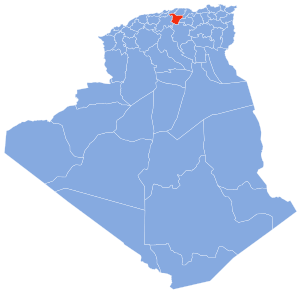
Map of Algeria highlighting Bouïra
|
|
| Country | |
| Capital | Bouïra |
| Area | |
| • Total | 4,439 km2 (1,714 sq mi) |
| Population
(2008)
|
|
| • Total | 694,750 |
| • Density | 156.510/km2 (405.36/sq mi) |
| Time zone | UTC+01 (CET) |
| Area Code | +213 (0) 26 |
| ISO 3166 code | DZ-10 |
| Districts | 12 |
| Municipalities | 45 |
Bouïra is a province in Algeria, a country located in North Africa. It is an important region within Algeria. The capital city of this province is also called Bouïra.
Contents
Exploring Bouïra Province
Bouïra Province is a fascinating part of Algeria. It is known for its beautiful landscapes. The province is located in the northern part of the country.
Where is Bouïra Located?
Bouïra Province is found in the northern central part of Algeria. It is nestled in the Atlas Mountains. This location gives it a varied landscape. You can find both mountains and valleys here.
How Big is Bouïra?
The total area of Bouïra Province is about 4,439 square kilometers. To give you an idea, that's roughly the size of a large city. In 2008, about 694,750 people lived in the province.
The Capital City
The capital of Bouïra Province is the city of Bouïra. This city is the main center for the province. It is where many important activities happen.
Districts and Municipalities
Bouïra Province is divided into smaller parts. These parts help manage the region. There are 12 main areas called districts. Within these districts, there are even smaller areas. These are called communes or municipalities. There are 45 municipalities in total.
List of Districts
Here are the 12 districts that make up Bouïra Province:
- Aïn Bessem
- Bechloul
- Bir Ghbalou
- Bordj Okhriss
- Bouïra
- El Hachimia
- Haïzer
- Kadiria
- Lakhdaria
- M'Chedellah
- Souk El Khemis
- Sour El Ghozlane
Learn More About Bouïra
If you want to learn more about Bouïra Province, you can check out these resources.
 In Spanish: Provincia de Bouira para niños

