Braunton Canal facts for kids
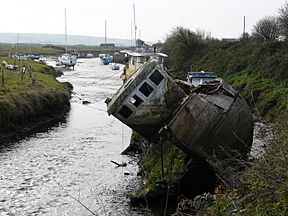
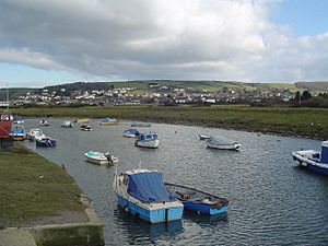
The Braunton Canal is a special waterway in North Devon, England. It was built to make the upper part of the River Caen (also called Braunton Pill) straighter. This also helped create a new dock, or quay, for the village of Braunton. The canal crosses an area called Braunton Marsh. This marsh was changed by laws in the early 1800s, which allowed people to claim and develop land. The Braunton Canal was the only one of many ideas that actually got built.
Contents
History of the Canal
Before 1808, the land around Braunton, Velator, and Wrafton was mostly a large salt marsh. In that year, the Board of Agriculture sent a person named Charles Vancouver to study the marsh. His report suggested that the land should be fenced off and improved for farming. Local people agreed with this idea.
Planning the Project
James Green was chosen as the engineer for this big drainage project. He asked John Pascoe to create a map and survey. This map showed two main plans. The first plan involved building a wall from the mouth of Braunton Pill to Bench Hill. It also suggested a canal from the Pill through Wrafton to some lime kilns near what is now Velator Quay.
However, people worried about how much this first plan would cost. There were also objections from a powerful local family, the Bassett Estate. So, the second plan became the basis for a special law passed by Parliament on May 25, 1811. This law was for "Inclosing, Draining, and Embanking Lands in Braunton." This meant fencing, draining, and building walls around the land.
Building the Canal
Construction began, and good progress was made. The details of the project were often worked out as they went along. The project was paid for by local farmers and landowners. Money also came from selling plots of land once the work was finished.
The Marsh Commissioners were in charge of the project. They received a letter from 20 farmers who did not want a lock built. James Green had suggested building a lock to allow boats into the marsh. Because of the farmers' objections, the lock was never built.
James Green also suggested draining an area called Braunton Mere. An agreement was made on September 10, 1814, to do this work for £765. Green finished this task ahead of time. He was praised for his "good, workmanlike manner" in doing the job.
The Braunton New Cut
The first plans for the marsh included building a canal. But this canal wasn't built right away. However, there was still a strong desire to build a new quay (dock) on Braunton Pill. This new quay would replace the older one at Wrafton.
In the 1840s, three plots of land were bought for this purpose. But nothing else happened until 1852. That's when the Bassett Estate was sold to Mr. William Williams. Williams proposed a big new plan. He wanted to straighten Braunton Pill even more. He also wanted to claim more land, including an area called Horsey Island. This was a sandy area that Charles Vancouver had said would be impossible to reclaim back in 1808.
Mr. Williams offered to pay for the work himself. The Marsh Inspectors, who now managed the marsh, approved his plan.
Challenges and Completion
An engineer named Nicholas Whiteley worried about the dangers of trying to reclaim Horsey Island. Despite his concerns, the project went ahead. Two main parts of the work were offered to contractors. One was for building walls around Horsey Island. The other was for digging the new canal cut and building walls along Braunton Pill.
In October 1854, calls went out for subcontractors. They also needed 200 navvies (laborers) and a haulier to move 60,000 yards of stone. This stone came from Braunton Down and other quarries.
There were some money problems during the project. Also, some of the new walls were damaged on the Heanton embankment in 1855. The upper part of the new canal was dug through clay. But the lower part was through sand, which caused many difficulties. The channel had to be lined with clay. The bottom was covered with gravel. Pumps had to run all the time to keep the water out so work could continue.
Despite these problems, the work was finished within three years. The total cost was £13,394, which was slightly less than the planned budget.
Mr. Williams also paid for the new quay at Velator. This quay opened around 1870. It was big enough for ships weighing up to 130 tons. The quay was used for unloading gravel until the 1960s. Around the same time the quay opened, some of the new canal walls needed repairs. They were sinking because of the soft ground they were built on.
In 1910, severe storms hit the North Devon Coast. The walls around Horsey Island broke in several places. A break also happened in the walls of the new canal. Local newspapers reported a boat sailing through the break onto the marsh. It then sailed back out when the tide changed. However, not many other details are known. Newspapers at the time were more focused on fixing the walls around Horsey Island.
The Canal Today
Today, Velator Quay and the area around it are used for mooring small boats. In 2006, the Braunton council blocked cars from reaching the quay. This was because the quay was in danger of collapsing.
In 2010, engineers studied the quay. The council hoped to make it a better place for people to visit. The study showed several ways to repair it, costing from £80,000 to £400,000. The council had a limited budget, so only basic repairs were considered.
Later, a council member named Peter Lord suggested that tearing down the quay might be the best long-term plan. He also suggested building a slipway to help boat owners. Many people believe the quay is a "free port." This means ships can use it without paying fees. This status was supposedly given to sailors from Barnstaple who fought against the Spanish Armada. However, the report pointed out that this is probably just a local story. The quay wasn't built until 300 years after the Spanish Armada!
Below Braunton, the original path of the River Caen still exists as separate ponds. These ponds are now very important homes for many different kinds of birds.
Points of interest
| Point | Coordinates (Links to map resources) |
OS Grid Ref | Notes |
|---|---|---|---|
| Braunton Bridge | 51°06′03″N 4°09′46″W / 51.1008°N 4.1627°W | SS486357 | Normal tidal limit |
| End of new cut | 51°05′36″N 4°10′04″W / 51.0933°N 4.1679°W | SS482349 | |
| Pill's mouth | 51°04′52″N 4°09′56″W / 51.0812°N 4.1655°W | SS484335 | Jn with River Taw |


