Bruntwood Loch facts for kids
Quick facts for kids Bruntwood Loch |
|
|---|---|

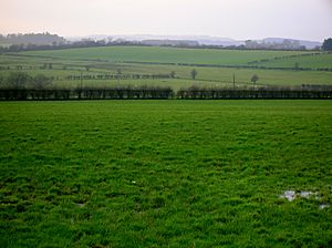
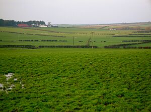
Site of Bruntwood Loch
|
|
| Lua error in Module:Location_map at line 420: attempt to index field 'wikibase' (a nil value). | |
| Location | East Ayrshire, Scotland |
| Type | Freshwater loch |
| Primary inflows | The Middleyard and Blacks Burns, rainfall and runoff |
| Primary outflows | Little Sorn Burn |
| Basin countries | Scotland |
| Settlements | Mauchline |
Bruntwood Loch, also known as the Loch of Bruntwood, was once a freshwater loch (a Scottish word for lake) in East Ayrshire, Scotland. It was located in a natural dip in the land called a glacial kettle hole, near the parish of Galston. Today, the loch has been completely drained.
Contents
What was Bruntwood Loch like?
Bruntwood Loch was found in the southwestern part of Galston Parish. By the years 1882-1885, the loch had been fully drained.
Wildlife at the loch
In 1869, a book called 'Birds of Ayrshire and Wigton' mentioned that the Eurasian bittern (a type of wading bird) used to breed at Bruntwood Loch. Another old record from 1861 described it as a "former loch" that was once very popular with waterfowl (birds that live on water). However, by that time, the land where the loch used to be was already being used for farming.
Who owned the land around the loch?
Over many centuries, different families owned the land around Bruntwood Loch.
In 1406, Dame Joanna de Keith gave the land of 'Bryntwood' to her son, Andree de Hamylton. Later, in 1491, the Lords of Council (a type of court) ruled that Alexander Hamilton of Bruntwood had to pay money to Alan Lord Cathcart. The King also agreed in 1485 to give 'Birnwood' to Alexander Hamilton and his wife, Marjorie Lindsay.
Records from 1565 show that James Hamilton of Fynnart owned the land, which included "2 marcat. land of Bruntwood, with mills, tennements, and fishing." This shows that the area was used for farming, milling, and fishing.
Later, in 1608, the King granted the land to George Campbell of Cesnock and his wife, Agnes Cunningham. The land was then passed to James, Duke of Hamilton, in 1611. By 1618, George and Hugh Campbell were granted the land again.
In 1620, Margaret Campbell, who was the oldest daughter of George Campbell, was granted the "land of Bruntwood with tenements, 40 sol. land of Auchinruglen, 20 sol. of Sorne, 10 sol. of Sornehill with mill." These lands became part of the free Barony of Wester Loudoun.
William Muir of Bruntwood was the uncle of Robert Montgomerie of Bogston. William's oldest daughter, Elizabeth, married Robert. They had many children, but only three lived to be adults.
What old maps tell us
Old maps help us understand how Bruntwood Loch changed over time:
- Blaeu's map (1654): This map, based on an earlier one from around 1604 by Timothy Pont, clearly shows the loch. It also shows the houses called Lochend and Bruntwood, and a single stream flowing into the loch.
- Roy's map (1747): This map shows that the land was being ploughed. It still records Lochend and shows a toll road that ran from Mauchline to Galston near the western edge of the loch.
- Armstrong's map (1775): This map shows the loch with two streams flowing into it. It also shows the Bruntwood estate on the lochshore, suggesting the loch was an important part of the planned landscape around the estate.
- Ainslie's map (1821): This map still shows the loch and a single stream flowing into it, along with the Lochend dwelling.
- Thomson's map (1832): This map no longer shows the loch, indicating it had started to disappear by this time.
- 1908 OS map: This map no longer shows Lochend. It shows a deep drainage ditch where the loch used to be.
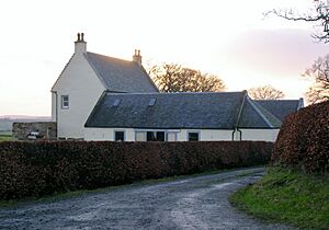
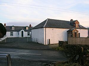
The loch was overlooked by farms like Bruntwoodhill Farm and Bruntwood Mains Farm, as well as Bruntwood House. Little Sorn was located near the stream that flowed out of the loch. The 1895 map shows a deep drainage ditch below Bruntwood Mains, which was used to drain the water from the old loch.
Archaeological finds
Archaeologists have found interesting items in the area. A stone whorl (a small, heavy disc used in spinning thread) was found in the earth near Cowgrove Quarry. Two other whorls and two polished stone axes were also discovered nearby. These finds suggest that people lived and worked in this area a very long time ago.
More about Bruntwood
The National Archives of Scotland have records that show there were coal mines running beneath the farm and lands of Bruntwood.
Bruntwood House was once the home of the local landowners. Until the late 1700s, the Moor or Muir family owned it. Their family coat of arms (a special symbol representing the family) can still be seen above the front doorway of the house today.


