Bryant, Iowa facts for kids
Quick facts for kids
Bryant, Iowa
|
|
|---|---|
| Country | United States |
| State | Iowa |
| County | Clinton |
| Elevation | 804 ft (245 m) |
| Time zone | UTC-6 (Central (CST)) |
| • Summer (DST) | UTC-5 (CDT) |
| ZIP codes |
52727
|
| GNIS feature ID | 454902 |
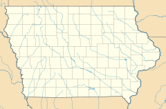
Bryant is a small, quiet community located in the northeastern part of Clinton County, Iowa, in the United States. It's known as an unincorporated community, which means it doesn't have its own local government like a city or town. Instead, it's managed by the county.
Bryant is situated along local roads, a bit northwest of Clinton, which is the main city and the county seat for Clinton County. A county seat is like the capital city of a county, where the main government offices are. Bryant sits at an elevation of about 804 feet (245 meters) above sea level. It uses the ZIP code 52727. This postal area first opened on August 25, 1870, under the name Ten Mile House, and then officially changed to Bryant on March 15, 1871.
The Story of Bryant
Bryant was officially planned out, or platted, in 1871. This means its streets and lots were mapped out and recorded. The community was given its name to honor William Cullen Bryant, who was a famous newspaper editor and poet from New York. In 1940, the population of Bryant was recorded as 60 people.
 | Valerie Thomas |
 | Frederick McKinley Jones |
 | George Edward Alcorn Jr. |
 | Thomas Mensah |


