Buena Vista, Hatillo, Puerto Rico facts for kids
Quick facts for kids
Buena Vista
|
|
|---|---|
|
Barrio
|
|

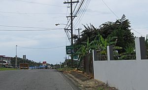
On PR-487 near PR-488 and PR-130
|
|

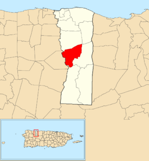
Location of Buena Vista within the municipality of Hatillo shown in red
|
|
| Commonwealth | |
| Municipality | |
| Area | |
| • Total | 3.55 sq mi (9.2 km2) |
| • Land | 3.55 sq mi (9.2 km2) |
| • Water | 0 sq mi (0 km2) |
| Elevation | 551 ft (168 m) |
| Population
(2010)
|
|
| • Total | 2,490 |
| • Density | 701.4/sq mi (270.8/km2) |
| Source: 2010 Census | |
| Time zone | UTC−4 (AST) |
Buena Vista is a quiet, rural area known as a barrio in the municipality of Hatillo, Puerto Rico. A barrio is like a neighborhood or district within a town. In 2010, about 2,490 people called Buena Vista home. It's a place where you can find open spaces and a connection to nature, typical of rural communities.
How Many People Live Here?
The number of people living in Buena Vista has changed over many years. In 1900, there were 963 residents. The population grew steadily through the mid-20th century, reaching 1,686 by 1940. After a dip in 1950, it started growing again. By 1980, the population was 2,034, and it continued to increase to 2,490 people in 2010. This shows how communities can grow and change over time.
Where is Buena Vista Located?
Buena Vista is located in the northern part of Puerto Rico, which is a commonwealth of the United States. It's part of the Hatillo municipality, which is on the island's northern coast. The area covers about 3.55 square miles (about 9.2 square kilometers) of land.
What is a Barrio?
In Puerto Rico, a barrio is a small administrative division, similar to a village or a district. It's a way to organize different parts of a municipality. Buena Vista is one of these barrios, helping to make up the larger area of Hatillo.
See also
 In Spanish: Buena Vista (Hatillo) para niños
 | Sharif Bey |
 | Hale Woodruff |
 | Richmond Barthé |
 | Purvis Young |


