Burakin, Western Australia facts for kids
Quick facts for kids BurakinWestern Australia |
|
|---|---|

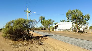
Dowerin-Kalannie Road, Burakin, 2014
|
|
| Established | 1928 |
| Postcode(s) | 6467 |
| Elevation | 359 m (1,178 ft) |
| Area | [convert: needs a number] |
| Location | |
| LGA(s) | Shire of Wongan-Ballidu |
| State electorate(s) | Moore |
| Federal Division(s) | Durack |
Burakin is a small town in the eastern Wheatbelt area of Western Australia. It's located near another town called Kalannie.
Burakin became an official town in 1928. Its name comes from an Aboriginal word. We don't know exactly what it means. The name was suggested by the local council, the Wongan Hills Road Board, in 1927. It was almost spelled 'Borrikin'!
Burakin's Railway History
Burakin was an important railway junction. It connected the Amery to Kalannie railway line with a branch line to Bonnie Rock. This railway line was finished on April 27, 1931.
Even though people had big hopes for the railway in the 1930s, train services didn't last forever. By 1953, the lines between Beacon and Bonnie Rock were closed down.
Earthquakes in Burakin
Between 2000 and 2001, Burakin was the center of many earthquakes. This group of earthquakes is called the Burakin Swarm.
Scientists study these earthquakes to learn more about the South West Seismic Zone. This is an area where many earthquakes happen in Western Australia. Studying the Burakin Swarm helps them understand how the Earth's crust moves there.
 | Calvin Brent |
 | Walter T. Bailey |
 | Martha Cassell Thompson |
 | Alberta Jeannette Cassell |


