
Wheatbelt (Western Australia) facts for kids


.JPG)
The Wheatbelt is a large and important area in Western Australia. It's one of nine main regions that help manage the state. People call it the "Wheatbelt" because a long time ago, much of this land was changed to grow crops. It's located around the city of Perth, stretching north, east, and south. It touches the Indian Ocean on its western side. The Wheatbelt is a huge area, about 154,862 square kilometers (that's bigger than some countries!). About 75,000 people live here, which is about 3% of Western Australia's total population.
Contents
Nature and Wildlife
The Wheatbelt used to be full of different kinds of plants and animals. But starting in the 1890s, a lot of land was cleared for farming. This meant many native trees and shrubs, like eucalypt woodlands and mallee, were removed. Now, about 11% of Australia's most endangered plants live in this area.
Many birds that are threatened across Australia also live in the Wheatbelt. These include the Carnaby's black cockatoo, which is highly endangered, and the malleefowl, which is vulnerable.
The Wheatbelt has different types of natural areas, called ecosystems. Because of this, many different jobs and businesses operate here. Some of these natural areas include the Avon Wheatbelt, Jarrah Forest, Geraldton Sandplains, and Mallee regions.
Jobs and Money
Near the coast, the Wheatbelt gets a good amount of rain and has mild weather. Its 150 kilometers of coastline is a popular spot for tourists. Further east, the land becomes very dry and is mostly used for pastoral farming, which means raising sheep.
The region also has mining for valuable minerals like gold, nickel, and iron ore. The rest of the Wheatbelt is perfect for agriculture, which is farming. It produces almost two-thirds of Western Australia's wheat and half of its wool. It also provides most of the state's lamb and mutton, oranges, honey, and many other farm products.
Changes in the Region
The Wheatbelt is facing changes in its climate and economy. Because of this, the government is working hard to help communities that are struggling. They are also trying to create new opportunities to keep people living and working in the region.
Getting Around
The Wheatbelt once had a very large railway system. This system was used to transport huge amounts of wheat grain. Some parts of the railway have been reduced, but the main lines are still used. Grain is moved on these lines to ports so it can be sent to other countries. This grain comes from CBH grain receival points (big grain silos), which are mostly found in the Wheatbelt.
Six main highways start from Perth and go into the Wheatbelt:
- Brand Highway goes north-west to Geraldton.
- Great Northern Highway goes north-east to Wyndham.
- Great Eastern Highway goes east to Kalgoorlie.
- Great Southern Highway goes east to York, then south to Cranbrook.
- Brookton Highway goes east-south-east to Brookton.
- Albany Highway goes south-east to Albany.
There is also a network of main roads that connect towns within the Wheatbelt to each other, to the highways, and to nearby regions. Smaller local roads provide access to smaller towns. Roads are often named after the towns they connect.
Local Councils
The Wheatbelt has many local government areas, also called shires. These shires help manage the towns and communities within the region. The Wheatbelt Development Commission lists the following shires as part of the Wheatbelt:
- Beverley
- Brookton
- Bruce Rock
- Chittering
- Corrigin
- Cuballing
- Cunderdin
- Dandaragan
- Dalwallinu
- Dowerin
- Dumbleyung
- Gingin
- Goomalling
- Kellerberrin
- Kondinin
- Koorda
- Kulin
- Lake Grace
- Merredin
- Moora
- Mount Marshall
- Mukinbudin
- Narembeen
- Narrogin
- Northam
- Nungarin
- Pingelly
- Quairading
- Tammin
- Toodyay
- Trayning
- Victoria Plains
- Wagin
- Wandering
- West Arthur
- Westonia
- Wickepin
- Williams
- Wongan-Ballidu
- Wyalkatchem
- Yilgarn
- York
Sub-regions of the Wheatbelt
The Wheatbelt is often divided into smaller areas, usually based on the local government shires.
Wheatbelt Development Commission Areas
The Wheatbelt Development Commission (WDC) divides the region into five sub-regions, each with an office:
- Avon
- Shire of Beverley
- Shire of Cunderdin
- Shire of Dowerin
- Shire of Goomalling
- Shire of Koorda
- Northam (WDC office)
- Shire of Quairading
- Shire of Tammin
- Shire of Toodyay
- Shire of Wyalkatchem
- Shire of York
- Central Coast
- Shire of Chittering
- Shire of Dandaragan
- Shire of Gingin
- Central Midlands
- Shire of Dalwallinu
- Moora (WDC office)
- Shire of Victoria Plains
- Shire of Wongan-Ballidu
- Central East
- Shire of Bruce Rock
- Shire of Kellerberrin
- Merredin (WDC office)
- Shire of Mount Marshall
- Shire of Mukinbudin
- Shire of Narembeen
- Shire of Nungarin
- Shire of Trayning
- Shire of Westonia
- Shire of Yilgarn
- Wheatbelt South
- Shire of Brookton
- Shire of Corrigin
- Shire of Cuballing
- Shire of Dumbleyung
- Shire of Kondinin
- Shire of Kulin
- Shire of Lake Grace
- Narrogin (WDC office)
- Shire of Pingelly
- Shire of Wagin
- Shire of Wandering
- Shire of West Arthur
- Shire of Wickepin
- Shire of Williams
Tourism Areas
Most of the Wheatbelt is part of a larger tourism area called Australia's Golden Outback. However, some shires closer to Perth are promoted as part of the Destination Perth region because they are easy to visit from the city. These include:
- Avon Valley
- Beverley
- Brookton
- Goomalling
- Northam
- Toodyay
- Victoria Plains
- York
- Peel and Rockingham
- Wandering
- Sunset Coast
- Gingin
- Swan Valley
- Chittering
Also, the northwestern Shire of Dandaragan is promoted as part of Australia's Coral Coast. This is because it has popular seaside towns like Cervantes and Jurien Bay, which grew differently from the wheat-growing areas.
Images for kids
-
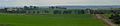
Wheat growing north-east of Northam
See also
 In Spanish: Wheatbelt para niños
