Great Southern Highway facts for kids
Quick facts for kids Great Southern HighwayWestern Australia |
|
|---|---|
 |
|
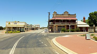
| The Great Southern Highway at Pingelly, 2014 | |
 |
|
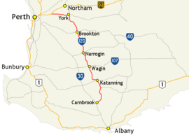
| Map of south-west Western Australia with Great Southern Highway highlighted in red | |
| General information | |
| Type | Highway |
| Length | 374 km (232 mi) |
| Route number(s) | |
| Major junctions | |
| North end | |
|
|
| South end | |
| Location(s) | |
| Major settlements | York, Beverley, Brookton, Narrogin, Wagin, Katanning |
| Highway system | |
| Highways in Australia National Highway • Freeways in Australia Highways in Western Australia |
|
The Great Southern Highway is an important road in Western Australia. It helps people travel through the southern part of the Wheatbelt region. This highway starts near Perth at a place called The Lakes. It then stretches all the way to Cranbrook, where it meets the Albany Highway.
This long road is like a main street for the area. It runs right next to the railway line that goes from Perth to Albany. The highway was officially named in 1949, but parts of it were built much earlier. It's also known as State Route 120 for most of its journey.
Contents
Exploring the Great Southern Highway
The Great Southern Highway is about 374 kilometers (232 miles) long. It begins about 50 kilometers (31 miles) from Perth. The road first heads east towards the old town of York.
After York, the highway turns south. It follows the Avon Valley and the railway line. This path takes it all the way to Narrogin.
Journey Through the Wheatbelt
From Narrogin, the highway continues south. It runs about 30 kilometers (19 miles) away from the Albany Highway. You'll pass through towns like Wagin and Katanning.
Near Cranbrook, the highway curves to meet the Albany Highway. It ends about 4 kilometers (2.5 miles) past Cranbrook. Many towns along this highway have large grain silos. These silos store grain from the farms.
Important Towns Along the Way
Narrogin, Wagin, and Katanning are big towns on this highway. They are important centers for farming and related businesses. These towns help support the agriculture in the region.
Towns Along the Highway
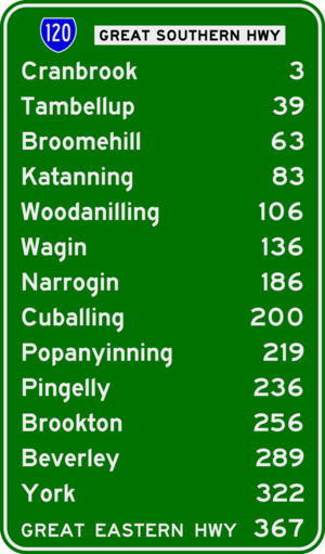
Here are some of the towns you can find along the Great Southern Highway:
 | William M. Jackson |
 | Juan E. Gilbert |
 | Neil deGrasse Tyson |


