Wheatbelt (Australia) facts for kids

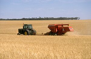
The Australian wheatbelts are special farming areas in southern and eastern Australia. They are called 'wheatbelts' because wheat was the first main crop grown there. But today, farmers grow many other crops too! These regions are very important for Australia's food supply.
Climate in Wheatbelt Areas
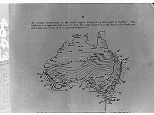
The wheatbelt areas are quite dry. There isn't much water underground for farming. This means farmers mostly depend on rain to grow their crops. The amount of rain changes across the wheatbelt. Areas closer to the coast usually get more reliable rain. Inland areas are drier and the rainfall can be less predictable. How much rain falls often decides how well crops grow and how much the land is worth.
Where Wheat is Grown
Wheat-growing regions in Australia are found in the country's temperate areas. These are places that usually get more than 300 millimeters of rain each year. A special line, called Goyder's line in South Australia, helps show where farming is possible. Towns like Orroroo and Minnipa are right on this boundary line.
In Western Australia, the town of Southern Cross is on the edge of the wheatbelt. Other places on the boundary include Mildura in Victoria, and Cobar or Walgett to Deniliquin in New South Wales. Also, St George in Queensland is part of these important farming regions.
What Farmers Produce
Besides wheat, farmers in the wheatbelt grow many other crops. They produce different types of grains like barley, oats, sorghum, and maize. They also grow plants for oil, such as canola (rape seed), sunflower, soybean, safflower, and linseed. Plus, they grow legumes, which are plants with pods. These include lupins, peanuts, and various kinds of peas, beans, and lentils.
 | Isaac Myers |
 | D. Hamilton Jackson |
 | A. Philip Randolph |


