
Burkes Pass facts for kids
Quick facts for kids Burkes Pass |
|
|---|---|
| Elevation | 709 metres (2,326 ft) |
| Traversed by | State Highway 8 |
| Location | New Zealand |
| Range | Two Thumb Range |
| Coordinates | 44°05′25″S 170°36′00″E / 44.09028°S 170.60000°E |
| Topo map | NZ Topo Map |

Burkes Pass is a mountain pass and a small town in New Zealand. It's located on State Highway 8, at the start of the Mackenzie Country. The pass is named after Michael John Burke. In 1855, he guided his bullock team through this route. This path offered a different way into the Mackenzie Country.
The pass was an alternative to the Mackenzie Pass. That route was used by James McKenzie, who was known for moving sheep. Burkes Pass sits at about 709 meters (2,326 feet) high. It separates the Two Thumb Range in the north from other ranges in the south. A special memorial for Michael Burke is near the pass's highest point.
Contents
The First Explorers
Michael Burke might not have been the very first European to cross the pass. Another person, G Dunnage, camped nearby in 1855. This was before the area's features were officially named.
Building a Route

Between 1857 and 1858, a rough track was built through Burkes Pass. This track was for drays, which are carts pulled by animals. Settlers and bullock teams soon found this route easier to use. It became the main way for travelers to enter the Mackenzie Country.
The Mackenzie Country was a large area. The Māori people knew it for its many wekas (a type of bird) and eels. Travel in those days was very slow and difficult. People needed places to rest along the way.
A New Town Appears

In 1859, a large area of land was set aside. It was meant to be a central place for coal, wood, and food supplies. This spot was quite open and windy. However, James Noonan built the first hotel in 1861. He chose a different spot, near Cabbage Tree Creek.
A town grew around this hotel. It was first called Cabbage Tree Creek, then Clulee, and finally Burkes Pass. For over 50 years, many different people passed through the town. Burkes Pass became an important center for the Mackenzie Country pioneers. Its busiest time was from 1890 to 1910. During this period, 143 people lived there, and the school had three teachers.
Changes and Decline

The town had hoped for a railway line to arrive. This would have made Burkes Pass the main town of the Mackenzie. However, the railway only reached Fairlie in 1884. This meant Fairlie became the new business center instead of Burkes Pass.
Another big change happened in 1891. The local road board, which managed roads, decided to move its office to Fairlie. This was a final blow to Burkes Pass's importance.
Nature and Wildlife
The Burkes Pass Scenic Reserve is a special area managed by the Department of Conservation. It used to be a place where livestock (farm animals) were driven. This reserve is home to unique plants and animals.
However, some introduced plants like lupin and broom, and animals like rabbits, threaten the natural environment. Burkes Pass is also the only known home for the critically endangered Canterbury knobbled weevil. This rare insect lives on speargrass in a small area of the pass.
Images for kids
-
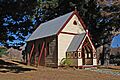
St. Patrick's Church, Burkes Pass, Canterbury 2007
-
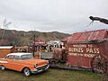
Burkes Pass (July 2021)
-
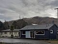
Burkes Pass (July 2021)
-
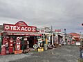
Three Creeks, Burkes Pass (July 2021)
