Burns Junction, Oregon facts for kids
Quick facts for kids
Burns Junction
|
|
|---|---|
 |
|
| Country | United States |
| State | Oregon |
| County | Malheur |
| Elevation | 3,934 ft (1,199 m) |
| Time zone | UTC-7 (Mountain) |
| • Summer (DST) | UTC-6 (MDT) |
| ZIP codes |
97910
|
| Area code(s) | 541 |
| Coordinates and elevation from United States Geological Survey | |
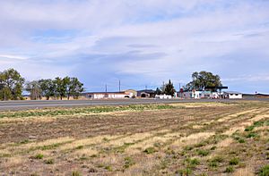
Burns Junction is a small, quiet community in Oregon, United States. It is not a big city but an unincorporated community. This means it does not have its own local government. You can find it in Malheur County.
The name "Junction" makes sense because it is where two important roads meet. These roads are U.S. Route 95 and Oregon Route 78. Burns Junction is about 80 miles (129 km) southeast of the city of Burns.
What's the Weather Like?
Burns Junction has a type of weather called a semi-arid climate. This means it is usually quite dry. It does not get a lot of rain or snow. This climate is often found in areas that are not deserts but are still very dry.
Learning and Schools
Kids living in Burns Junction go to school in the Arock School District 81. This school district is based in a nearby community called Arock. A school district is a local area that manages public schools.
 | Tommie Smith |
 | Simone Manuel |
 | Shani Davis |
 | Simone Biles |
 | Alice Coachman |


