Burnt River (Oregon) facts for kids
Quick facts for kids Burnt River |
|
|---|---|

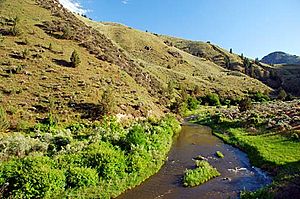
Flowing through Burnt River Canyon
|
|
|
Location of the mouth of Burnt River in Oregon
|
|
| Country | United States |
| State | Oregon |
| County | Baker |
| Physical characteristics | |
| Main source | Blue Mountains near Unity, Oregon 3,824 ft (1,166 m) 44°30′15″N 118°10′51″W / 44.50417°N 118.18083°W |
| River mouth | Snake River near Huntington, Oregon 2,073 ft (632 m) 44°21′54″N 117°13′34″W / 44.36500°N 117.22611°W |
| Length | 98 mi (158 km) |
| Basin features | |
| Basin size | 1,090 sq mi (2,800 km2) |
The Burnt River is a river in eastern Oregon, United States. It flows for about 98 miles (158 km). This river is a branch, or tributary, of the Snake River. It joins the Snake River near a town called Huntington, Oregon.
The Burnt River gets its name from either burnt trees along its banks or dark, burned-looking rocks in its path. It flows mostly from west to east. The river's water comes from an area of about 1,090 square miles (2,823 km²).
Contents
Where Does the Burnt River Start?
The Burnt River begins in the Blue Mountains. It starts at a place called Unity Reservoir. This reservoir is formed where four smaller streams meet. These streams are the North, West, Middle, and South forks of the river.
Unity Reservoir and Nearby Areas
The Unity Reservoir is located near the town of Unity, Oregon. It is also close to the Wallowa-Whitman National Forest. A fun place called Unity Lake State Recreation Site is right next to the reservoir. It's a great spot for outdoor activities.
The River's Journey
After leaving Unity Reservoir, the Burnt River flows under Oregon Route 245. It then travels east through the upper Burnt River Valley. Along its way, it passes by small towns like Hereford and Bridgeport.
The river then flows through a beautiful area known as the Burnt River Canyon. This canyon leads the river to the town of Durkee.
Flowing South and East
At Durkee, the river changes direction and turns south. It then flows alongside Interstate 84. As it follows the Interstate, it passes more towns. These include Weatherby, Dixie, and Lime.
Eventually, the Burnt River flows under Interstate 84. After this, it turns east again. Soon after, it passes the town of Huntington. This is where the Burnt River finally joins the larger Snake River.
 | Madam C. J. Walker |
 | Janet Emerson Bashen |
 | Annie Turnbo Malone |
 | Maggie L. Walker |


