
Huntington, Oregon facts for kids
Quick facts for kids
Huntington, Oregon
|
|
|---|---|

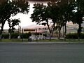
Looking north from Huntington
|
|

Location in Oregon
|
|
| Country | United States |
| State | Oregon |
| County | Baker |
| Incorporated | 1891 |
| Area | |
| • Total | 0.74 sq mi (1.92 km2) |
| • Land | 0.74 sq mi (1.92 km2) |
| • Water | 0.00 sq mi (0.00 km2) |
| Elevation | 2,123 ft (647 m) |
| Population
(2020)
|
|
| • Total | 502 |
| • Density | 678.38/sq mi (261.91/km2) |
| Time zone | UTC-8 (Pacific) |
| • Summer (DST) | UTC-7 (Pacific) |
| ZIP code |
97907
|
| Area code(s) | 541 |
| FIPS code | 41-35700 |
| GNIS feature ID | 2410808 |
Huntington is a small city in Baker County, located on the eastern edge of Oregon, United States. It sits right by the Snake River and is easily reached by Interstate 84 and U.S. Route 30. In 2020, about 502 people lived there.
Contents
Huntington's History
Henry Miller was one of the first settlers in this area in August 1862. Later, in 1870, Miller's Stagecoach Station was set up. The city of Huntington was named after J.B. and J.M. Huntington. These two brothers bought Miller's land in 1882.
Early Settlement and Growth
The Huntington brothers ran a small trading post on their property. Soon after, the Oregon Construction Company arrived. They brought a general store, a blacksmith shop, and places to stay like the Pacific Hotel. There were also several restaurants and saloons.
In 1898, the Northwest Railroad Company started building a train line. It went down the Snake River and reached Homestead around 1910. This new train line made it easier to transport goods from Huntington. It helped areas like Eagle and Pine Valley send out their fruits, cattle, lumber, and ore. This train line was later covered by water from the Brownlee Dam.
Becoming a City
Huntington became an official city in Baker County in 1891. It was the only city in the county on the historic Oregon Trail to have its own local government, thanks to the Home Rule Law. This law allowed the city to make its own rules.
You can still see parts of the Old Oregon Trail today. If you travel north from Farewell Bend State Recreation Area towards Huntington on U.S. Route 30, you might spot them. There's also a small iron cross visible from Route 30. It marks a spot where pioneers faced dangers in 1860.
A Wild Frontier Town
Around the year 1900, Huntington gained a reputation as a "wild frontier town." It had many saloons and was known for its gunslingers.
Between 1912 and 1914, Governor Oswald West worked to make the city safer. He also helped clean up the nearby community of Copperfield.
Huntington's Location and Climate
Huntington covers about 0.74 square miles (1.92 square kilometers) of land. It is located right across the Snake River from the westernmost point of Idaho.
Weather in Huntington
Huntington experiences different seasons throughout the year. Summers are generally hot, with temperatures sometimes reaching over 100 degrees Fahrenheit. Winters are cold, and the city gets some snow. The average high temperature in July is around 94 degrees Fahrenheit, while in January, it's about 37 degrees Fahrenheit. The city receives about 12 inches of rain each year.
People of Huntington
Huntington has seen its population change over the years. In 1880, about 200 people lived there. The population grew to over 800 by 1900. By 2010, the population was 440, and in 2020, it increased to 502 people.

Who Lives in Huntington?
According to the 2010 census, there were 440 people living in Huntington. Most residents (92.3%) were White. There were also people who identified as Native American (3.9%), Asian (0.7%), and African American (0.2%). About 1.8% of the population was Hispanic or Latino.
The average age of people in Huntington was 54 years old. About 16.6% of residents were under 18, and 30.7% were 65 or older.
Education in Huntington
The Huntington School District 16J runs the K-12 Huntington School. This means students from kindergarten all the way through 12th grade attend the same school.
The area where Huntington is located is also part of the Treasure Valley Community College district. This means students can access college courses nearby.
See also
 In Spanish: Huntington (Oregón) para niños
Images for kids
-
Looking north from Huntington
-

Location in Oregon
-
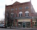
The Oregon Commercial Company Building is listed on the National Register of Historic Places
