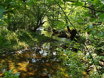
Burrows Run facts for kids
Quick facts for kids Burrows Run |
|
|---|---|

Burrows Run in Delaware
|
|
| Other name(s) | Tributary to Red Clay Creek |
| Country | United States |
| State | Delaware |
| County | New Castle |
| Physical characteristics | |
| Main source | Craigs Mill Run divide Pond at Mendenhall, Pennsylvania 325 ft (99 m) 39°51′07″N 075°38′40″W / 39.85194°N 75.64444°W |
| River mouth | Red Clay Creek about 0.25 miles east of Ashland, Delaware 135 ft (41 m) 39°47′52″N 075°38′13″W / 39.79778°N 75.63694°W |
| Length | 4.73 mi (7.61 km) |
| Basin features | |
| Progression | generally south |
| River system | Christina River |
| Basin size | 7.16 square miles (18.5 km2) |
| Tributaries |
|
| Waterbodies | Shadowbrook Pond |
| Bridges | Burrows Run Road, Spring Mill Road, Burnt Mill Road, Center Mill Road, Snuff Mill Road, Old Kennett Road, Way Road |
Burrows Run is a small stream, about 4.73 miles (7.61 km) long. It flows into a larger stream called Red Clay Creek in New Castle County, Delaware. It's an important part of the local water system in both Pennsylvania and Delaware.
Contents
About Burrows Run
Burrows Run is a "second order" tributary. This means it's a stream that forms when two smaller "first order" streams (which don't have any tributaries of their own) join together.
Other Names for the Stream
Over time, Burrows Run has been known by a few different names. These include:
- Barris Run
- Burris Run
- Burroughs Brook
Where Burrows Run Starts and Ends
Burrows Run begins its journey in Chester County, Pennsylvania. It starts near a place called Mendenhall. The stream then flows south, crossing the state line into Delaware. Finally, it meets the Red Clay Creek. This meeting point is about 0.25 miles (0.40 km) east of Ashland, Delaware.
The Burrows Run Watershed
A watershed is like a giant bowl where all the rain and snowmelt drain into a specific river or stream. The Burrows Run watershed covers an area of about 7.16 square miles (18.5 km²).
This area gets a good amount of rain each year, around 48.6 inches (123 cm). About 37.5% of the land in this watershed is covered by forests. Forests are very important because they help keep the water clean and healthy.
 | Ernest Everett Just |
 | Mary Jackson |
 | Emmett Chappelle |
 | Marie Maynard Daly |


