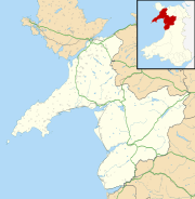
Caer Euni facts for kids
| Location | Near Llandderfel, Wales |
|---|---|
| Coordinates | 52°57′35″N 3°29′21″W / 52.95972°N 3.48917°W |
| Type | Hillfort |
| Length | 216 metres (709 ft) |
| Width | 58 metres (190 ft) |
| Height | 365 metres (1,198 ft) |
| History | |
| Periods | Iron Age |
Caer Euni is an ancient hillfort from the Iron Age. This means it was built by people living in Britain during the Iron Age, a time when tools and weapons were made from iron. It is located in Gwynedd, Wales. You can find it about 2.5 miles (4 km) north-east of Llandderfel village. It's also about 5 miles (8 km) north-east of Bala Lake. Today, Caer Euni is a scheduled monument, which means it's a special historic site protected by law.
Contents
What is Caer Euni?
Caer Euni is a type of ancient settlement called a hillfort. People in the Iron Age often built these forts on high ground. This helped them see enemies coming and made the fort easier to defend.
Where is Caer Euni Located?
The fort sits on a narrow ridge, a long, raised strip of land. It is quite high up, at about 365 metres (1,198 ft) (1,198 ft) above sea level. This high spot gave its ancient inhabitants a great view of the surrounding area.
How Big is the Fort?
Caer Euni is shaped like a long oval. It stretches for about 216 metres (709 ft) (709 ft) in length. Its width is about 58 metres (190 ft) (190 ft). The fort is built along the same direction as the ridge it sits on.
Defenses of the Hillfort
The main part of the fort is surrounded by a large bank of earth or stone called a rampart. On one side, the rampart has a very steep slope. In other areas, there are ditches and extra banks called counterscarps. These features made it very difficult for attackers to get inside.
The main way into the fort was through an entrance on the north-east side. Over time, the fort was made even bigger. You can still see an old bank inside the fort. This bank used to be the south-west end of the original fort. More defenses were added to the south-west. These included a large ditch dug out of rock and another rampart built from the stones removed from the ditch.
Homes Inside the Fort
Archaeologists have found traces of about 25 round huts inside Caer Euni. These huts were where people lived. Each hut was about 15–20 feet (4.6–6.1 m) (4.6–6.1 m) across. Most of these huts are in the newer, enlarged part of the fort.
What About Burnt Stones?
In the south-west corner of the fort, some burnt stones have been found. However, experts don't think this means Caer Euni was a "vitrified fort." Vitrified forts are a special type of fort, mostly found in Scotland, where the stone walls were heated so much they melted and turned into a glassy substance. The burnt stones at Caer Euni are not thought to be from this process.
 | Sharif Bey |
 | Hale Woodruff |
 | Richmond Barthé |
 | Purvis Young |


