Calala, New South Wales facts for kids
Quick facts for kids CalalaTamworth, New South Wales |
|||||||||||||||
|---|---|---|---|---|---|---|---|---|---|---|---|---|---|---|---|

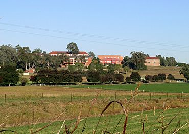
Farrer Memorial Agricultural High School
|
|||||||||||||||
| Population | 3,927 (2016 census) | ||||||||||||||
| Postcode(s) | 2340 | ||||||||||||||
| LGA(s) | Tamworth Regional Council | ||||||||||||||
| State electorate(s) | Tamworth | ||||||||||||||
| Federal Division(s) | New England | ||||||||||||||
|
|||||||||||||||
Calala is a suburb near the city of Tamworth in New South Wales, Australia. About 3,927 people lived there in 2016. The local council, Tamworth Regional Council, looks after the area.
Calala is located about 4.5 kilometers southeast of Tamworth's main city area. Calala Lane is the main road connecting it to Tamworth and runs through the suburb. Sometimes, during heavy rain, Calala Lane can flood. This might cut off residents for a few hours, but it usually clears quickly. Further along Calala Lane, you'll find Farrer Memorial Agricultural High School and a plant research center. This center is run by the New South Wales Department of Agriculture.
Contents
Shopping and Services in Calala
Calala has a handy shopping center that opened in 2006. It serves the people who live in the suburb.
What You Can Find at the Shops
The main shopping complex includes several useful stores:
- An IGA supermarket for your groceries.
- A fish and chip takeaway shop.
- A bottle shop for drinks.
- A butcher for fresh meat.
- A pharmacy for medicines and health items.
- A Northwest Health GP clinic, where you can see a doctor.
In late 2017, the shopping center grew bigger. Now, a Domino's pizza outlet is also part of this center. Calala also has a smaller group of shops. This includes another bottle shop, a different takeaway shop, and a small store selling unique clothing and gifts.
Schools Near Calala
Calala is close to a couple of important schools.
Local Schools for Students
- Carinya Christian School is a private school that offers education from early learning to high school.
- Farrer Memorial Agricultural High School is a public boarding school for boys. It focuses on agricultural studies. This school is located just outside the main residential area of Calala.
History of Calala
The name "Calala" comes from the local Aboriginal people. It was their name for this area along what is now the Peel River.
Early European Settlement
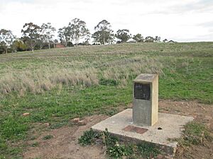
Over time, people tried to write down the Aboriginal name in different ways. Some spellings included "Kalala," "Kilala," "Kallala," and "Callala." The very first house built in the Calala area by European settlers was for Charles Hall in 1834. It was named "Killala." Today, there is a special marker on the northwest edge of Calala. It helps us remember where this first house was built.
 | Selma Burke |
 | Pauline Powell Burns |
 | Frederick J. Brown |
 | Robert Blackburn |


