Calvary, Georgia facts for kids
Quick facts for kids
Calvary, Georgia
|
|
|---|---|
| Country | United States |
| State | Georgia |
| County | Grady |
| Area | |
| • Total | 1.57 sq mi (4.07 km2) |
| • Land | 1.54 sq mi (3.98 km2) |
| • Water | 0.04 sq mi (0.09 km2) |
| Elevation | 260 ft (80 m) |
| Population
(2020)
|
|
| • Total | 129 |
| • Density | 82.2/sq mi (31.70/km2) |
| Time zone | UTC-5 (Eastern (EST)) |
| • Summer (DST) | UTC-4 (EDT) |
| ZIP code |
39829
|
| Area code(s) | 229 |
| FIPS code | 13-12484 |
| GNIS feature ID | 0354940 |
Calvary is a small community in Grady County, Georgia, in the United States. It's known as a census-designated place, which means it's an area the government counts for statistics, even though it's not officially a city or town. It's also an unincorporated community, meaning it doesn't have its own local government.
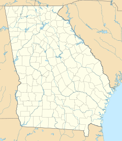
As of 2020, about 129 people lived in Calvary. It is located along Georgia State Route 111, about 15 miles (24 km) southwest of Cairo, which is the main town in Grady County. Tallahassee, Florida, is also nearby, about 23 miles (37 km) to the south.
Farming is a very important part of life and work in Calvary. The main crops grown here are cotton, corn, and peanuts. When it comes to farm animals, chickens are the most important livestock. In 2018, Hurricane Michael hit the area, causing a lot of damage to the farms and crops.
Contents
History of Calvary
How Calvary Was Settled
The area where Calvary is today was first settled around 1835 or 1836. The first people to move here came from Sampson County, North Carolina. They chose this spot because they heard the soil was similar to their home county. This meant they could grow the same kinds of crops they were used to. Because of these early settlers, some people used to call the community the "North Carolina settlement."
Calvary on Maps
Early maps didn't always show Calvary by name. For example, A.J. Johnson's 1863 map of Georgia and Alabama didn't include it. However, by 1883, a map of Georgia by Georgia Franklin Cram clearly showed Calvary in what was then Decatur County. By 1910, the "Rand McNally Map of Georgia" also labeled the community as Calvary.
Becoming Part of Grady County
On June 15, 1869, Harrison Fairbanks became the first Postmaster in Calvary, Georgia. At that time, Calvary was part of Decatur County. Later, on August 17, 1905, Grady County was created. It was formed using parts of Decatur County and Thomas County, and Calvary became part of the new Grady County.
Population Information
How Many People Live in Calvary?
The U.S. Census Bureau keeps track of how many people live in different places. They count Calvary as a census-designated place for their statistics. This means they count its population like they would for a city or town. Calvary was first listed as a CDP in the 2010 U.S. Census.
The population of Calvary has changed over the years:
- In 2010, there were 161 people.
- In 2020, the population was 129 people.
Who Lives in Calvary?
The U.S. Census also looks at the different groups of people living in a place. Here's a quick look at the racial and ethnic makeup of Calvary:
- In 2020, most residents were White (79.84%).
- About 9.30% of the population was Black or African American.
- About 10.85% of the population identified as Hispanic or Latino. People of Hispanic or Latino background can be of any race.
See also
 In Spanish: Calvary (Georgia) para niños
 | Janet Taylor Pickett |
 | Synthia Saint James |
 | Howardena Pindell |
 | Faith Ringgold |


