Camas Creek (Clark and Jefferson counties, Idaho) facts for kids
Quick facts for kids Camas Creek |
|
|---|---|
|
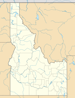
Location of the mouth of Camas Creek in Idaho
|
|
| Country | United States |
| State | Idaho |
| Counties | Clark County, Idaho, Jefferson County, Idaho |
| Physical characteristics | |
| Main source | near Kilgore, Clark County, Idaho 6,287 ft (1,916 m) 44°21′52″N 111°53′36″W / 44.36444°N 111.89333°W |
| River mouth | Mud Lake northeast of Mud Lake, Jefferson County, Idaho 4,783 ft (1,458 m) 43°53′24″N 112°21′32″W / 43.89000°N 112.35889°W |
| Length | 63 mi (101 km) |
| Basin features | |
| Basin size | 1,011 sq mi (2,620 km2) |
Camas Creek is a stream that flows for about 63-mile (101 km) in southeastern Idaho, United States. It is a "tributary," which means it's a smaller stream that flows into a larger body of water. Camas Creek flows into Mud Lake.
Description
Camas Creek starts high up in the mountains. Its source is near a place called Kilgore in Clark County, Idaho. Here, the elevation is about 6,287 feet (1,916 m) above sea level.
The creek then flows southwest into Jefferson County, Idaho. Along its journey, it gets bigger when another stream, called Beaver Creek, joins it. Beaver Creek is the largest stream that flows into Camas Creek.
After this, Camas Creek flows through a special area called the Camas National Wildlife Refuge. This refuge is a protected place for many different kinds of wildlife.
Finally, Camas Creek reaches its end northeast of the town of Mud Lake. Here, it flows into Mud Lake. The elevation at its mouth is about 4,783 feet (1,458 m).
The Camas Creek Watershed
A "watershed" is an area of land where all the water drains into a single river or lake. The watershed for Camas Creek covers a large area. It is about 1,011-square-mile (2,618 km2). This means all the rain and snow that falls in this big area eventually flows into Camas Creek.
This creek is important for the local environment. It provides water for wildlife and helps support the natural habitats in the area.
 | Bayard Rustin |
 | Jeannette Carter |
 | Jeremiah A. Brown |


