Mud Lake (Jefferson County, Idaho) facts for kids
Quick facts for kids Mud Lake |
|
|---|---|
| Location | Jefferson County, Idaho United States |
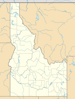
| Coordinates | 43°52′24″N 112°24′27″W / 43.87333°N 112.40750°W |
| Type | Reservoir |
| Primary inflows | Camas Creek |
| Primary outflows | Evaporation, seepage, and irrigation |
| Surface area | >3,000 acres (1,200 ha) |
| Average depth | 5 feet (1.5 m) |
| Surface elevation | 4,783 feet (1,458 m) |
Mud Lake is a special body of water in Jefferson County, Idaho, United States. It's not a natural lake anymore. Instead, it's a reservoir, which is like a big, artificial lake. People create reservoirs to store water for different uses. Mud Lake is part of the Mud Lake Wildlife Management Area. This area helps protect local wildlife.
Contents
Mud Lake: A Unique Water Spot
Mud Lake is located on the Snake River Plain. This is a large, flat area in Idaho. The lake sits northeast of the city that shares its name, Mud Lake. It is about 4,783 feet (1,458 m) above sea level. That's pretty high up!
Where Does Mud Lake Get Its Water?
The main source of water for Mud Lake is Camas Creek. Think of Camas Creek as the lake's main water supplier. Another important stream that feeds into Camas Creek, and then into Mud Lake, is Beaver Creek. These creeks bring fresh water to the reservoir.
How Water Leaves Mud Lake
Unlike many lakes that have rivers flowing out of them, Mud Lake doesn't have a natural river outflow. Water leaves the lake in a few different ways. One way is through evaporation. This is when the sun's heat turns the water into vapor, and it goes up into the air. Another way is through seepage. This means water slowly soaks into the ground. Finally, a lot of water from Mud Lake is used for irrigation. This is when water is moved through canals to help farmers water their crops.
The History of Mud Lake
Mud Lake wasn't always a reservoir. It started out as a "sump." A sump is a low area where water collects naturally. Over time, people built dikes around the lake. Dikes are like walls or banks built to hold back water. As these dikes were built, the lake changed. It gradually became smaller in area but deeper. This transformation helped turn it into the useful reservoir we see today.
Size and Depth of Mud Lake
Mud Lake is quite large. It covers an area of over 3,000 acres (1,200 ha). To give you an idea, an acre is about the size of a football field. So, imagine more than 3,000 football fields covered in water! Even though it's wide, Mud Lake is not very deep. Its average depth is only about 5 feet (1.5 m). That's roughly the height of an adult.
 | William M. Jackson |
 | Juan E. Gilbert |
 | Neil deGrasse Tyson |


