Camps-sur-l'Agly facts for kids
Quick facts for kids
Camps-sur-l'Agly
|
||
|---|---|---|

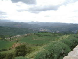
The Plana de l'Aglin
|
||
|
||
| Country | France | |
| Region | Occitanie | |
| Department | Aude | |
| Arrondissement | Limoux | |
| Canton | La Haute-Vallée de l'Aude | |
| Intercommunality | Pays de Couiza | |
| Area
1
|
26.35 km2 (10.17 sq mi) | |
| Population
(Jan. 2019)
|
53 | |
| • Density | 2.011/km2 (5.21/sq mi) | |
| Time zone | UTC+01:00 (CET) | |
| • Summer (DST) | UTC+02:00 (CEST) | |
| INSEE/Postal code |
11065 /11190
|
|
| Elevation | 445–1,227 m (1,460–4,026 ft) (avg. 540 m or 1,770 ft) |
|
| 1 French Land Register data, which excludes lakes, ponds, glaciers > 1 km2 (0.386 sq mi or 247 acres) and river estuaries. | ||
Camps-sur-l'Agly is a small commune located in the south of France. It is part of the Aude department in the region of Occitanie. In January 2019, the commune had a population of 53 people.
Contents
What is Camps-sur-l'Agly?
Camps-sur-l'Agly is a type of local area in France called a commune. Think of it like a small town or village with its own local government. It is one of many communes that make up the Aude department.
Where is Camps-sur-l'Agly located?
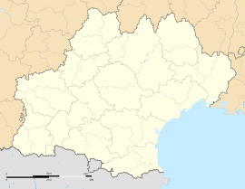
This commune is found in the southern part of France. It is specifically in the Aude department. The Aude department is part of the larger Occitanie region. This region is known for its beautiful landscapes and history.
How big is Camps-sur-l'Agly?
Camps-sur-l'Agly covers an area of about 26.35 square kilometers. Its elevation, or how high it is above sea level, varies quite a bit. The lowest point is 445 meters, and the highest point reaches 1227 meters. The main part of the village is around 540 meters high.
Who leads Camps-sur-l'Agly?
Like all communes in France, Camps-sur-l'Agly has a mayor. The mayor is the head of the local government. From 2008 to 2014, the mayor was Rolande Alibert. The mayor helps manage the daily life and services for the people living in the commune.
See also
 In Spanish: Camps-sur-l'Agly para niños
 | Georgia Louise Harris Brown |
 | Julian Abele |
 | Norma Merrick Sklarek |
 | William Sidney Pittman |


