Cape St. Elias Light facts for kids
 |
|
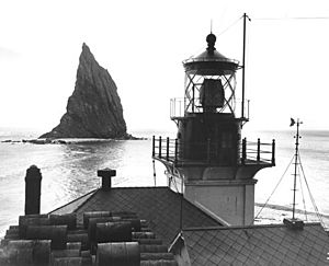
| Top of Cape St. Elias light | |
|
|
|
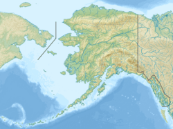
| Location | Cape St. Elias Kayak Island Alaska United States |
|---|---|
| Coordinates | 59°47′54″N 144°35′56″W / 59.79844°N 144.59897°W |
| Year first lit | 1916 |
| Automated | 1974 |
| Foundation | rock |
| Construction | concrete tower |
| Tower shape | square tower at one corner of fog signal building. |
| Markings / pattern | art deco architecture white tower, red lantern |
| Height | 55 feet (17 m) |
| Focal height | 85 feet (26 m) |
| Original lens | Third-order Fresnel lens (Now on display) |
| Current lens | VRB-25 aerobeacon |
| Range | 17 nautical miles (31 km; 20 mi) |
| Characteristic | Fl W 10s. obscured from 160° to 287° and from 018.5 to 027° emergency light (Fl W 6s) of reduced intensity when main light is extinguished. |
| Admiralty number | G6582 |
| ARLHS number | ALK-005 |
| USCG number | 6-1100 |
The Cape St. Elias Light is an important lighthouse located on Kayak Island in Alaska. Lighthouses help guide ships safely. This one has been a crucial aid for boats traveling along the Alaskan coast for many years.
History of Cape St. Elias Light
Building the Lighthouse
The idea to build a lighthouse at Cape St. Elias was approved in October 1913. Congress set aside $115,000 for its construction. Building work started in 1915. A special lens, called a Third-order Fresnel lens, was installed.
The lighthouse began working in 1916. This was the same year the Alaska Engineering Commission started building the Alaska Railroad. This railroad helped make Southcentral Alaska a major economic center.
The Cape St. Elias Light became a vital tool for ships. It guided vessels traveling from the lower American states and Southeastern Alaska. These ships were heading to ports like Cordova, Valdez, Seward, and Anchorage.
In 1916, a radio system was also installed at the station. This allowed lighthouse keepers to tell ports when ships were arriving. In 1927, the station got even better radio beacon facilities. This was only the second such system in all of Alaska.
Modern Times
The United States Coast Guard made the light automated in 1974. This means it could operate without people living there all the time. In 1998, a new solar-powered light, called a Vega optic, was put in place.
The original Fresnel lens is now on display. You can see it at the Cordova Museum in Cordova, Alaska. The Cape St. Elias Lighthouse was added to the National Register of Historic Places in 1975. This means it is recognized as an important historical site.
Today, the lighthouse is managed by the Cape St. Elias Lightkeepers Association. This group is a non-profit organization. They work hard to protect, fix up, and share the lighthouse with others.
 | Laphonza Butler |
 | Daisy Bates |
 | Elizabeth Piper Ensley |


